Questions
- Personally visit the site (yes apparently I have to say this) and email me the names of the people you are submitting answers for. Everyone should log within a few days of the person sending the ansswers in. Submit a photo with your log, it should contain, you, your gps, or your shoe with the arch in the background
- Looking at the North and South window do they appear to be in the same fin. For all these questions, it may help if you take a walk over to the fins.
- How would you compare the two windows, do you think they were formed using the same process?
- What are the differences in the two arches? (size, thickness of arches, differences in the formation)
- Add a photo of you from the location or of an identifiable item (paper with trackable name). Posting a photo pulled from the internet, or photoshopped will result in instant deletion.
Links and Resources:
- Wikipedia on Salt Domes
- Wikipedia on Evaporites
- How arches are formed.
- Park Service Descriptions
- Technical paper
- Really technical paper
- Anticlines, synclines and monoclines.
Directions:
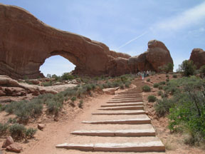
South Window
From Hwy. 191 enter Arches National Park. You should stop at the Visitors’ Center on the way into the park to pick up descriptive pamphlets and see the exhibits. Do not miss the excellent film shown in the new auditorium that describes the geology of rock arches.
Follow the road past Balanced Rock, turning right at ~9.2 mi. Proceed another 2.5 mi. to the parking area. The trail goes to the North and South Windows and Turret Arch.
Supplies: Water, sunscreen, camera.
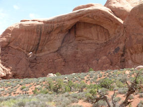
Alcove: An Arch "Wanna'be"
Learning Objectives:
- To become familiar with the terms “fins”, “joints” and “evaporite”.
- To understand how arches and alcoves are formed.
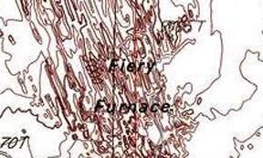
Fins on a TOPO Map
The Entrada Sandstone lies atop a massive body of salt that formed in the Paradox Basin ~250 million years ago. The salt is water soluble and plastic. It migrated as the weight of deposited sediments pressed down on it. The overlying rocks bowed upward into an inverted “U” (an anticline). Under this stress the sedimentary rock fractured into parallel slices known as "fins". The fractures are called "joints", weakened places subject to erosion.
Alcoves and arches form as these sandstone fins are worn away by chemical weathering (dissolution of the calcium carbonate that cements the sand grains) and mechanical weathering (water, wind, ice, abrasion)