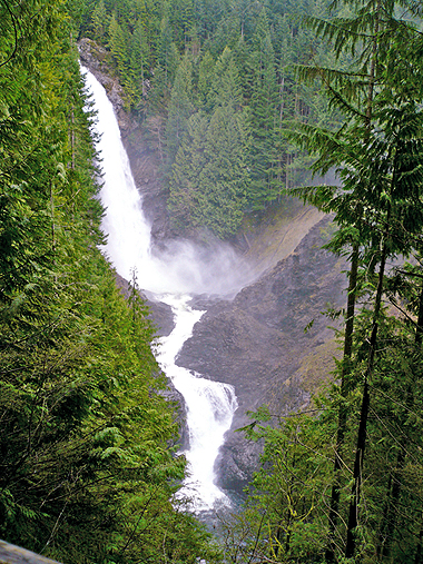
 This is just outside of Wallace Falls State Park, and about half a mile
before you reach GCX4QH (a.k.a. Hiking Wallace) by mohai. If you
would like to prepare by reading a very good description of the
approach and the general area, please see mohai's cache write-up.
If not, you can also read quite a bit at the State Park itself the
day you get there.
I was so surprised that by March 2007, only 3 other geocachers
had been to Hiking Wallace since July 2006 that I decided to place
GCQJJJ to try
to entice more visitors to the area. It really is a gorgeous hike. We'll see if
it works.
The hike centers around a series of waterfalls, 9 of which drop
over 50' and whose centerpiece is the 265' drop of Middle Falls.
You will also enjoy old-growth forest, an excellent network of
trails and local history. You will be under forest canopy almost
the entire time. Would you like to see the overview map?
You may choose to rest at a covered picnic shelter with a view
of Lower Falls.
Be prepared for a good cardiovascular workout. Check out the
stats from the very very very rainy day when this cache was placed:

— Time: 6 hours of hiking, with 3.5 hours of moving
time
— Elevation gain: about 1500 ft
— Total loop hike: just shy of 9 miles (but you will have
many options and trail choices)
— One possible route: Up Woody Trail (with a short side trip
into the Interpretive Trail), then follow the signs for the
waterfalls. The trails start off mildly but get steeper and steeper
as you approach the falls, and waaaay steep right above the Upper
Falls. Up the blue-diamond-blazed ascent to the DNR Road. Back down
into the State Park interior along the Greg Ball Trail, and a bit
of the old railroad grade, finally getting back on Woody Trail.
I
started this cache off with a Rite In The Rain logbook and a
handful of my usual trade items: Sharpie markers! It's best to
use a pencil for writing on that special paper, though, so
there is also one of those. The container was a prize from GCWG2G (a.k.a. SEPAG Storms the Castle III).
Please re-hide it judiciously.
I think you can take Bus 270 to get here. I have not tried it,
though.