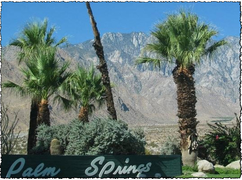
Palm Springs is built in an area shaped by flash floods and
material carried by these floods from the surrounding
mountains.
Flash Floods.
Even though it seem pretty far fetched to talk about flash floods
in an area suffering extended drought, the last one happened here
in 1985 when a stretch of the Tram Road was washed away. Flash
flooding happened in the Palm Springs area numerous times in the
20th century.
Alluvial fans.
An alluvial fan is a fan-shaped deposit formed where a fast flowing
stream flattens, slows, and spreads typically at the exit of a
canyon onto a flatter plain.
Alluvial fans are often found in desert areas subject to periodic
flash floods from nearby thunderstorms in local hills. They are
common around the margins of the sedimentary basins of the Basin
and Range province of southwestern North America. The typical
watercourse in an arid climate has a large, funnel-shaped basin at
the top, leading to a narrow defile, which opens out into an
alluvial fan at the bottom. Multiple braided streams are usually
present and active during water flows.
Phreatophytes are plants that are often concentrated at the base of
alluvial fans, which have long tap roots 30 to 50 feet (9.1 to 15
m) to reach water. The water at this level is derived from water
that has seeped through the fan and hit an impermeable layer that
funneled the water to the base of the fan where it is concentrated
and sometimes forms springs and seeps if the water is close enough
to the surface. These stands of shrubs cling onto the soil at their
bases and over time wind action often blows away sand around the
bushes which form islands of habitat for many
animals.
Bajada.
A convergence of neighboring alluvial fans into a single apron of
deposits against a slope is called a bajada, or compound alluvial
fan. Palm Springs is built on such a bajada formed by alluvial fans
from the San Jacinto Mountains.
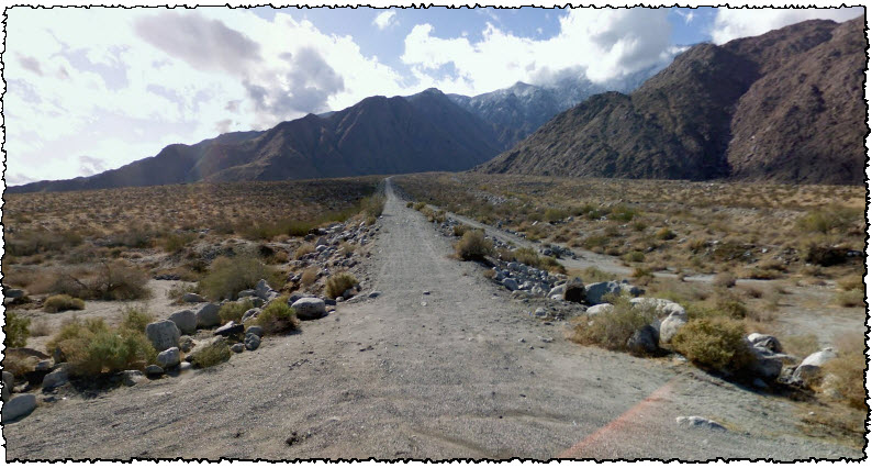
At the cache site:
Looking south you are looking directly in to the canyon and up the
alluvial fan. Looking North you see the plains down the slope of
the alluvial fan. Looking east is the highest part of Palm
Springs.
Logging this cache:
Answer the following questions by message
via my profile:
- Looking south, how is it evident that you
are looking at an alluvial fan?
- What would you say is the slope angle of
this alluvial fan?
Now have a look at the areas that has not
been disturbed by human activity.
- Do you see signs of erosion
here?
- Will the elevation of this alluvial fan rise
or fall, and what are the determining factors?
Please feel free to take a picture at the
site and upload with your log, include gps and/or yourself in pic
if you like.
No need to wait for logging permission, I will contact you if your
answer is missing or unacceptable.
Getting
there:
Go SOUTH on N Palm Canyon Drive and pull out at the dirt road at
coordinates.

Thanks to Vels for help in getting this EarthCache made.