The BRADSHAW TRAIL
Location: Southeastern Riverside County, with a small segment in Imperial County. This east-west trail begins about 12 miles east of the community of North Shore near the Salton Sea State Recreation Area. Its eastern end is about 14 miles southwest of Blythe near the Colorado River.
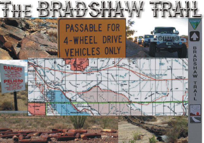
Trail Length: 70-mile graded road with sandy washes and ruts in places.
Description: The first road across Riverside County to the Colorado River was blazed by William Bradshaw in 1862 as an overland stage route. Beginning in San Bernardino, the trail was used extensively between 1862 and 1877 to haul miners and other passengers to the gold fields at La Paz, Arizona (now Ehrenberg). The trail traverses mostly public land and offers spectacular views of the Chuckwalla Bench and the Orocopia, Chuckwalla and Mule mountains.
Directions: From Indio, take State Highway 111 east about 23 miles to the Salton Sea State Recreation Area. Across from Park Headquarters is Parkview Drive. Turn left on Parkview Drive for about 1.7 miles, then left on Desert Aire for about 0.5 miles to the canal road. Follow the canal road for about 10 miles to Drop 24 and the beginning of the Bradshaw Trail. Exit the trail by turning north at Wiley’s Well Road where it intersects the trail. Travel north for 9 miles to Interstate 10.
Four-wheel-drive vehicles are recommended due to stretches of soft sand and dry wash conditions. Summers can be extremely hot, with temperatures that can reach 125° F. Carry plenty of water. In the winter months, temperatures can often drop below freezing. Bring extra warm clothing.
Always tell someone your plans, and stick to your itinerary. Do not attempt this road if it is raining or if rain is forecast. The Chocolate Mountain Naval Gunnery Range is located immediately south of the trail. This is a live bombing range and closed to all public entry. DO NOT ENTER THE BOMBING RANGE!
For More Info