Sossusvlei
Sossusvlei area (500 km²) is a circular shaped depression in the
heart Namib Desert. The whole area is a part of Namib Naukluft
park, the largest conservation area in Africa, and fourth largest
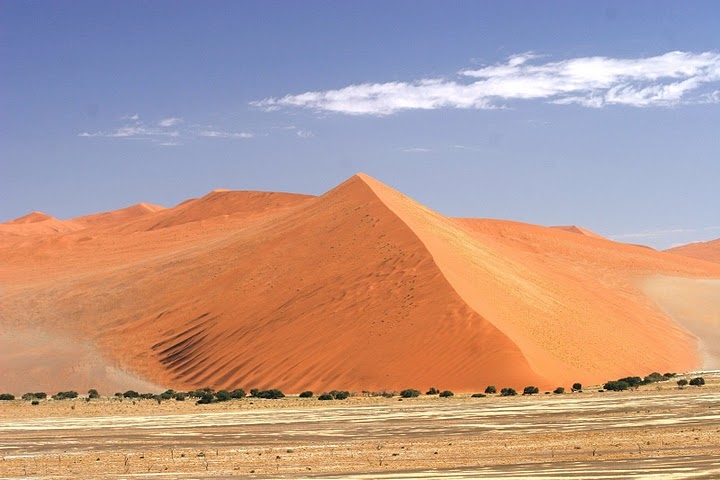
in the world (close to 50.000 km²). Sossusvlei is a huge clay pan
characterized by high sand dunes of vivid pink-to-orange color, a
consequence of a high percentage of iron in the sand and consequent
oxidation processes. The oldest dunes are those of a more intense
reddish color. These dunes are among the highest in the world; many
of them are above 200 metres, the highest being the one nicknamed
Big Daddy, about 380 metres high.
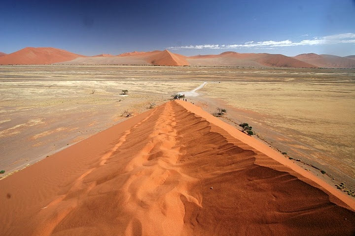
Dunes
In this gigantic sea of sand the dune ridges slope from a cust in a
star pattern in different directions why they are referred to as
star dunes. The dunes of the Namib desert have developed over a
period of many millions of years. Vast quantities of sand were
deposited into the Alantic Ocean from Kalahari desert by the Orange
river. This material was flowed to the Atlantic Ocean and
subsequently moved northwards by the Benguela current to be dumped
back onto the land by the surf. The coastal sand was then
continuously shifted further inland by the wind. Wind permanently
reshapes the patterns of the Namib dunes. It timelessly forces the
grains of sand on the flat windward slope upwards to the crest of
the dune. Here they fall down in the wind shade. The leeward slope
is therefore always considerably steeper than the windward side.
Vital part of forming dunes is played by trees, which makes
something like "dune backbone".
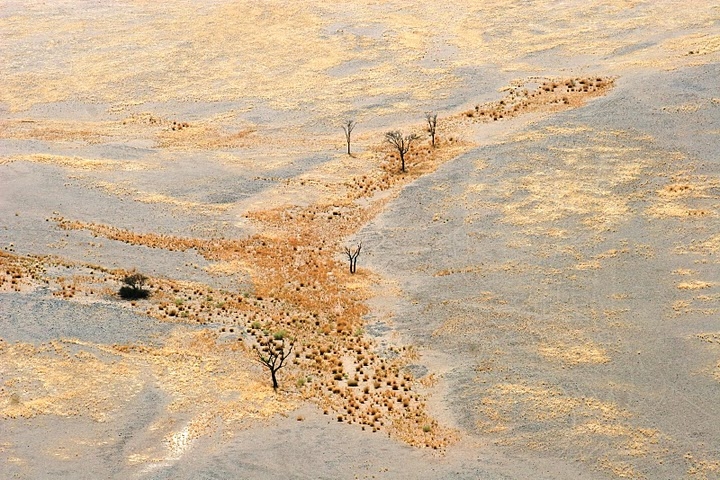
Water and sand
Sossusvlei is a mud pan created by a river that flows through the
Namib every 5 to 10 years, but most of the time it is a bone dry
clay ground. Only after a rare heavy rainfall does the valley fill
with water coming from nearby Naukluft Mountain. As the clay layers
hardly allow any water infiltration, a turquoise lake will remain
for quite some time. The highest and more stable dunes are
partially covered with a relatively rich vegetation, which is
mainly watered by a number of underground and ephemeral rivers that
seasonally flood the pans, creating marshes that are locally known
as vlei; when dry, these pans look almost white in color, due to
the high concentration of salt. Another relevant source of water
for Sossusvlei is the humidity brought by the daily morning fogs
that enter the desert from the Atlantic Ocean.
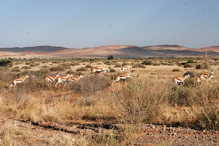
Fauna
Fauna in the Sossusvlei area is relatively rich. It mostly
comprises small animals that can survive with little water,
including a number of arthropods, small reptiles and small
mammalians such as rodents or jackals); bigger animals include
antelopes (mainly oryxes and springboks) and ostrichs. During the
flood season, several migrant bird species appear along the marshes
and rivers. Much of the Sossusvlei and Namib fauna is endemic and
highly adapted to the specific features of the Namib. Most notably,
fog beetles such as the Namib Desert Beetle have developed a
technique for collecting water from early morning fogs through the
bumps in their back.
Dune 45
The sand-dunes at Sossusvlei are some 65km from the Sesriem gate
and it takes about an hour to reach the end. Please, note that the
gate into Sesriem only opens at sunrise and close at sunset. The
most acccessible dune (close to tar road) is the Dune 45, which is
very close to tar road and have parking place nearby. You should
take adventurous climb to the very top and enjoy "liquid" sand and
spectaculous view. The best time to make pictures there is sunrise
or sunset, due to dramatic shadows formed by dunes edges.
To log this cache you need to answer following questions via
my profile
email:
1) How the dunes here were/are formed?
2) What shapes dunes can form (mention 3 at least)?
3) What dune shape is Dune 45?
4) What is the altitude you measured right on cache
coordinates?
Optionally:
I´d love to see your picture(s) taken there and linked to your
log.
Sources: owner archive and experiences,
wikipedia.org, touristic information brochures
Disclaimer: All photos taken by the owner are subject to copyright.
Any usage have to be agreed with owner.