 Part of the Water of Leith cache series.
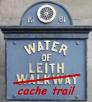
This cache is located at the very beginning of The Water of Leith walkway, which follows the course of the river, covering the 12 miles from Balerno through our capital to Leith. Recently completed thanks to funding from the Millennium Commission, CEC and SEEL. This is a unique way to explore Edinburgh on foot or bike.
The Water of Leith may be only a little more than 18 miles long from its source in the Pentland Hills to the harbour in Leith, but for its size it has held an importance and an affection substantially more significant than many much longer Scottish rivers. It passes through some of the finest rural countryside in Lothian, with vignettes of exquisite beauty, through one-time thriving mill villages, it meanders by sections of Edinburgh's dark old industrial past, vivid parts of the Capital's story have unfolded along its banks and for at least 900 years it has played a key role in the development of Edinburgh and Leith.
Its vast potential for recreational use was first recognised in the Edinburgh plan of 1949, when imaginations were flaring after the war years, but the daunting and painstaking task of its development in the face of so many different owners, was at last taken up by the old Edinburgh Town Council and then the District Council in 1973.
Nowadays the dream of those far-sighted planners has been fulfilled because the Water of Leith Walkway, in the words of that 1949 concept, now "offers one of the finest riverside walks that any citizen could ask for". Apart from its outstanding scenic delights, its industrial and historical heritage, the course of the Water of Leith is rich in wildlife, ancient and modern woodlands and a vast array of plants. It is remarkable that such a full hand of interests and attractions should be associated with such a little river and much of it within the city itself. The Walkway has been divided into six natural segments from the High School in Balerno to the 17th-century Signal Tower in Leith. Some of their points of interest are as follows:
Balerno to Juniper Green:
This section includes the 17th-century Malleny House; the ruined Lennox Tower with 15th-century origins; the Waulk Mill of Ballemoch has a varied history as a 13th-century mill and later a distillery; Balerno Paper Mill has roots in the 18th century; Currie Mill had links to the early 16th century; and Currie Kirk (1785) is said to have had a church on the spot for the last thousand years.
Juniper Green to Slateford:
Woodhall House is the first point of interest dating to the 16th century; Woodhall Grain Mill is now the only working mill on the river; the Mossy Mill weir is still intact; the village of Colinton had its beginnings in the 11 th century; Spylaw House (1650) was the home of snuff merchant James Gillespie, founder of Gillespie's Hospital and James Gillespie's Girls School; Redhall weir once powered Redhall Mill, latterly used to produce wood flour for the plastics industry; Redhall House (1765) was the site of a castle laid waste by Oliver Cromwell in 1650.
Slateford to Roseburn:
Slateford's industrial past is remembered in this section by the Slateford Aqueduct (1822) and Viaduct ( 1847); The Water of Leith Heritage Centre, formerly the village school, retains many of the old records; Stenhouse Castle was one of the names given to the ancient Stenhouse Mill and remains of its dam are still discernible. One of the attractive signposts found along the banks of the Water of Leith Walkway.
Roseburn to Stockbridge:
The ruined windmill on the left bank is said to have been a whinmill for grinding gorse to feed horses; the Scottish Gallery of Modem Art, designed by William Bum in 182.5, was opened as a gallery in 1984; Well Court (1884) was presented by Mr J. R. Findlay, proprietor of The Scotsman, to house workers; the Dean village, was a former centre of milling reaching back to the 12th century; Dean Bridge (1832) was designed by Thomas Telford and makes a spectacular crossing of the river at the Dean gorge; the Doric temple of St. Bernard's Well, designed by Nasmyth after the Sybils' Temple at Tivoli, was once said to have healing waters and is opened by appointment with the Park Patrol; a little to the west St. George's Well, was erected in 18 10 over another reputed healing spring.
Stockbridge to Bonnington:
The Colonies were built between 1861 and I911 by the Edinburgh Building Co-operative as one of the first low-cost housing schemes; Canonmills with its 12th-century roots was royal land gifted by David 1 to the Canons of Holyrood; Puddocky, once a favourite fishing section, lies between Canonmills and Warriston, but it takes its name from the former Paddock Hall and not from Water of Leith puddocks as commonly believed; Warriston Cemetery was once a fashionable burial ground for the rich and it still retains an exceptional number of different tree types; the Steadfast Gate provides a valuable connection with Victoria and St. Mark's parks.
Bonnington to Leith:
Parts of the present Junction Bridge date to the original in 1860; Coalie Park is a landscaped part of the bank built from a coal depot; McGregor's Mill was built around the remains of the Old North Leith Church (1493); Sandport Place Bridge was originally constructed in the 18th century; Lamb's House, now run by Leith Old People's Welfare Centre, remains a striking example of a 17th- century merchant's house; King's Landing was the landing point for the celebrated visit of George IV in 1822; the King's Wark was originally built by James I in 1438; the Signal Tower (1686) once sported a windmill, but it was converted into a signal station for Forth shipping during the Napoleonic Wars.
Down to the cache
The size of the cache container is only 10mm x 25mm. Due to the size, there is only a piece of paper in there for the log (you will need to bring your own pencil). Please only leave the date and your name in the boxes. When the paper starts to get full, I will replace it and scan the old one onto here.
Please ensure that it is hanging back on the right hand side, this way it is out of view of muggles.
Here is a Bookmark List of all current caches situated on the Water of Leith. They are in order starting from Balerno to Leith.
Some more information with links that you may find useful.
Roolku has put together a OS Landranger map and an aerial map showing the caches on the river.
If you’re a visitor and decide that you want to cycle, you can find a bicycle hire shop in Leith. This would mean you would have to do it the opposite way and backtrack slightly on Multi’s. You could opt for the easier option of hiring your bike from Cycle Scotland which provide a delivery and pick up service, but this is at a cost.
Or you can get the No. 44 bus from the City centre to Balerno. Look for the timings for St. Andrews square / Haymarket, and the No. 22 bus will bring you back to the City centre from Leith.
If you are new to Geocaching or don't know the area, then have a look at my bookmark lists for Edinburgh, you may find them helpful.