[OPIS KESZA POCHODZI Z 2010r. - zostawiam go jednak w oryginalnym kształcie. TERAZ JEST TO PARK ale miejsce ukrycia jest dalej to samo - klasyczne ;) ]
Zapomniany, dawny cmentarz.
Forgotten, old cemetery.
glówna aleja / main lane
 |
POLISH DESCRIPTION |
O miejscu:
"Na poczatku byl to maly cmentarz otwarty i poswiecony w dniu 20 V 1834 roku. Z czasem zostal przylaczony do nowego cmentarza sw. Bernardyna w 1892 r. Ostatni pochówek 1945. Zamkniety w 1967" link
Na poludniowym skraju cmentarza znajduje sie schronisko dla bezdomnych.
Kilka informacji o miejscu.
Nie ma juz praktycznie sladów po nagrobkach ale zwiedzajac i szukajac trzeba pamietac, ze mozemy stapac po miejscu dawnych grobów.
Bardzo polecam przejscie sie ze stara, przepiekna mapa topograficzna z 1942r.(tzw. Messtischblatt) w skali 1:25 000, która mozna sciagnac ze skorowidzu Archiwum Map Zachodniej Polski a konkretniej Breslau Sud. Na stronie przygotowane sa genialne skany starych map wraz z plikiem .map dla gps! Mozna taki plik przygotowac dla swojego urzadzenia. Ja polecam darmowy program Trekbuddy LINK Mape pld Wroclawia przygotowana dla tego programu mozna sciagnac TUTAJ lub zrobic samemu - wszystko na forum.
Dojazd:
Mozna dojechac samochodem w poblize kesza lub przespacerowac sie z Alei Armii Krajowej (przystanek "Mostostal")
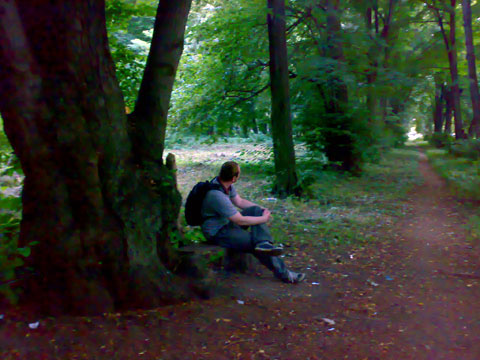
Cmentarz jest na terenie otwartym ale aby zachowac wzgledne incognito mozna wejsc na teren cmentarza przed schroniskiem - zaraz za koncem charakterystycznego plotu zbudowanego z galezi, który ciagnie sie przez jakis czas wzdluz cmentarza, idac od Alei Armii Krajowej (zdjecie). Na cmentarzu sa waskie zarosniete sciezki, mozna nimi przejsc sie do kesza. Teren jest mocno zarosniety, nie polecam zwiedzania bez dlugich nogawek i rekawów - komary, pokrzywy itd :) Mozna tez wejsc przez glówna brame osrodka i udawac turyste.
Skrytka:
Kesz ukryty jest w poblizu szerokiej cmentarnej alei, która odchodzi od terenu schroniska. Kordy prowadza do kesza +/- 8m.
Kesz na starcie zawieral: certyfikaty dla 3 pierwszych znalazców (z limitowanej serii :)), na wymiane: bezcenne karty Football (kto pamieta?:)), smycz, przypinka do komórki, rzepy mocujace, GK. Nie na wymiane: logbook, olówek, pochlaniacz wilogci oraz zapasowy worek i recepturke.
Cache zarejestrowany jest takze w polskim systemie - kod OP2994
 |
ENGLISH DESCRIPTION |
[DESCRIPTION IS FROM 2010 - but I leave it in its original shape. NOW THIS IS A PARK, but the hiding place is still the same - classic;)]
About this spot:
"In the beginning it was a small cemetery, open and dedicated on May 20, 1834. With time, been connected to the new cemetery St. Bernardin in 1892. The last burial in 1945. Closed in 1967" link
On the southern edge of the cemetery there is a shelter for the homeless.
Some information about the place.
Not many traces of the graves left but during searching you have to remember that you can walk on the places where the graves where.
I highly recommend to search for the cache with the old, beautiful topographic map from 1942. (So-called Messtischblatt) in 1:25 000, which can be downloaded from Maps of the western Poland Archives and more specifically HERE. On the site are prepared brilliant scans of old maps with the .map file for gps! You can prepare a file for your device. I recommend the free program Trekbuddy. Map of south Wroclaw prepared for this program can be downloaded HERE or do it by yourself - all in the forum.
Directions:
Cache can be reached by car or you can walk down from Armii Krajowej Avenue (bus stop "Mostostal")
The cemetery is open, but in order to maintain relative incognito, you can enter the cemetery before the shelter - just after the end of the typical fence made of branches, which spread over some time along the cemetery, walking down from the Armii Krajowej Avenue (photo). At the cemetery are the narrow overgrown path, you can move them to the cache. The area is heavily overgrown, I do not recommend walking in without long trousers and sleeves - mosquitoes, nettles, etc.:) You can also enter the main gate from the shelter for the homeless and pretend to be tourist.
The cache:
Cache is hidden in the cemetery near a wide avenue, which departs from the shelter. Coordinates lead to cache + / - 8m.
Cache at the start include: certificates for three of the first finders (with limited edition:)), to exchange: priceless Football Card (who remembers ?:)), leash clasp to the cells, Velcro fastening, GK. Not on the exchange: logbook, pencil, and a spare absorber, bag and rubber band.
Cache is also registered in the polish system - code OP2994