Eastern Pinnacle Rock is a trail highlight of Berea Forest and
located close to one of the oldest geocaches in Kentucky. The rock
formation is a geological formation and the twin to the Western
Pinnacle about a mile and a half away.
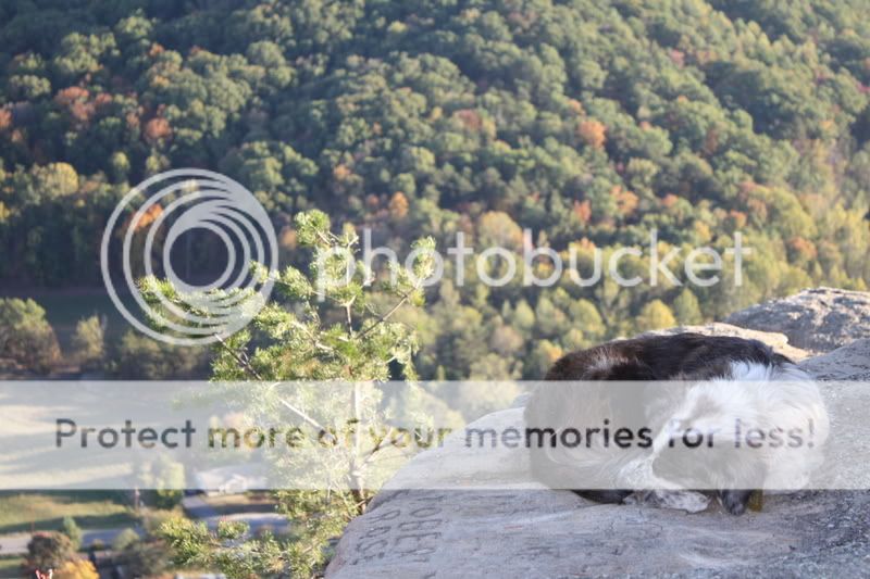
What’s even more amazing is the little dog named Tillie who is a
veteran trail guide along these trails in Berea Forest. She knows
each and every rest spot along the trails and will be happy to show
each one of them. Tillie the Trail Dog is a resident of Berea
Forest. Tillie accompanied me during my visit to this location. She
was so helpful that I named the EarthCache in her honor. Please be
nice to this little trail guide.
As you hike to the East Pinnacle Rock, you will see several
types of rock that make up the pinnacles and cliffs in this forest.
It can be categorized as (starting from top to bottom), Grundy
Formation, Livingston Sandstone Member, Newman Limestone Member, St
Geneviene Limestone Member, and the St Louis Limestone Member. That
is a lot to list but you have to remember, geologically speaking,
millions of years are represented here at the Pinnacle. Listed
below is detailed information on the types of limestone the West
Pinnacle Rock is made of.

GRUNDY FORMATION. Primary Lithology: Shale, siltstone,
sandstone, and coal. Shale and siltstone irregularly interbedded
with sandstone; coal: Shale and siltstone (90 percent), mostly
light-brownish- to greenish-gray, commonly limonite-stained; sparse
black flakes of carbonaceous material; in part very fine sand and
micaceous; in part very carbonaceous, medium-gray to black;
laminated, poorly fissile. Sandstone, brownish- to yellowish-gray
and pale-orange, commonly limonite-stained; mostly fine grained, in
part silty and micaceous, sparse to abundant flakes of black
carbonaceous material, sparse impressions of woody material; mostly
obscurely bedded, locally crossbedded in lensing units a few feet
to a few tens of feet thick; only relatively thick ledge-forming
units mapped separately. Iron-rich siliceous and calcitic
concretions, a few inches in diameter, occur sporadically in all
lithologies. First resistant sandstone unit below Corbin Sandstone
Member pinches out in southeast part of quadrangle; probably is
Hazel Patch Sandstone of Kilburn. Coal, ranging from 0 to about 36
inches in thickness is in lenses, a few tens to several hundreds of
feet long, in the basal 50 feet of unit east of the outcrop of the
Livingston Conglomerate Member; does not crop out, known only from
dumped material near abandoned workings. Unit forms moderate
slopes; thins toward north or northwest. In part rests conformably
on and intertongues with Livingston Conglomerate Member and in part
rests, probably unconformably, on shale of Pennington Formation or
limestone of the Newman Limestone.

LIVINGSTON CONGLOMERATIC SANDSTONE MEMBER. Primary Lithology:
Sandstone. Sandstone, conglomeratic, interstratified and
intergrading with sandstone and with conglomerate; mostly yellowish
and light gray, commonly limonite stained orange to brown. Composed
mostly of subangular fine to medium grains of clear quartz;
contains scarce to abundant well-rounded pebbles, mostly less than
1 inch in diameter, of clear quartz and light- and pinkish-gray
chert. Sparse impressions of woody material. In lensing sets
commonly several feet thick and several tens of feet long, of
horizontal beds and crossbeds, commonly 2 to 4 inches thick. Forms
steep cliff with bench at top. Unit deposited in south-trending
channel cutting out upper member of Newman Limestone locally, as on
western part of Indian Fort Mountain. Basal unconformity has local
relief of about 60 feet in this quadrangle; unit feathers out west
of U.S. 421.
NEWMAN LIMESTONE UPPER MEMBER. Primary Lithology: Limestone and
shale. Upper Limestone and shale: Limestone, medium- and
light-gray, weathers medium gray; dominantly fine grained but
micrograined to medium grained, evenly grained; in beds 6 to 24
inches thick; fossils rare to common but generally not conspicuous,
include abraded fine to coarse fragments of brachiopods and crinoid
columnals, corals, bryozoans, blastoids, and small whole
brachiopods. Lenses, a few feet thick, of light-gray abundantly
fossiliferous medium-grained limestone occur sporadically at top of
unit. Shale, calcitic, greenish-gray, weathers yellowish brown;
laminated in sets a fraction of an inch to a few feet thick,
irregularly interstratified with limestone; poorly exposed. Unit
forms steep ledgy slope, bench common at top. Thin shale bed Shale,
calcitic, greenish-gray, weathers yellowish brown; contains
partings and lentils of dark-gray fine-grained limestone;
laminated; forms recess; poorly exposed.

St Genevievel Limestone Member. Primary Lithology: Limestone
Limestone, light-olive-gray, mostly fine- to medium-grained,
slightly to very oolitic; in planar sets, a few feet thick, of
low-angle crossbeds; contains few fossils, mostly abraded
brachiopods and horn corals. About 10 percent of unit is
micrograined, olive gray; irregularly interstratified in thin beds,
commonly containing a few stringers and ovoidal masses of dark-gray
chert; also generally forms layer a few feet thick at top of unit,
faintly brecciated; unfossiliferous. Uncommon but conspicuous are
lenses of medium- to coarse-grained skeletal limestone containing
abraded brachiopods; resembles limestone in overlying unit.
ST. LOUIS LIMESTONE MEMBER. Primary Lithology: Limestone.
Limestone, light-brownish-gray, weathers light gray, micrograined
to coarse-grained, mostly fine grained, in fairly even beds mostly
1 to 8 inches thick separated by partings and very thin seams of
pale-green claystone. Chert, dark-gray grading to reddish and
brownish gray, common in upper part of unit as irregular layers and
small discoidal and ovoidal masses and as replacements of fossils.
Fossils in upper part of unit, scarce to common, are mainly
lithostrotionoid corals and small brachiopods mostly replaced by
chert; near base of unit fossils more abundant and varied, include
small brachiopods, bryozoans, crinoid columnals, and trilobite
fragments.
Now that you read all of the geological information about the
West Pinnacle its time to hit the trail and visit the beautiful
rock formation. Be prepared for an hour hike.
Berea College Forest is located off Ky. 21, three miles east of
Berea in Madison County, is well known as the location for the
Kentucky Guild of Artists and Craftsmen’s craft fairs. But it’s
also a scenic and quiet place for a day hike, with eight miles of
trails of varying lengths. (800) 598-5263. The Berea Forest trail
is open during daylight hours so please plan accordingly.
A special thanks to Steve Greb from the Kentucky Geological
Society for pointing me in the right direction for finding
information on the Berea Pinnacles and thank you to Jay Buckner for
allowing the EarthCache on the forest trails. DO NOT LOG AS A FIND
UNTIL YOU HAVE A PICTURE READY TO POST. To get credit for this EC,
post a photo of you (I do not accept pictures of just a hand) at
the posted coordinates with the open valley or of West Pinnacle
rock in the background and please answer the following
questions.
1. What is the elevation at the posted coordinates?
2. How wide is the flat open area of Grundy Rock at the posted
coordinates?
3. Looking directly east in the valley below is another rock
formation shaped like a tree covered volcano. How far across
(distance) the valley do you think it is?

Logs with no photo of the actual EarthCacher/Geocacher (face
must be included) logging the find or failure to answer questions
will result in a log deletion. Exceptions will be considered if you
contact me first (I realize sometimes we forget our cameras or the
batteries die). Logs with no photos will be deleted without notice.
I have used sources available to me by using google search to get
information for this earth cache. I am by no means a geologist. I
use books, internet, and asking questions about geology just like
99.9 percent of the geocachers who create these great Earth Caches.
I enjoy Earth Caches and want people to get out and see what I see
everytime I go and explore this great place we live in.