The Ripples of Zurich EarthCache
-
Difficulty:
-

-
Terrain:
-
Size:  (not chosen)
Please note Use of geocaching.com services is subject to the terms and conditions
in our disclaimer.
The Ripples of Zurich Earthcache is located on Sararas Sideroad, off of Hwy 2, south of Zurich, Ontario. You do not need to leave the road to complete this Earthcache. Please park to one side of the road as the road is quite narrow at this location.
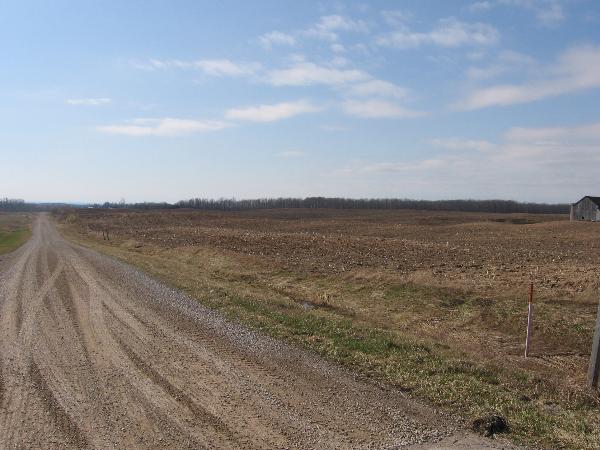
You are looking at a landscape that has been shaped largely by glacial processes. You will notice that gently rolling terrain is predominant. If you look to the west, on a clear day you can see Lake Huron, another feature of local glaciation. The retreat of the Huron Lobe of the Wisconsin Ice Sheet, about 10 000-12 000 years ago, is responsible for the major physiographic features in this area, including glacial spillways, till moraines, kame moraines and drumlins. Glacial Lake Warren waters were higher than the present day Lake Huron, and left behind gravel deposits, beaches, wave-cut terraces, and dunes, particularly north of Goderich and in Lucknow, two settlements north of this location. The shoreline of the earlier glacial Lake Algonquin is in close proximity to the shoreline of the present Lake Huron.
The large glacial feature that you are standing on is called the Wyoming till moraine. It extends from the northern to the southern boundary of the Maitland River watershed along Lake Huron. The moraine was created by the melting of a glacier, and is partially responsible for the meandering character of the Maitland River’s southern reaches. An additional three moraines are located in the southern section of the Maitland basin. These moraines are formed mainly of clay loams and silt loams and can be subject to erosion. Drumlins are found throughout much of this area and are closely associated with moraines.
A drumlin is an elongated whale-shaped hill formed by glacial action. Its long axis is parallel with the movement of the ice, with the blunter end facing into the glacial movement. Drumlins may be more than 45 m high and more than 0.8 km long, and are often in drumlin fields of similarly shaped, sized and oriented hills. Drumlins usually have layers indicating that the material was repeatedly added to a core, which may be of rock or glacial till. There are many theories as to the exact mode of origin and plenty of controversy among geologists interested in geomorphology. Some consider them a direct formation of the ice, while a theory proposed since the 1980s by John Shaw and others postulates creation by a catastrophic flooding release of highly pressurized water flowing underneath the glacial ice. Either way, they are thought to be a waveform, similar to ripples of sand at the bottom of a stream. It is also poorly understood why drumlins form in some glaciated areas and not in others. Drumlins are found in groups called drumlin fields or drumlin camps. A terrific example of these fields is right where you are standing in south-eastern Ontario. It is estimated that there are approximately 7000 drumlins located in southern Ontario.
To claim this Earthcache, please complete the following requirements:
1. Take a picture of your group with the drumlins in the background. Post this picture with your log. In your e-mail, state how many members there were in your group.
2. By looking at the alignment of the drumlins, include in your e-mail the answer to this question. In which direction did the Huron Lobe of the Wisconsin Ice Sheet recede when it retreated? To determine this, the tilted side of the hill looks toward the direction from which the ice advanced (stoss), while the longer slope follows the ice's direction of movement (lee). The road on which you are standing has been cut through the tilted sides of some drumlins. Please log your visit after sending the e-mail and the cache owner will contact you only if there is a problem.
3. Due to the fact that drumlins are a collection of glacial till, complete a soil test at the site to determine the soil type. Include this in your e-mail as well. To complete a Soil Texture Test, take a handful of moist soil, feel it and rub it between your fingers. If it is rough and gritty and breaks up easily it is sandy. If it feels sticky and like plastic it is clay. If it feels slippery with smaller particles than sand, it is silt. Next try to form a lump with it. If it makes a solid lump that won't crumble it is clay. If it won't form a lump but crumbles at once it is sand.
Here are four common types of soil:
Sandy soil; tends to be very light and dries out swiftly. Water drains very quickly and makes the soil easy to dig. It is the first to warm up in the sun.
Silt soil; retains moisture and feels slippery when wet. Retains nutrients better than sand, but does not dry out as quickly.
Clay soil; a very heavy soil, it holds moisture for long periods of time when wet and dries hard as a brick. Clay soil retains nutrients and is very fertile but is heavy, sticky and very hard to dig. It is the last to warm up in the sun.
Loam soil; the ideal soil texture, it is composed of sand, silt and clay. The ideal loam soil contains 40% silt, 20% clay and 40% sand and organic matter. Loam is a separate category because none of its compontents account for more than 50%.
Some of this information was gathered with thanks from the following web site: www.uoguelph.ca/gwmg/wcp_home/Pages/M_ne_ph.htm
Additional Hints
(No hints available.)