|
 Rock fall at Eiger Rock fall at Eiger
There is hardly anywhere else in the whole of the Alps where the connection between climate change and natural hazards can be observed as clearly as here, high above the Lower Grindelwald glacier.
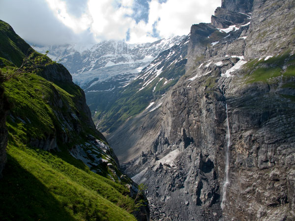
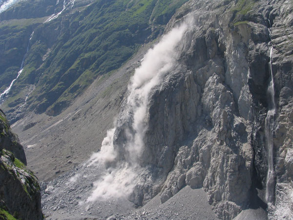
On the evening of July 13, More than 20 million cubic feet of rock came crashing down from the east face of the Eiger (13,025 feet) in Grindelwald, Switzerland - an amount comparable to half the size of the Empire State Building.
In early June, a 16-foot-wide crack appeared near the monster chunk of rock, measuring eight inches wide, but the crack grew (at 35 inches a day) to roughly 16 feet before it gave way. Since the appearance, scientists have warned of the eventual unsheathing of the Eiger’s east face, and only days before, a 100-foot high rock formation, dubbed 'Madonna', cut loose.?
Source: WikiPedia
The increase in massive rock fall on the Eiger stems from permafrost melting.
Permafrost is high altitude soil that stays frozen for more than two years in a row, and is responsible for holding much of the surface of the Alps together. Once this permafrost melts, water gets trapped inside the rock creating pressure. The fissure in the Eiger’s east face is a result of this pressure.
Start...
... your tour at the arial cableway station Pfingstegg. From here you can reach Berghaus Bäregg in 1.5 hours. On the trail to Berghaus Bäregg you can easily reach WP1 - WP4. All waypoints are located directly on the trail.
Questions
Please, head for waypoints mentioned below. At waypoint WP1 - WP3 you will find an information board. Read the board carefully and answer the following questions:
(1) - WP1 - N46 36.800 E8 03.259
The information doesn't exist any longer at this WP, so skip this WP please.
(2) - WP2 - N46 36.443 E8 03.237
How many years ago the glacier was on the same level as the hiking trail?
(3) - WP3 - N46 36.069 E8 03.440
The pictures doesn't exist any longer at this WP, so skip this WP please.
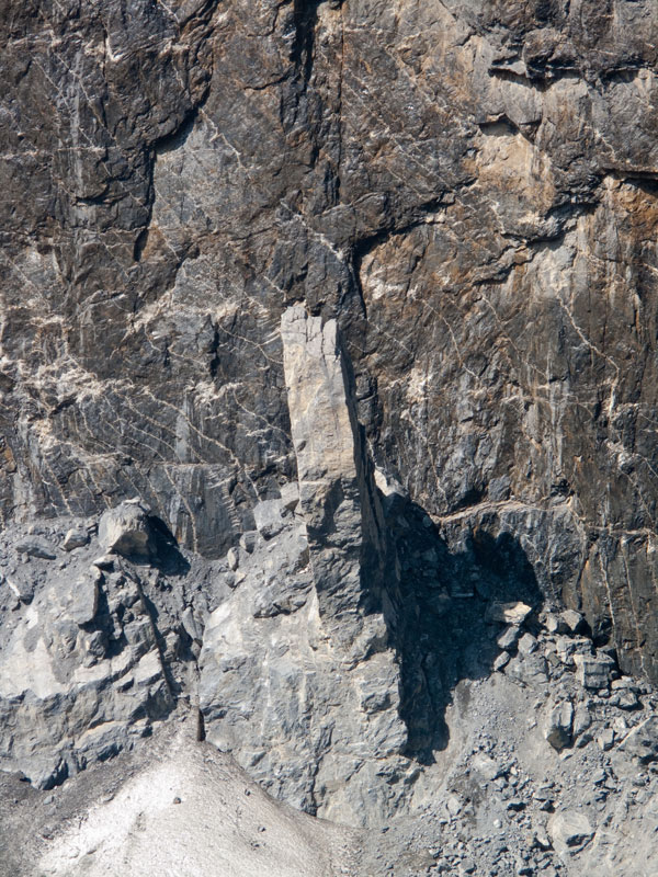
(4) - WP4 - Please find this "Stone Formation". Which height has this "Stone Formation" in meters (estimated)?
Attention! The precise details are required, provided on the boards! Unfortunately, solutions found in the internet cannot be accepted.
Log terms
- Please send us an Email with the answers to the questions above. Please wait for approval Email before you make your log. Important! Please add your GC Name to Email Subject!
- Please take a optional picture of you or your GPS in front of the rock fall and add it to your log.
Logs without approval Email will be deleted without comment.
We hope you will enjoy this EarthCache as much as we do. We thank you for your visit and are looking forward to your Emails!
Kind regards, Kate!
Waymarking
In combination with this cache you can log Waymark WM9CB9.
EarthCache Bonus (virtuell) Geocoin
If you like.... you can discover our EarthCache Bonus (virtuell) Geocoin. Just give us a hint in your Email.
Statistics
History
- 2010.06.12 Listing created.
- 23.01.2011 Picture optional.
- 13.05.2012 Opencaching removed.
- 04.07.2022 Infoboard at WP1 and WP3 no longer available.
|