|
Fraga do Caixão
Esta cache pretende dar a conhecer
mais um recanto escondido da Serra da Estrela. O percurso pode ser
feito em veículo todo o terreno, de BTT ou a pé, fazendo-se um
pequeno desvio da rota pedestre circular – PR1 – Rota dos Galhados
– com início e fim em Folgosinho. Pode ainda ser alcançada no
decurso da Rota das Aldeias Históricas GR22 (do INATEL) ou da
grande rota T1 do PNSE. No ponto N 40° 29.160 W 007° 30.266 deve
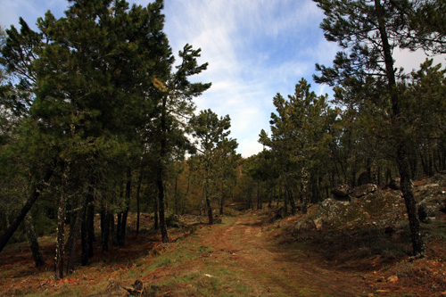
tomar-se o caminho voltado a Sul, atravessando-se um pequeno bosque
de bétulas até sensivelmente a 100 metros da cache. Daí
desbravam-se os últimos metros até à formação rochosa através do
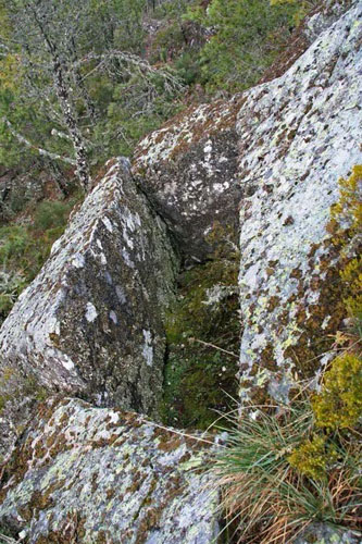
pinhal. A fraga responsável pelo nome do local está localizada na
coordenada N 40° 28.833 W 007° 30.236, a poucos metros da cache.
Para se alcançar o caixão é necessário ter muito cuidado,
principalmente se a rocha estiver molhada.
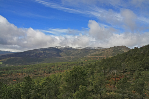
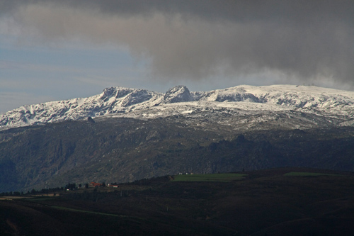
Para além da curiosa formação
rochosa tem muito interesse o enquadramento paisagístico do local.
Avista-se a Torre, o vale do Mondego salpicado pelos Casais de
Folgosinho e o pico de São Tiago. Recomenda-se ainda a visita ao
ponto N 40° 28.828 W 007° 29.895 de onde se avista a cidade da
Guarda e os Poios, dois aglomerados graníticos de grande
imponência.
Esperemos que gostem e que se divirtam com mais esta cache.
The Coffin Rock
With this cache we want to show
another hidden place of Serra da Estrela. The route can be done in
all-terrain vehicles, mountain biking or walking, making up a small
deviation of the walking route - PR1 – “Rota dos Galhardos” - with
start and end in Folgosinho. It can also be reached during the
Route of the Historical Villages GR22 (from INATEL) or the large T1
route of PNSE. In point 40 ° N 29.160 W 007 ° 30.266 you should
follow the path that leads to South, crossing a small grove of
birch until getting approximately 100 meters away from the cache.
To reach the rock formation you must go through the pine forest.
The rock that gave the name to the site is located at the
coordinate 40 ° N 28833 W 007 ° 30.236, a few meters from the
cache. To achieve the coffin you must be very careful, especially
if the floor is wet.

Besides the curious rock formation
the landscape is also very interesting. You can see the Tower
(highest point of the continental part of the country), the Mondego
valley dotted by the “Casais de Folgosinho” (small farms) and the
peak of S. Tiago. We also recommend a visit to the point N 40 °
28.828 W 007 ° 29.895 were you can see Guarda city and the “Poios”,
two granite formations of great magnificence.
We hope you enjoy and have fun with this cache.
|