 How Mountains Are Formed
Mountains can be formed in basically four different ways. Different kinds of mountains are formed different ways, therefore we say there are four different kinds of mountains: Volcanic, erosional, fault-block, and folded.
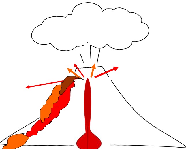
Volcanic mountains, also known as volcanoes, can be standing alone or be part of one big chain of volcanoes. Volcanoes are areas in which lava and magma move to the surface and burst through the crust. Igneous rocks are formed here. Sometimes, hot molten rock spews out of volcanoes. This is earth's way of releasing its internal heat, and many people have died and even cities have been buried from volcanic eruptions. The Hawaiian Islands are a good example of this kind of mountain chain.
Erosional mountains are formed by wind or water wearing down weak spots in land and carrying it away. Non-resistant material is washed away, whereas the stronger material remains. Pike's Peak (4,301 m/ 14,110 ft) is an example of an erosional mountain. Pike's Peak is a large mass of granite that has resisted erosion for many years. It is all that is left of the mountain.

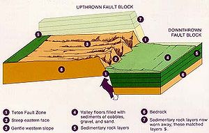
Fault-block mountains are formed by the vertical faulting of large blocks of earth. These are common in the western United States. Fault-block valleys are also formed by this manner. They occur on the fault lines between the tectonic plates that make up the surface of our planet.
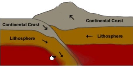
Folded mountains are the most common type of mountain. They are created by tectonic plates pushing against each other. This creates intense pressure. Therefore, the only direction for these mountains to move is up. When two plates move away from each other, they create a rift valley in between them. Sometimes, if plates collide, one will force the other under itself. This is another way that folded mountains occur.
Mount Cheaha
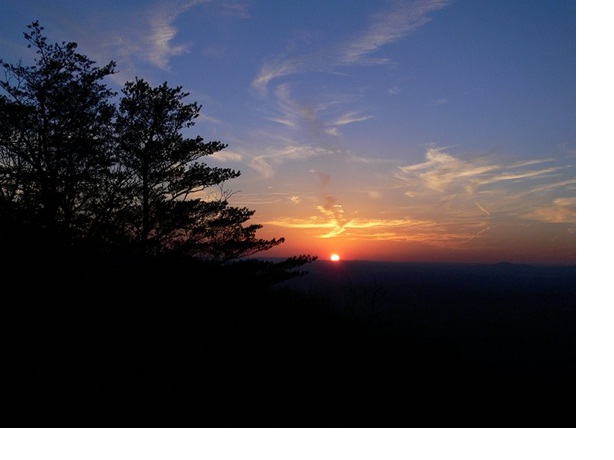
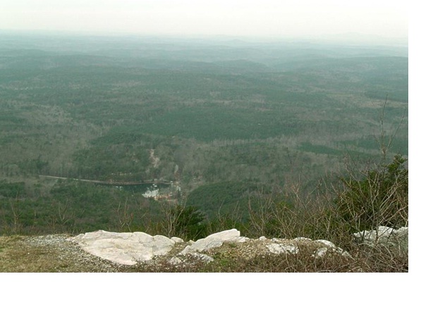
Located in Clay and Cleburne Counties, Cheaha State Park is the pinnacle of natural beauty and awe in Alabama. Surrounded by the Talladega National Forest, this foothill of the Appalachian Mountains holds the reputation of the highest point in Alabama. Standing 2,407 ft. above sea level, it is no wonder why the local Creek Indians named this place “Chaha,” meaning high place.
After the state of Alabama acquired lands in 1933, which today comprise 11 of the 22 State Parks, a cooperative effort with the State of Alabama and the National Park System, paved the way for the Civilian Conservation Corp's (CCC) development and construction of Cheaha State Park. Its continuous operation since 1933, makes Cheaha, Alabama's oldest continuously operating State Park.
The above coordinates represent the highest point in the state of Alabama
The Cache...
To get credit for logging this cache, you must visit the above coordinates. While there, you will discover some interesting facts, and be able to answer the following questions. Please email your answers to me at the above link, and please do NOT post any spoilers in your log.
1. Please tell me which type of mountain chain you are visiting today, and explain.
2. What is the building you are standing directly in front of? What was it's function? And why was this site chosen for such a building, based on its special geological feature?
3. Locate the USGS benchmark located at the above coordinates. Put your GPSr on its elevation page (if it has one) and lay your machine on top of the benchmark disk (please position it so that the secret code for number 5 is not showing in your pictures!) and take a picture that shows your elevation reading. The exact elevation at this disk is 2407 feet above sea level so now would be a good time to calibrate your unit to that exact elevation. If you do this, please take another picture, showing how close you were able to get the reading. See my before and after pictures of this!
4. Next do some exploring and tell me the highest point that you can find in the immediate area (within 50 feet) of the benchmark disk. Describe this point for me... What is located in the rock there?
5. Lastly tell me the secret code word that is stamped into the benchmark disk at the coordinates. (There are many words engraved on the disk, but there is a nine letter word that is stamped into the disk.)
Remember to be careful when writing your log. Do not give away any of the above answers!!!