Meade County occupies over 324 square miles of land which is
mostly underlain by a sinkhole plain. Surface drainage in
this area is rare with each sinkhole acting as a vertical input to
the ground water supply. This forms a lattice work of cave
passages that feed trunk channels. These cave trunk channels
in turn lead to major karst resurgences, sometimes many miles
away.
| A resurgence is
where the subterranean water flow reaches the surface, or better
known as a spring. All resurgences are found either in
the floor or walls of major valleys extending back from the Ohio
River or along the Muldraugh Escarpment adjacent to the Ohio
River. Meade County’s three major creeks Doe Run, Otter
Creek, and Wolf Creek all either originate from or contain major
resurgences. Karst
resurgences are broken down into three physical categories: blue
holes, occluded bluff springs, or tubular bluff springs.
Blue hole springs
discharge beneath the surface of the water where occluded bluff and
tubular bluff springs discharge at or above the surface of the
water. Occluded bluff
springs are obscured by slumped material over the free face of the
bluff springs. |
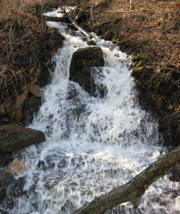
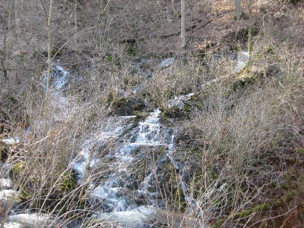
Buttermilk Falls |
More than 40 significant springs have been indexed in Meade County
with seven of these considered major
resurgences. The
largest of these springs being Doe Run complex, Hamilton Hill, and
Wolf Creek Rise with each having recorded flows of over 1000 cubic
feet per second during periods of
flood. In other words
these springs can issue massive flows of
water. The Buttermilk
Falls complex is the smallest of the major resurgences but one of
the most scenic.
Buttermilk
Falls Historic Walking Trail
Parking & Trailhead
N38 00.235 W86 09.887
In 1996 the town of Brandenburg recognized they had a hidden
treasure here and began the clean up of tons of trash that had
accumulated from years of
abuse. They added paved
walking trails and benches to create a park like setting you see
today. The now closed
road that passes Buttermilk Falls extends for a total length of
about 2 ½ miles one way and makes for an excellent hike and bike
trail. |
 |
Small Springs - N38 00.222 W86 09.871
If you are fortunate enough to visit shortly after a period of rain
you will hear the sound of flowing water as soon as you pass by the
trailhead entrance gate. The sounds you hear are from the first two
of many small occluded bluff springs you will encounter along the
Muldraugh Escarpment as you wind your way along this paved
trail.
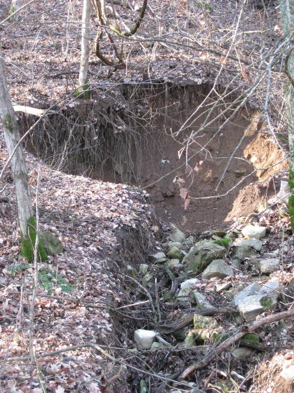
Collapsed Spring - N38 00.185 W86
09.785
Here you will notice the recent collapse of the soil and
rock above around a small spring. Karst hydrosystems
are constantly slowly changing and in this instance the ground
around the spring had become unstable as water undercut the strata
below it. This collapse which occurred in the winter of 2008
altered the water flow here. The water that once flowed from
this spring most likely has been diverted to a nearby spring or
continues to flow beneath the current creek bed and exists
somewhere below the trail.
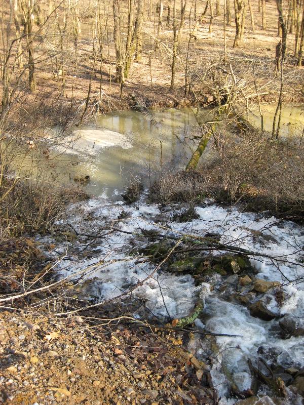
Flippins Run - N38 00.149 W86 09.662
As you are walking down the trail you can see Fippins Run to your
left. Flippins Run is the drainage conduit for all the
springs in the Buttermilk Falls
Complex. It’s
confluence with the Ohio River is near the boat ramp. During
periods when the Ohio Rivers pool level is high, water backs up
Flippins Run in this area flooding the lower valley area below
you. |
 |
Old Potters Workshop - N38 00.036 W86
09.597
James Miller was a local potter who
had a kiln up the hill from here at the turn of the century.
He collected clay soil, used in his pottery near this stream which
is fed by two nearby springs. Many shards of pottery and
crockery have been found in this streambed where they have washed
down from above.
Lithograph Quarry - N38 00.059 W86 09.579
If you look closely you can see several concrete forms in the
hillside here. These
are remnants of a Lithograph Quarry that operated here from the
late 1800’s to the early
1900’s. The limestone
was quarried here and transported by barge to New Orleans where it
was used for printing.
The artist would draw directly on the flat smooth piece of
limestone and then the stone was used to produce additional
prints. At the time
this was the only known source of lithograph quality stone
available in the US.
|
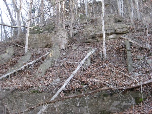
Lithograph Quarry Ruins
|
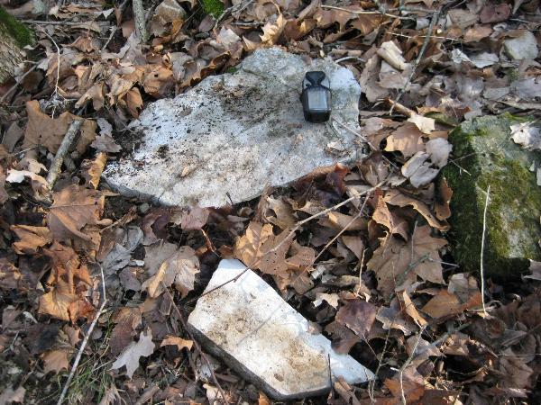
Lithograph Quality Stone
|
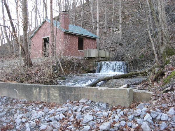
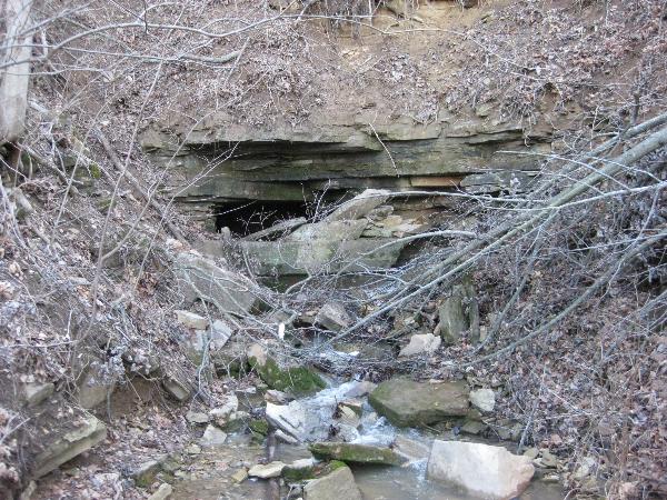
Mint Spring
N38 00.117 W86
09.533
Mint spring is a tubular bluff type
spring. The spring was
once used as the public water supply for the town of
Brandenburg. The cave
entrance was dammed to facilitate water collection and water was
then pumped up to the city water
tower. This
spring was abandoned as a water source when it was found to contain
pollutants. |
|
Two new wells were drilled down into the aquifer which afforded
maximum infiltration from the river and cave spring flows and this
in turn provided a safer water supply for the
town. Mint spring’s
water flow is variable ranging from 60 to over 2500 gallons per
minute. A new shelter house now stands on the foundation of the old
pump house.
|
Mint Spring
|
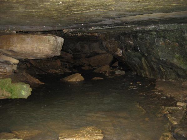
Mint Spring Cave
|
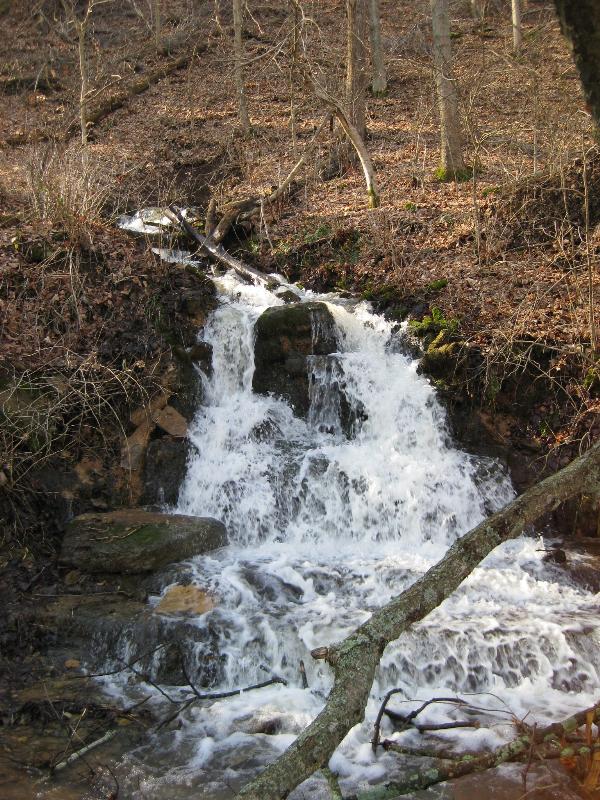
Buttermilk Falls
N38 00.124 W86 09.438
The Buttermilk Falls complex consists of more
than a dozen Occluded Bluff Springs.
For many years these springs served as a source of water for
families through out this part of Meade
County. Pipes were
added to some of the springs to facilitate water
collection. I remember
coming here years ago and seeing farm tank trucks being
filled. The trucks
would haul the water to people’s homes to be stored in their
cisterns. In addition
folks would come here from all around to fill up their water
containers from the springs. |
|
The springs of Buttermilk falls were closed for public consumption
in 1982 after an outbreak of hepatitis due to fecal coli form
contamination from septic tank seepage and farm runoff into
sinkholes. This was a
classic case on how indiscriminate dumping of human, animal, and
farm waste in dolines up above in the sinkhole plain eventually
contaminated the town’s drinking
water. Tests show that
elevated levels of E-Coli still persist in the spring water to this
day although at a much lower level than during the hepatitis
breakout. A better awareness by the community of drainage patterns
has been attributed to this improvement.
The springs of Buttermilk Falls are developed in the Saint Louis
Limestone and are a good example of valley wall karst
resurgences. The
collective discharge from this spring complex is between 250 to
over 3000 gallons per minute depending on weather conditions.
|
Left Section of Springs
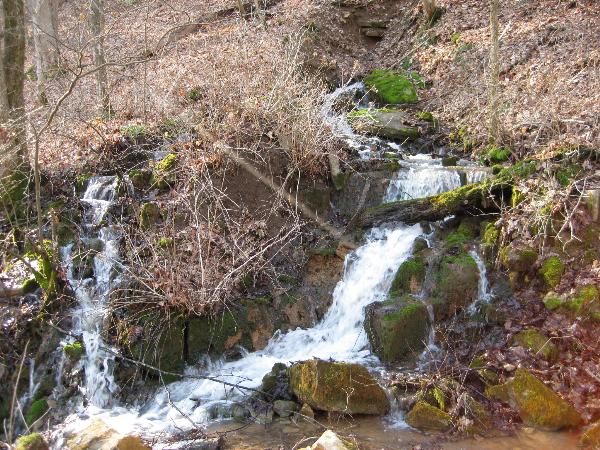
Right Section of Springs
|
Lower Cascades
|
Beyond the Falls:
From here the trail continues on for another 1.4 miles to the other
gate and parking lot near Arch Chemical Plant. Three
additional springs can be found along the escarpment within a few
hundred feet of here. If you are interested in logging a
benchmark, one can be found about four tenths of a mile further
down the trail where it crosses a creek.
To get
credit for this Earthcache post a picture of yourself with GPS in
hand with Buttermilk Falls or Mint Spring in the background, and
send an email to
Mooseky@gmail.com
with the answers to the following questions.
Questions:
1. What is the geologic name for a spring?
2. What are the three types of springs?
3. What is the predominant type spring along Buttermilk Falls
Trail?
4. How many active springs did you observe along the trail
today? (Answer would vary by season and weather conditions)
5. What is the size of the cave opening at Mint Spring?
6. What is the total elevation drop from the mouth of
Buttermilk Falls spring all the way down to the bottom of the
cascades below the trail?
Acknowledgments
Grateful
thanks is extended to Bees4me for her help in developing this
EC.
References
George, A.I. (1972) - Karst
of Meade County, Kentucky: Guidebook to the Kentucky
Speleofest;
p.1-31.
Wilson, Doug &
A.I. George (1976) -
Selected Hydrosystems of
Meade County, Kentucky: Guidebook to the Kentucky
Speleofest;
p.7-17.
Bergeisen G.H., M. W. Hinds, & J. W.
Skaggs(1985)
A Waterborne Outbreak of Hepatitis A in Meade County,
Kentucky American
Journal of Public Health. February 1985;
p.161–164.
Meade County Area Chamber of Commerce and Tourism - "Buttermilk
Falls Historic Walking Trail"
pamphlet