Kontinentální rozvodí a město Závist
Evropské kontinentální rozvodí
V Evropě je hlavní kontinentální rozvodí, které rozděluje tok řek do dvou hlavních směrů; na jedné straně do Atlantického oceánu, Severního a Baltského moře a na straně druhé do moře Středozemního a Černého. Rozvodí je tvořeno horským hřebenem; dešťová voda, která dopadá na jednu stranu hřebenu, odtéká do Atlantického oceánu, Severního nebo Baltského moře, zatímco dešťová voda dopadající na druhou stranu hřebenu odtéká do moře Středozemního nebo Černého. V rámci hlavního rozvodí existuji i menší rozvodí, která rozdělují odtok vod do jednotlivých výše zmiňovaných moří.
Hlavní evropské kontinentální rozvodí se táhne od Gibraltaru, přes Španělsko a Francii, podél Vogéz a švýcarských Jur až k Bündnerským Alpám. Dále pak přes pohoří Arlberg, kolem severní strany Bodamského jezera, přes Švábskou Albu až ke Smrčinám. Odtud dále pokračuje přes Waldviertel (Rakousko) a přes Českomoravskou vrchovinu až do Polska. Z Polska pokračuje podél hranic s Ukrajinou až do Lvova a končí Smolenskou vrchovinou, 200 kilometrů západně do Moskvy.
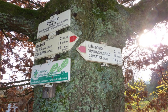
Závist
Vesnice Závist, které se týká tato keš, se nachází přesně na hlavním kontinentálním rozvodí. Voda severně od vesnice vtéká do řeky Radbuzy, jejíž voda teče směrem k Severnímu moři. Voda na severozápad od vesnice, například řeky Schwarzach (viz keš u pramene) teče do moře Černého. Kontinentální rozvodí může být geologicky přesně určeno, což na některých místech vede k zajímavým úkazům (viz otázky níže).
Otázky: 1. Co zde tvoří kontinentální rozvodí?
2. Jaké je číslo domu na rozvodí?
3. Jak se jmenují dvě hlavní řeky, které odvádí vodu ze svého kontinentálního rozvodí do Severního, resp. Černého moře?
4. Vysvětli význam kontinentálního rozvodí pro ryby v těchto řekách.
5. Dobrovolně: Rád bych viděl fotky Vás v této oblasti.
It would be Great if you could send the answers in English or German, the google translator is Not the best :)
Wasserscheide bei Zavíst
Europäische Hauptwasserscheide
In Europa gibt es eine Hauptwasserscheide, die den Wasserzulauf zwischen Atlantik, Nordsee und Ostsee vom Zulauf zum Mittelmeer und Schwarzen Meer trennt. Physikalisch ist das ein Bergrücken, bei dem der Regen, der auf der einen Seite auf den Boden fällt, schlussendlich in die Nordsee, Ostsee oder den Atlantik fließt, während das Regenwasser auf der anderen Seite in das Mittelmeer oder das Schwarze Meer geleitet wird. Abzweigend davon gibt es noch Wasserscheiden, die den Zufluß zwischen Atlantik und Nordsee trennen, zwischen Nordsee und Ostsee oder das Zustromgebiet von Mittelmeer und Schwarzem Meer.
Die Europäische Hauptwasserscheide verläuft von Gibraltar durch Spanien und Frankreich, berührt die Vogesen und den Schweizer Jura bis hin zu den Bündner Alpen. Weiter verläuft sie über den Arlberg und nördlich vom Bodensee, über die schwäbische Alp zum Fichtelgebirge. Von dort verläuft sie über das Waldviertel/Österreich zu der Böhmisch-Märischen Höhe bis nach Polen. Von Polen verläuft sie an der Grenze von der Ukraine nach Lemberg, um schließlich in Russland in den Smolensker Höhen 200 km westlich von Moskau zu enden.
Zavíst
Der kleine Ort Zavíst, von dem dieser Cache handelt, befindet sich genau auf der Europäischen Hauptwasserscheide. Wasser nordöstlich des Ortes fließt über den Radbouza Richtung Nordsee, südwestlich davon, wie zum Beispiel die in der Nähe entspringende Böhmische Schwarzach (siehe der Quellencache) fließen in das Schwarze Meer. Man kann die Wasserscheiden geologisch genau bestimmen, so dass es an manchen Stellen zu interessanten Begebenheiten (siehe Fragen unten) kommen kann.
Fragen:
1. Welche gerade Linie zeigt hier die Wasserscheide an?
2. Welche Hausnummer hat das Grundstück auf dem die oben genannte Linie verläuft?
3. Über welche beiden Hauptflüsse erreicht das Wasser von den beiden Seiten der Wasserscheide Nordsee bzw. Schwarzes Meer?
4. Erkläre, welche Bedeutung Wasserscheiden für die Fische in den verschiedenen Flüssen haben?
5. Optional: Über ein Foto in der Gegend würde ich mich sehr freuen!
Bitte schickt mir die Antworten und ich antworte Euch so schnell als möglich!
Continental water divide and the town Závist
European continental divide
In Europe there is one main continental divide, which divides the water inflow of the Atlantic Ocean, North Sea and Baltic Sea on the one hand and the Mediterranean Sea and the Black Sea on the other hand. Physically, the divide is a mountain ridge; rain that falls on the one side finally flows into the Atlantic Ocean, North Sea or Baltic Sea, whereas rain from the other side goes into the Mediterranean Sea or Black Sea. Furthermore, there are some more diversions, that seperate the inflow of the Atlantic Ocean and the North Sea, the North Sea and the Baltic Sea or the Mediterrean and the Black Sea.
The European main continental divide stretches from Gibraltar through Spain and France, touches the Vosges Mountains and the Swiss Jura Mountains to the Bündner Alps. Further it goes over the Arlberg and in the north of the Lake Constance, above the Swabian Jura Mountains to the Fichtel Mountains. From there it goes over the Waldviertel/Austria over the Bohemian and Moravian Highlands to Poland. From Poland it goes in the near of the border to the Ukraine to Lviv and finally to the heights of Smolensk Highland, 200 kilometers in the west of Moscow.
Závist
The litte town Závist, of which this earth cache is about, is located exactly on the main continental divide. Water northeast of the town flows in the river Radbuza in direction of the North Sea (see also the cache at the spring there - TCL#1 -pramen Radbuzy/Spring of Radbuza, http://www.geocaching.com/seek/cache_details.aspx?wp=gc12crw). Water in the southwest, for example in the river Schwarzach flows into the Black Sea. The continental divide is geologically determined precisely, which leads to interesting occurences in some places– see the questions below.
Questions:
1. Which line represents the continental divide here?
2. What is the house number on which is this imaginary line located?
3. What are the two main rivers through which the water from both sides of the continental divide reaches the North Sea or the Black Sea, respectively?
4. Explain, the relevance of the continental divide for the fishes in the rivers?
5. Optionally: I would like to see a picture of you in this area!