[CZE]
Chranena oblast s nazvem „Dunitova skalka“, zalozena v roce 1964, je vyjimecna svym vyskytem horniny „dunit“, na kterou jsou navazany urcite druhy rostlin, ktere nerostou na zadnem jinem podlozi.
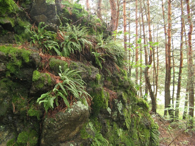
Je tak nejvychodnejsi evropskou lokalitou vyskytu Hadce (serpentin), resp. „Sladic obycajny hadcovy“ ( Polypodium serpentini) a vyznamne naleziste vzacnych kapradin, ze kterych jsou 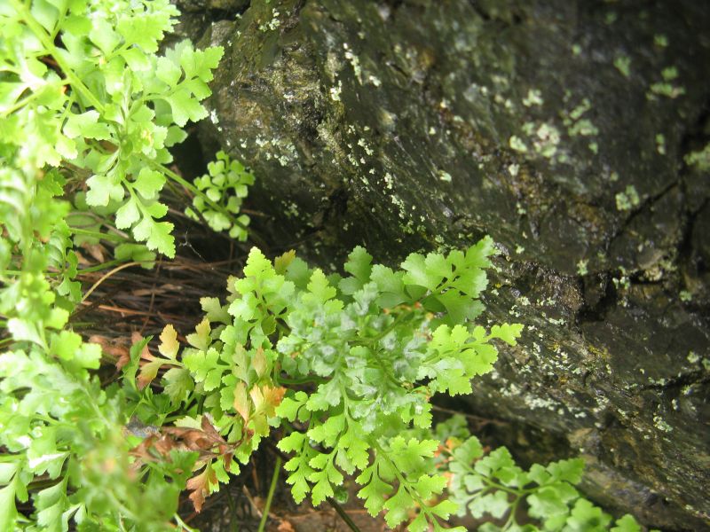
nejvzacnejsi „Slezinnik hadcovy“ (Asplenium cuneifolium), „Slezinnik nepravy“ (Asplenium adulterinum).
Toto uzemi je navhrnute za chranene uzemi evropskeho vyznamu site NATURA 2000. V soucastnosti velkou cast Dunitove skalky pohlcuje borovice cerna, v jejiz stinu nenachazi vzacne rostliny optimalni podminky k zivotu, proto je nutne ji odstranovat.
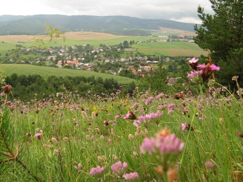
Krome vzacnych rostlin a horniny se muzete take pokochat krasnym vyhledem na cast obce Sedlice a okoli.
Jednotlive stage multikese kopiruji naucnou stezku. Prvni stanoviste se nachazi u autobusove zastavky a je zde take planek trasy, ktery jsem umistil i do listingu (viz obrazky). Na prvni tabuli se muzete jit kouknout, ale neni to potreba, tak vzhuru po naucne stezce.
Stage 1:
Zaciname u obecniho uradu. Tady zjistite rozlohu prirodni rezervace Dunitova skalka ve tvaru X,YYYY ha a zapiste si posledni cifru rozlohy jako cislo A. Bohuzel se sem vloudil textovy sotek a rozloha zde neni uvedena spravne. X je zde 3, nicmene spravny udaj je 0.
Stage 2:
Po celkem peknem stoupani si na teto stage muzete odpocinout. Z informacni tabule zjistite cislo B jako posledni cifru z roku, kdy byla prirodni rezervace oficialne zarazena do site NATURA 2000.
Stage 3:
Na informacni tabuli o botanice zjistete kolik druhu kapradin roste na Dunitove skalce a zapiste si ho jako cislo C.
Stage 4:
Nyni se nachazite na vrcholu Dunitove sklaky odkud je nadherny vyhled na Sedlice a siroke okoli. Na tabuli najdete vysku Somara a prvni cifru si zapiste jako cislo D.
Stage 5:
Stojite pred tabuli o zoologii a lesa. Z teto tabule zjistete kolik druhu ptaku se v prirodni rezervaci Dunitova skalka vyskytuje a oznacte jako cislo E. K dalsi stage se muzete vydat po jednodussi ceste doleva nebo obtiznejsi doprava.
Stage 6:
Posledni stage na ktere se dozvite chybejici cislo F. Na informacni tabuli o geologii najdete informaci o peridotitu a kolik druhu mineralu obsahuje v malem mnozstvi.
Final:
Samotna kes je ukryta na souradnicich:
N 48°55.BFA
E 021°07.ECD
[ENG]
The protected area, called „Dunit rockwork“ was created in 1964, it is interesting with occurence of the mineral „dunit“ to which are connected special kinds of plants, which doesn´t grow on another bedrock. So it is the eastmost europe place of the Hadec (serpentin), or „Sladic obycajny hadcovy“ ( Polypodium serpentini) and it is also important occurence of unusual ferns like „Slezinnik hadcovy“ (Asplenium cuneifolium), „Slezinnik nepravy“ (Asplenium adulterinum).
This area is suggested to be protected area of the NATURA 2000 network. In present most of the Dunit rockwork is covered by Black pine, in which shadow the plants can´t find optimal conditions to grow, hence it is needed to eliminate it.
Except these unusual plants and rocks you can enjoy nice view of the Sedlice village and the countryside.
All stages are placed on the educational trail. First stage is near the bus stop where is also the plan of the trail, which is placed here in the listing. You can go there, but it isn't needed. Let's go to the educational trail.
Stage 1:
Starting at the council. You are standing before the information table about the village. Read the size of the protected area Dunitova skalka and write down the last digit as number A.
Stage 2:
Find out the number B as the last digit of the year, when the protected area was officially included in the NATURA 2000.
Stage 3:
On the information panel about botany locate how many kinds of ferns is vegetating here and write down the number as C.
Stage 4:
Now you are on the top of the Dunit rockwork where is beautifull view of the Sedlice village and the countryside. On the table find out how high is the "Somar" mountain and the first digit represents the number D.
Stage 5:
You are standing before the table about the zoology and the forest. Get to know how many kinds of birds are living here and mark this number as E.
Stage 6:
Last stage to discover missing number F. Find out the information about the peridotit and how many kinds of minerals it contains in a small amount.
Final:
The final cache is hidden at the following coordinates:
N 48°55.BFA
E 021°07.ECD