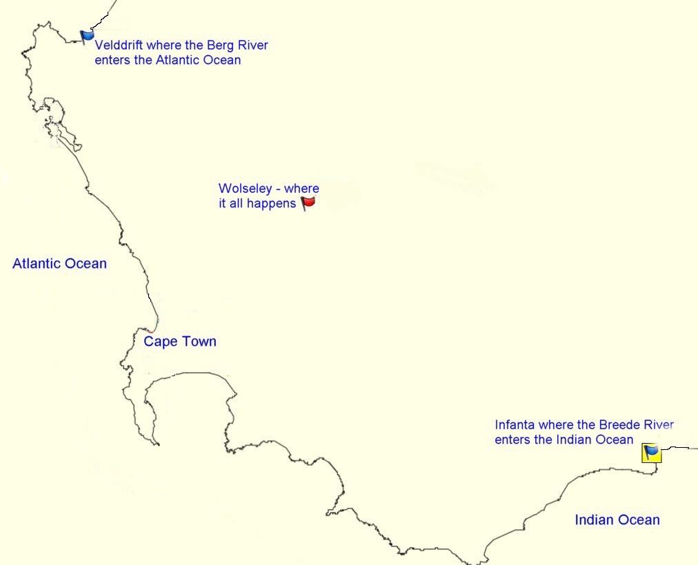
Wolseley has a rather unique feature in that it straddles a watershed - that makes it one of only two towns in the world to be situated on a watershed – the other being in Russia and this is why the cache is here. Water falling on one half of the town and indeed one side of this street drains into the Little Berg River, which flows towards Tulbagh and through the Nuwekloof Pass (Tulbagh Kloof) to join the Berg River, which runs into the Atlantic Ocean at Velddrif. The other side of town, and this street drains into the Breede River, which flows into the Indian Ocean at Infanta. These river mouths are about 700km apart.
The railway line from Wellington to the farm called Goedgevonden was completed in 1875. This point was called Ceres Road around which a town sprung up. It served as the railhead for fruit farmers in the area and an important link to the Diamond fields in and around Kimberley as a staging point for wagons until the railway was extended to Worcester and the hinterland. In 1910 residential stands were offered for sale and the town was renamed Wolseley in honour of Sir Garnet Joseph Wolseley, commander in chief, British forces, in the Zulu War of 1879.
The surrounding mountains, the Witsenberg, Waaihoek and Waterval are impressive and provide a good supply of water to this very fertile and rich valley, in winter the surrounding mountains are covered in snow.
Two Anglo-Boer War blockhouses (also caches)are found guarding the railway line to the south of the town.