See http://www.earthcache.org/ for further details.
GEOLOGICAL INFORMATION
A continental divide is a topographic feature – a natural
boundary line of elevated terrain which forms a border between two
distinct watersheds. This border means that streams, rivers and
waterways along the divide are separated with water flowing toward
opposite sides of the continent. Continental Divides result over
millions of years during the formation of the earth as mountain
ranges form and the earth’s crust folds, terrain erodes and ridges
and peaks that are now defined as divides are formed.
In North American there are five continental divides: Eastern,
Northern, Great, Canada and this St. Lawrence River Divide. The St.
Lawrence River Divide separates the Atlantic Ocean water shed and
the Great Lakes Basin.

At the coordinates of this earthcache, you will find the
sub-continental Divide as it runs through Wisconsin at Hwy 33 in
Washington County.
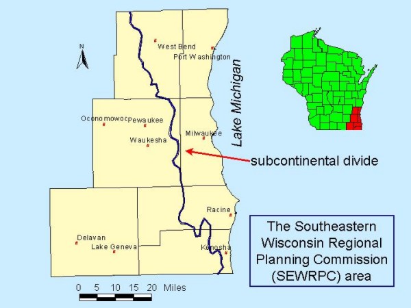
This sub-continental divide intersects the seven county region as
shown in the map above. While the population growth of the region
has had a great effect on the ground water flow system, the geology
or hydrogeology (ground water flow) has remained ever so constant.
For the purpose of this earthcache, I wanted to explore this
constant so you can gain an understanding of the aquifers of our
area that this sub-continental divide helps feed.
Our region has three principal groups of rocks, each containing
aquifers:
- 1. Shallow unlithified material containing sand and gravel
aquifers (Shallow part of flow system)
- 2. Shallow bedrock containing the fractured dolomite aquifer
(Shallow part of flow system)
- 3. Deep part of the flow system containing the sandstone
aquifer
Along Lake Michigan, the shallow and deep parts of the flow
system are separated by the Maquoketa shale, an aquitard that keeps
the deep sandstone under pressure.
Most municipal pumping in cities near Lake Michigan is from deep
bedrock.
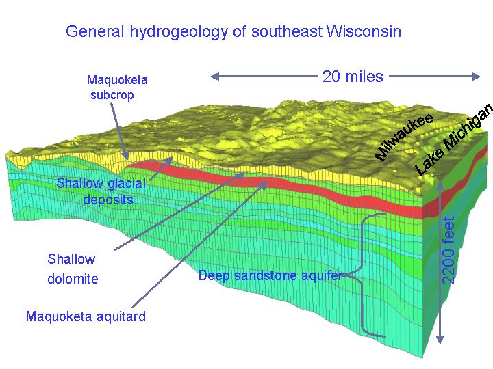
Source: http://wi.water.usgs.gov/glpf/cs_set_hydro.html
There is plenty of room for safe parking off the roadway.
At this point, you will be able to observe the natural boundary
line forming this ridge.
Enjoy your visit!
To log this earthcache, you must complete
TWO tasks.
1) Email me the answers to the following questions:
- A. According to the definition of a divide, the actual ridge
should be at a higher elevation that the surrounding land. When you
are facing the historical marker, is this ridge to your right or to
your left?
- B. How many feet above sea level AND how many feet above Lake
Michigan is this ridge?
- C. Water on the west side of this ridge travels down what river
and eventually this reaches what major body of water?
- D. Water on the east side of this ridge travels down what river
and eventually this reaches what major body of water?
-
If you like, bring a container of water. Pour it onto the grass
or asphalt near the posted coordinates to see which direction the
water flows.
2) BRING YOUR CAMERA. We would like a photo of your team
with your GPSr so it shows you were here but please do not include
the parts of the sign that give the necessary answers!
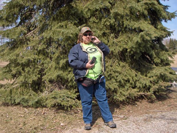
AuntieNae at the Divide
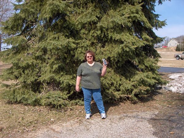
Gr8 Eyes at the Divide
Please be advised, failure to complete the
TWO tasks listed above (emailing the answer and posting your photo)
will result in log deletion without notice. PLEASE DO NOT POST A
PHOTO OF THE SIGN UNLESS THE ANSWERS ARE WELL COVERED.
THANKS
You do NOT have to wait for confirmation from me before logging
your find. Please do not make any reference to the answers in your
log.

 Want to be further rewarded
for visiting EarthCache sites around our planet?
Then why not become involved in the exciting new
EarthCache
Masters program. Just visit three or more EarthCache sites
(view guidelines)
to start being sent special collectable EarthCache Masters
pins. There are four levels to strive to own - Bronze,
Silver, Gold and Platinum. Its free and easy to participate!
Come join in the fun.
Want to be further rewarded
for visiting EarthCache sites around our planet?
Then why not become involved in the exciting new
EarthCache
Masters program. Just visit three or more EarthCache sites
(view guidelines)
to start being sent special collectable EarthCache Masters
pins. There are four levels to strive to own - Bronze,
Silver, Gold and Platinum. Its free and easy to participate!
Come join in the fun.
To visit an Earthcache near you, click on the Earthcache
Listings, and find a site that interests you.
Special thanks to Team HoneyBunnies who adopted Little Otters
traditional cache also at this location, for their permission for
placement of this Earthcache.