Alcaria Ruiva é uma freguesia do concelho de Mértola, com 215,24 km² de área e 1 013 habitantes (2001). Densidade: 4,7 hab/km².
Esta cache situa-se poucos quilómetros a norte de Mértola, no topo do Cerro de Alcaria Ruiva, ao lado da aldeia com o mesmo nome, a cerca de 315m de altitude, numa zona que integra o Parque Natural do Vale do Guadiana.
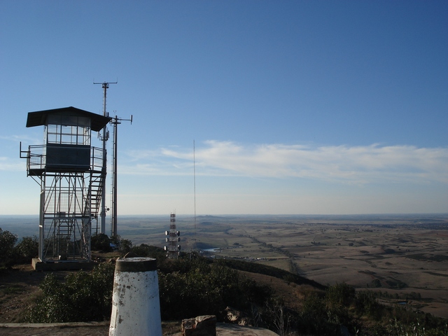
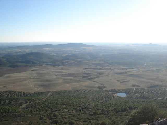
No local, acima das antenas de comunicações, encontra-se um marco geodésico de nível 1 e um posto de observação com vista previlegiada para a planície alentejana.
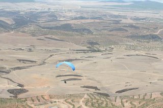
Dadas as óptimas condições do Cerro, existe também uma pista de 'descolagem' para parapente e fazem-se ali ocasionalmente cursos e encontros desta modalidade de vôo livre.

É possível chegar de carro até muito perto da cache, no entanto o estradão de acesso ao cimo do Cerro (em direcção às antenas) tem nalgumas zonas declive acentuado, é de cascalho e pode estar em mau estado no inverno. Se estima muito o seu automóvel, suba a pé ou use um todo-o-terreno. Neste caso, recomendo que deixe o carro junto às antenas.
Caso opte por caminhar desde a base do Cerro, a distância a percorrer deve rondar os 800m a subir, desde a estrada de alcatrão a norte do Cerro.
Na zona da cache há rochas soltas - cuidado onde põe os pés.
Divirta-se e não se esqueça : Cache In Trash Out.
ENGLISH: Alcaria Ruiva is a parish in the county of Mértola, with 215,24 km² of area and 1 013 inhabitants (2001). Density: 4,7 hab/km².
This cache is located a few kms north of Mértola, on top of the "Cerro (Hill) de Alcaria Ruiva", next to a village called Alcaria Ruiva, at about 315m of altitude, in a zone within the Natural Park of the Valley of the Guadiana.
From the hill top, near a geodesic landmark, you'll have a panoramic view over the 'planicie alentejana' (plain). The Cerro has excellent conditions for parapent and occasionally courses and meetings are held here.
You can drive very close to cache, however the track to the hill top (to the antennas) has accented declivity, has lots of gravel and it can be in bad conditions in the winter. If you care too much for your car, walk or use a 4x4.
If driving uphill, I recommend parking near the antennas. If walking, the distance is around 800m uphill, from the road north of the Cerro.
Near the cache there are loose rocks - watch your feet.
Have fun...and remember: Cache In Trash Out.