On the way to the Stawamus Chief (normally referred to just as "The Chief") from Vancouver you will pass Brittania Beach, which is a former mining town and now home to the BC Museum of Mining. The mining operations here ceased in 1974. Since then the area has been plagued with environmental concerns but is now becoming a rejuvenated community with an influx of interest from developers that could turn it into a popular place to live along this scenic coastline.
The next site of note that you will pass is Shannon Falls where you can view British Columbia's third highest waterfall at 335 metres. From the parking lot here there is trailhead access to one of the trails that ascends the Chief. Upon leaving Shannon Falls you should now see the huge rock wall just on the East side of the highway.
While the Stawamus Chief has always been a landmark for the people in the Squamish area, it only became internationally known when it was first climbed (the rock face itself) in 1961. It has now become home to many elite rock climbers and on most nice days you will see rock climbers gathering their gear in the parking lot or if your eyesight is good you will climbers on the wall itself.
The Chief lies within Stawamus Chief Provincial Park and you do not have to leave your car or the highway to see it. There are also easier ways to reach the top than climbing the sheer granite wall but you will still find it strenuous to reach the top of the Chief. Hiking trails lead to the 1st, 2nd, and 3rd peaks of the chief by way of the back side of the mountain which is quite a bit less steep than what you see from the highway.
Geology
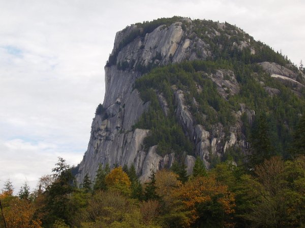
It is proclaimed that the Stawamus Chief is the second largest granite monolith in the world (The Rock of Gibraltar is the largest). Whether or not that is true, it is still 1 big rock! Much of the Coastal Range of British Columbia is underlain by granitic rock formed 95 million years ago. Through uplift and erosion some of it has now been exposed on the surface. One of the best examples of this granitic rock is the Stawamus Chief. Due to its proximity to the highway it is visible to a large number of people travelling between Vancouver, Squamish, and Whistler.
Legend
Stawamus Chief is named after the Indian village of STA-a-mus located at the north end of the Squamish River. STA-a-mus means "birth place of the winds" and Squamish itself means "strong winds". Undoubtedly these names reflect the typical weather phenomena experienced in the Squamish area which is the funnelling of winds coming off the glacier studded peaks of the area into a narrow canyon and out into Howe Sound. This also makes the area a popular one for windsurfing.
As of November 20, 2006 to log this Earthcache:
You must e-mail me some unique bit of information regarding the site that you learnt while there. This can be done by answering any of the following questions: What do you estimate to be the height of some of the sheer cliff faces? or What size are some of the trees that you see amongst the cliff faces? Posting a photo is not required but appreciated. I will monitor logs and check my e-mails for appropriate information. Unfortunately, any log that does not meet the requirements will be deleted. Thanks for visiting an Earthcache!