About 100 feet east of this
waterproof match container is a series of ground water monitoring
wells maintained by Dr. Mohammad Iqbal in the Earth Science
Department at UNI. There are 8 shallow wells, ranging in depth
between 10 and 20 feet. The shallow ones are made of PVC pipe and
only reach down to the alluvial aquifers (sand and gravel) just
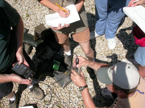
overlying the pre-illinoian glacial till. They are used for
teaching demos as well as for contaminant transport modeling. They
use them to see how fast dyes injected in the soil make it into the
ground water at that level.
There are also 2 deep wells,
[they have larger pipes that are made of metal]. One penetrates
down 70 feet and the other is 90 feet deep. They reach into the
upper Devonian limestone bedrock aquifers. The bedrock in this area
directly underlie the pre-illinoian till.
The well site was developed
through funding from the UNI, and the Iowa Science Foundation. It
is located by the Dry Run creek on UNI property making it
convenient for Dr. Iqbal to show students the linkages between the
surface water and the ground water below.
They get to compare water
chemistry from this site with a few other locations in the Dry Run
Creek. They also compare results with some locations in the main
channel Cedar. This gives students a realistic view of how our
water resources get polluted by agricultural, municipal, and
industrial activities.
The following parameters are
monitored but not regularly as yet: nitrate, nitrite, phosphorus,
total dissolved solids, conductivity, dissolved oxygen, pH,
temperature, chloride, and sulfate.