Menominee County does not currently have a lot of caches, so we
thought it would be fun to create a series of caches to bring
people to a bunch of places within the county that may have not
been seen by most geocachers and travelers before and to place a
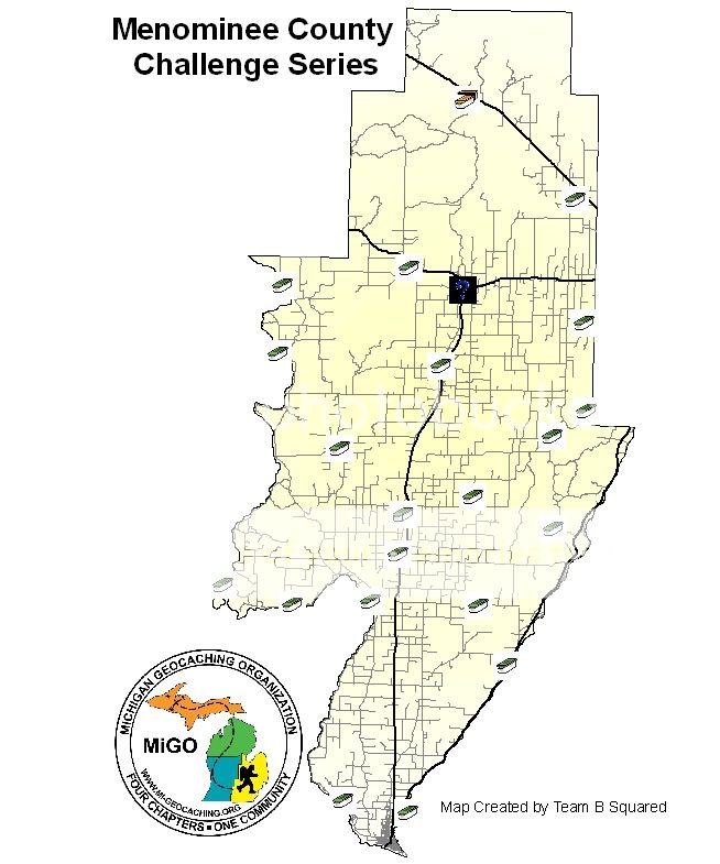
few new caches. To that end we have placed at least one cache in
each of the 14 townships of the county as well as a few other
municipalities. We tried to take you off the beaten path a little
bit with this series, we hope that you enjoy hunting these caches
as much as we enjoyed placing them.
Menominee River
The Menominee River is a huge part of the geography of Menominee
County, acting as the border of the county with the state of
Wisconsin until it reaches its terminus at Lake Michigan. The
Menominee River is about 118 miles long and forms about 10 miles
northwest of Iron Mountain, where the Brule and Michigamme Rivers
combine. The entire length of the Menominee River forms part of the
geographical border between Wisconsin and Michigan's Upper
Peninsula.
This cache takes you to a little known public access point along
the Menominee River, we hope that you enjoy it! It is just a short
walk from the parking area to the cache.
This cache is part of the Menominee County Challenge (MCC)
series. Please be sure to note the letter on the inside of the
cache lid, as you will need this letter to come up with the
coordinates for the final cache.
The caches in this series are...