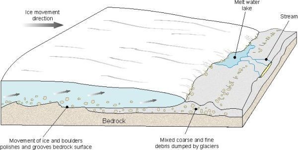
Over 300 million years ago, this area of South Africa was part of the super-continent Gondwana, which was then situated near the south pole and covered with ice. Rocks imbedded in the slowly moving ice sheets scoured and polished the underlying older rocks giving rise to glacial pavements. Here in KwaZulu-Natal Striation marks found indicate that the direction of the ice flow was from North to South
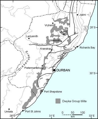
Surveys have shown that the rocks overlying the Natal Group is a thick unit of Tillite. This was deposited in the glacial environment by retreating ice sheets during this period.Tillite is mostly a very fine-grained, blue-grey rock comprised of clay matrix with inclusions (or clasts) of many other fragments picked up by glaciers during their travels. The map below shows areas where Dwyka Group Tillite can most commonly be found in KwaZulu-Natal.
The photographs below are just some of the clasts evident in the rock formation at the given coordinates.
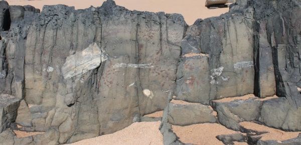
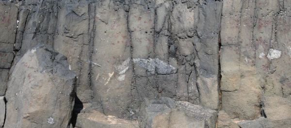
This this outcrop of Tillite appears to have to have evidence of lava layer as well. From the studies of the geology of Kwazulu-Natal it is stated that there was a significant period of unique igneous activity following Gondwana breakup, That formed numerous volcanoes of kimberlite rock, commonly known to contain diamonds. Unfortunately, the kimberlite pipes of KwaZulu-Natal have not yielded any significant diamonds. This is due to the kimberlites having originated from beneath the Natal Metamorphic Province.
To claim this Earth cache you need to email the cache owner the answers to the following questions:
1: What are the clasts sizes that can be seen in the exposed rock face.
2: Apart from the clasts, what else can be seen in the Tillite layer?
3: If you view the angle at which the layer of Tillite now lays, estimate this angle and in your own words describe why this is so?
4: look around the area and describe any other Geological feature that can be seen close to GZ
Source:
Geology of KwaZulu-Natal
http://www.geology.ukzn.ac.za/GEM/kzngeol/kzngeol.htm