Kayak Point Overview Traditional Geocache
-
Difficulty:
-

-
Terrain:
-

Size:  (regular)
Please note Use of geocaching.com services is subject to the terms and conditions
in our disclaimer.
Trail head is in the Kayak Point campground, just east of campsite #15. Use the trail with the rough sign, not the one with the cable. You will have to pay for day use unless you have a Snohomish County permit. **Note 9/13/14** The aforementioned trial seems to have been closed and is now grown over. The best access id form the trail beginning by the water faucet next to camp site #15.
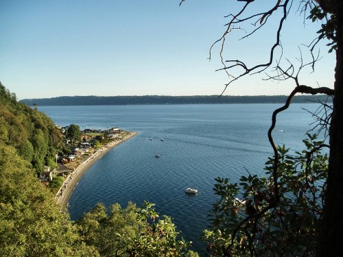
The cache is 50cal ammo box close to a primitive trail that follows along the edge of a cliff. The view is lovely, but may be dangerous if you have small children or dogs with you. **Note 9/14/14** I haven't been to this cache in several years and was surprised at all the changes. Parts of the trail are grown over, parts of the cliff edge have crumbled off and trees have fallen. The trails have rerouted and are somewhat more rough but you can still get through. The coords now show GZ as off the side of the cliff! I relocated the cache so that it's back from the edge but still within 20 feet of the coords. You do NOT have to go near the edge to find the cache. Please disregard the log that mentions Madrona trees as the container has been moved.
Additional Hints
(Decrypt)
Vafvqr n snibevgr jbbqynaq pnpur uvqvat fcbg, npprffrq sebz gur gbc.