Come join us for a fun filled weekend of games,camping
and geocaching. This year's picnic will be held only on Saturday, with other events being planned for Friday and Sunday. You can come for a couple hours have some fun and meet a few new friends. Or you can come for a couple of days have some fun and meet a whole bunch of new friends. Either way you will go away with some great memories and many new friendships. We have reserved the park for the entire weekend so this event will be held rain or shine.
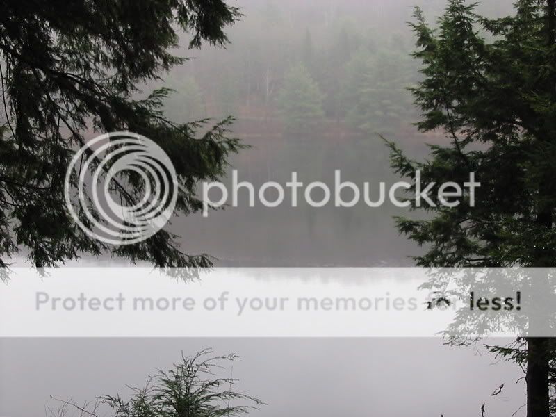
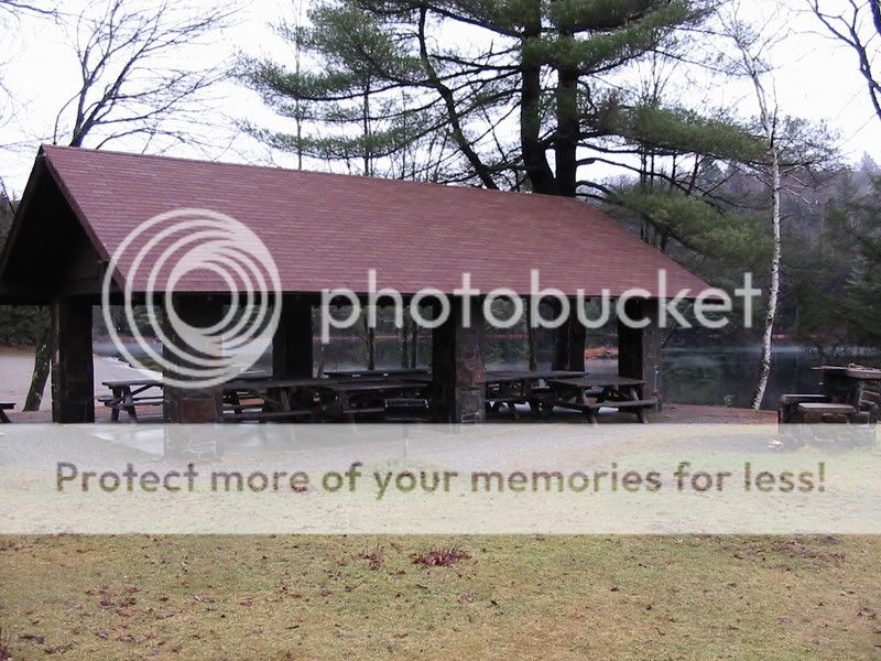
The parks 176 acres is a quiet alternative to other parks in the region. The park is set on BlackRiver Pond, which was dammed in the 1930`s by the Civilian Conservative Corps (CCC). The park was opened to the public in 1962. A special feature of the park is a Charcoal Kiln Site, which may be found by hiking a trail that begins at the southern corner of the main parking lot. The Capital District Wildlife management Area surrounds the park and offers another 4, 153 acres of NTS forested land for outdoor recreation. Picnic grounds and a boat launch are adjacent to the beach. The park also has bridle paths and hiking, biking and nature trails. Anglers fish for bass, bullhead and pickerel. The park has 30 sites for overnight camping. Additional information can be found at Cherry Plain SP. The park is closed this time of year, so site reservations will go through me. More on that in my next update. Folks only coming for the day will not be required to pay the $7 day use fee, as it has been waved for the weekend. I will be editing this page on a regular basis as the picnic gets closer so check back often.

This is a Potluck Picnic.
This year the Capital region Geocachers will be supplying the Hamburgers, hot dogs and buns. We need people to bring a dish to share with the group and whatever you would like to drink. Please add the number of people in your group and what you are bringing to share for the picnic to your "will attend" log.
Pets: Pets are allowed with proof of current/valid rabies vacination. Campers can walk a dog on a leash no longer than 6 feet as long as the dog is under control. Dogs can not be left unattended. Campers are responsible for cleaning up after your pet. Pets are not allowed in day use areas, beaches or any structures.
Cell Phone Coverage: There is very spotty cell service at the park. My Verizon phone jumped between 1 bar and no service. The park does have a pay phone
Directions:
Cherry Plain State Park
26 State Park Road, Po Box 11
Cherry Plain NY 12040
From points north: Take the Northway, rt. 87, south to exit 7 rt. 7. Follow rt. 7 east toward Troy/ Bennington for 5.6 miles to rt. 278 on right. Right on rt. 278 for 1.5 miles to rt. 2. Left onto rt. 2 for 13.3 miles to rt. 22 south. Right on rt. 22 and follow it for 10.8 miles to CCC Dam rd. on the right. Follow CCC Dam rd for 2.5 miles to the park on the left.
From points south: Take NYS Thruway north to Albany exit 23. Follow rt. 787 north to exit 5, I-90 East. Follow I-90 East for less than a mile to exit 8. Follow the ramp to the second light where rt. 43 starts. Go straight through the light onto rt. 43 and follow it 8.6 miles to the fifth traffic signal from the highway(ignore the blinking light in Averill Park). Go straight through this light onto Taborton road and follow it to its end (8.4 miles) at Miller rd. Take a right onto Miller rd. and follow it 2 miles to Cherry Plain SP on the right.
From points east: Take New York State Thruway (Interstate 90 Berkshire Spur) to Exit B3. Take a right on Route 22 and head north for 20 miles to CCC Dam Road, take left onto CCC Dam Road. It is 2.5 miles to the park.
From points west: Head east on Interstate 90 to Exit 8 (Defreestville/Route 43). Follow Route 43 east for 8.6 miles to Sand Lake (fifth traffic signal from the highway). Continue straight onto Taborton rd for 8.4 miles to Miller Road. Take right onto Miller Road. Follow Miller Road for 2 miles to the park.
Schedule of Events:
The schedule of events may change so check back often or put this page on your watchlist. I'll post a note whenever I make a change.
| Saturday, September 15th, 2012 |
| 9:00am -- Registration Opens |
| 9:00am -- Poker Run Registration |
| 9:00am -- Downloading of Coordinates |
| 10:00am -- Geocoin trading at the pavilion |
| 11:45am -- Potluck Lunch |
| 3:00pm -- 5:00pm Poker Run Check In |
| 5:00pm -- Group Photo |
| 5:15pm -- Game Winners Announced |
| 7:00pm -- Night caches available |
| 8:00pm -- Campfire --At the pavilion |