 Photograph by Quingdao. A Word or two of Warning: Hidden at 840m (2755ft) this isn't an easy spot to reach, and there's no phone reception. I suggest this cache isn't attempted alone, take clothes for a change of weather and let someone know where you're going and when you expect to be back.
Suggested Parking: N56° 55.259' W004° 33.389' (260m/853ft elevation), where there's off-road parking for a car or two, at the end of a blocked-off layby. If it's full, there's another a little way to the north-east, at the other end of the closed-off layby.
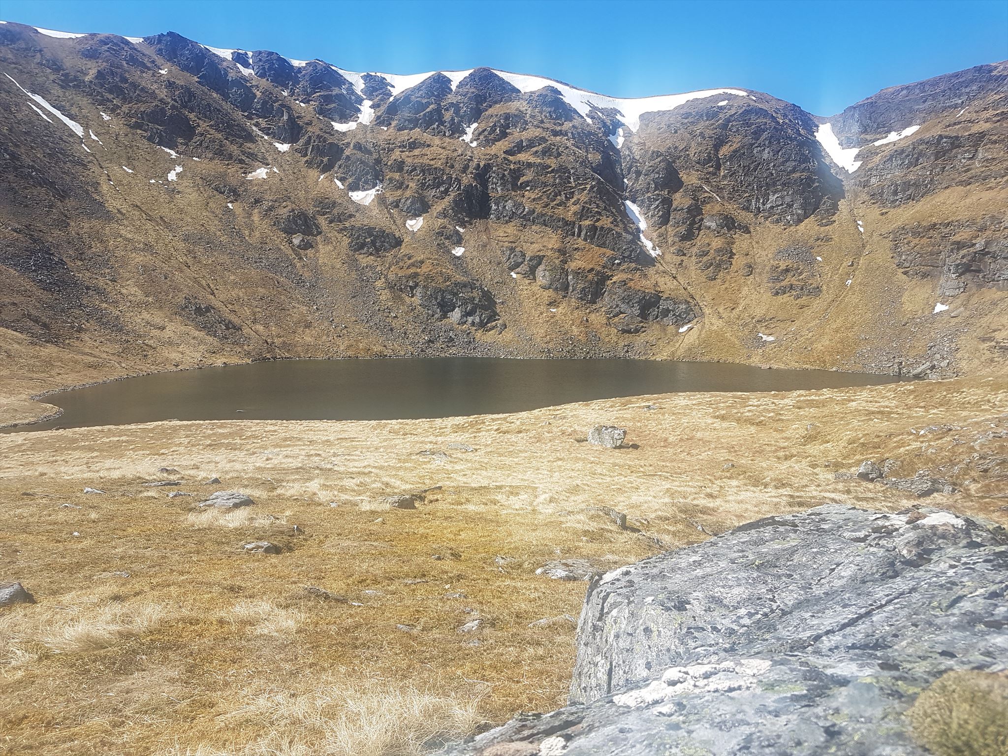
Suggested Route: From parking, walk over the stones used to block the layby to vehicles and have a look at the bridge over the little river. Looking up-hill, pass into the trees of Moy Woods to the left of the water (there's a gate, or even easier, just duck under the remains of the wire fence) and climb up between them, following the fairly visible path. Don't cross the river, but pop-out of the woods at the top, via a rusted gate at the end of the meandering path. Climb up, crossing the river at the small bridge if you want (it's what I did) and follow the east bank NNW, past another waterfall, then carefully recrossing the water on stones (or not) to continue up onto a bit of a plateau below the horseshoe of hills which enclose Lochan Coire Choille-rais. It's about a 580m (1902ft) climb and because of the terrain, will take at least an hour (mere mortals, anyway) but could take much longer, especially in poor weather. This is no easy drive-by!
The Cache: A good sized lock-n-lock box hidden by the local cache-hiding material. May be rather harder to find in snow! At the cache site you'll have a view of the lochan and down into the valley below, where you parked. A more peaceful, dramatic, beautiful, lonely spot I challenge you to find.

Read more about The Historic Geocaches' campaign.