Location History
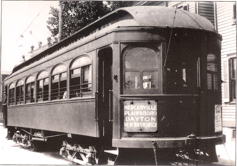 The Fast Line trolley, build in 1902 provided access to two of Central Jersey's primary cities, New Brunswick and Trenton. The small villages Dayton and Deans grew in size and population along the trolley route. The "Trenton and New Brunswick Fast Line" trolley was part of a vast network of trolley lines throughout New Jersey in the early 1900s. Several "traction" companies preceded Public Services Fast Line and were incorporated into the "Fast Line" interurban route. The first section of The Trenton and New Brunswick Traction Company was laid in 1902. This rail line crossed South Brunswick in a diagonal line from north-east to southwest. Regular passenger service began on May 13, 1904. Trolleys ran hourly with half-hour service between Trenton and New Brunswick. Average daily ridership was estimated to be 650 pasangers!
The Trenton and New Brunswick Fast Line, was one of many Public Service lines that networked across the state. This branch ultimately connected Newark to Trenton, creating the Newark-Trenton Fast Line. In 1913 the fare was $.95 one-way from Newark to Trenton.
Local stops were in Plainsboro, Dayton at Georges Rd. and Deans, at Deans - Rhode Hall Road.
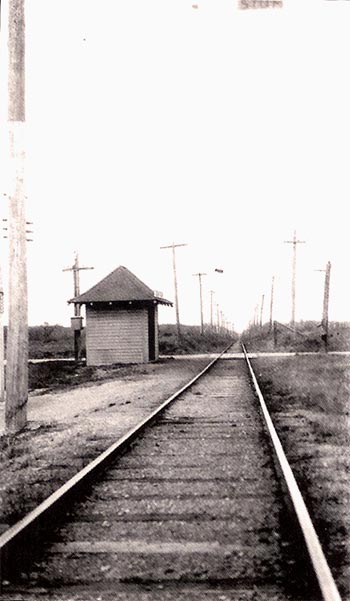
The "Fast Line" route is now traversed by Public Service Electric lines, where once trolleys carried passengers making various stops along the way, today electricity flows on high-tension towers. After World War I, passenger use declined, Competition with the Pennsylvania Railroad and the automobile were the main causes. On January 16, 1936, the Trenton-New Brunswick line ceased operation. A section north of New Brunswick remained in operation until the end of service on May 11, 1937. The Fast Line tracks was removed and later replaced with steel towers for electric transmission lines.
The cache is near the mile mark for Ireland Brook (East Brunswick./South Brunswick boundary) and is approximately 28 miles from Trenton, 4 miles from New Brunswick and 32 miles from Newark via rails.
 Other nearby crossing are:
- Patrick's Corner (Station)
- Davidson's Siding, P.S. (Station)
- Dean's Station
- Cranbury Turnpike (Dayton Station)
- Monmouth Siding (Station)
- Dayton Trestle (Jamesburg & Freehold Branch, PRR )
- Coaling Siding, P.S
- Wolff's Road
- Friendship Road (Station)
- Broadway (Station)
- So.Brunswick- Cranbury Line (Scott's Corner Station)
Referances:
1. Public Service Trolley lines in New Jersey. Edward Hamn, Jr. 1991.
2. The Marker. Published by North Jersey Chapter of National Railway Historical Society. No. 25. November 1952. "Fast Line Album: a pictorial history of the Public Service Railroad.
3. Images of America: South Brunswick, Maria Kotun, 2004
http://www.daytonvillage.org/history/trolley.htm
http://en.wikipedia.org/wiki/Newark-Trenton_Fast_Line

This cache is certified Central Jersey!

