 Welcome to Werner-Boyce
Salt Springs State Park - Florida's newest state park - located
along the west coast of Pasco County. Only a small section of the
park is open for landside access, with an entrance off Scenic
Drive. However, the park is open for exploration by kayak or canoe.
With over four miles of frontage on the Gulf of Mexico, natural
springs, and twelve navigable streams to explore, it is truly a
kayaker's dream come true. For more information about the park,
visit the official park service webpage at floridastateparks.org/wernerboyce.
Welcome to Werner-Boyce
Salt Springs State Park - Florida's newest state park - located
along the west coast of Pasco County. Only a small section of the
park is open for landside access, with an entrance off Scenic
Drive. However, the park is open for exploration by kayak or canoe.
With over four miles of frontage on the Gulf of Mexico, natural
springs, and twelve navigable streams to explore, it is truly a
kayaker's dream come true. For more information about the park,
visit the official park service webpage at floridastateparks.org/wernerboyce.
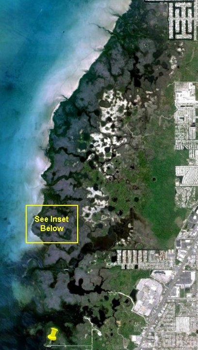
Currently, there are no kayak launch points within the park. Once
the main entrance to the park (on the west side of U.S. 19 just
north of Ridge Road) is opened, a kayak launch facility is planned.
But for now, the nearest launch point for access to the southern
part of the Park is at Brasher Park at the end of Koons Road in
Port Richey - shown as a yellow pushpin on the park map.
Note: the north extension of Old Post Road leads to the Pasco
County Energy Marine Center (owned by Pasco County Schools) and the
State Park headquarters, and is not a public road. There are no
publicly accessible kayak/canoe launch sites in this
area.
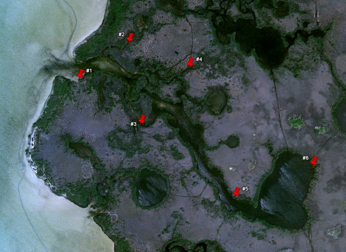
This Pound Net Creek kayak series takes you on an ambitious 6 mile
round trip tour of one of the smaller tidal streams in the park.
From the launch at Brasher Park it is almost two miles in mostly
open gulf waters to get to the mouth of Pound Net Creek. There are
6 caches in the series - illustrated by red pushpins in the map
below. All are match holders tethered in place. You will need about
1-1/2 feet of tide to access this series. Bring enough water,
snacks and sunscreen to last 3 to 4 hours.
Note: All of the geocaches in this series may be accessed
without leaving your boat. In fact, there are very few places in
the wetlands area where land access is convenient. While kayak and
canoe access to the park is welcomed, please respect the natural
habitats and nesting areas by refraining from hiking and exploring
on foot in the wetlands area.
Geocaches were placed with permission of Larry Steed, park manager.
Congratulations to Postpile and
Zogstarlene for the FTF!