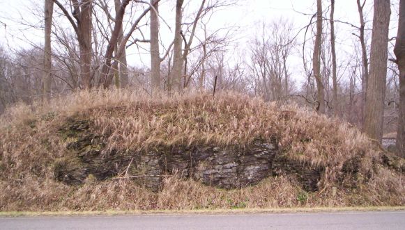
This Earthcache will take you to a fine example of a small
Wabash Valley Klint east of Lagro, Indiana. It is a small
outcropping of limestone that sticks out like a sore thumb on the
relatively flat flood plain of the River which lies to the south.
North of this location you will note many high bluffs and ridges.
This klint has been cut into to allow for the highway revealing a
cross section. Trees are growing on top of it and the groundcover
is periwinkles, which would have to have been introduced. Please do
not climb to the top of the Klint. So what caused it?
Klintar: Ancient Marine Reefs
of the Wabash Valley
Scattered throughout the Wabash sluice-way
between Huntington and Peru, Indiana are numerous dome- and
mound-shaped hills, which are remnants of ancient coral reefs.
These reefs may be partly or completely isolated as rocky hills, or
they may form bluffs along streams. These features are called
klintar (the singular is klint) after similar fossil reefs on
Gotland Island in the Baltic Sea.
The Wabash Valley klintar were formed in
Silurian seas that covered the area more than 400 million years
ago. Later deposition buried them to unknown depths. After regional
uplift, weathering and erosion removed overlying strata, parts of
these ancient reefs were gradually exposed. Rock materials left
behind by Ice Age glaciers reburied many of these reefs, and some
of them were again partly exposed by postglacial erosion. Hanging
Rock just south of here is a very large klint.
The form of a klint is primarily dependent
on the original contour of the reef mass, but in some cases the
final shape of the hill has been determined by the degree to which
the enclosing materials have resisted erosion. Rock ridges in the
Wabash Valley form a special type of klint, in which the upstream
portion consists of a partially destroyed reef standing up as a
bulwark that protects the low narrow tongue of unremoved bed rock
or glacial drift on the leeward side.
"Busy Road"
In order to log this cache you
MUST:
1. Post a picture of yourself, including
your face, holding your GPSr with the Klint in the
background.
2. Email the cache owner your estimate of the
height of the Klint from the road bed to the
top.
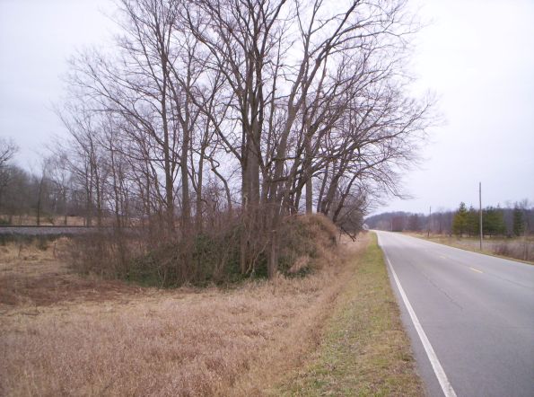
There is not room to park on the highway
shoulder. Park on a side road east of the cache site, and hike
back.
Happy hunting!

GAG PHOTOS WILL NOT BE ACCEPTED
THIS YEAR'S SPONSORS Click on Image to visit
webpage):
Military Association of GeoCachers

WABASH WARRIORS |


Lex et Libertas—Semper Vigilo, Fortis,
Paratus, et Fidelis! Please pray for our Patriot Armed Forces
standing in harm’s way around the world, and for their families,
especially those of our fallen Soldiers, Sailors, Airmen, Marines
and Coast Guardsmen, who have died in defense of American liberty
while prosecuting the war with Jihadistan.