Flooding has presented a danger to human settlements from the time we built our homes and cities near the water. Catastrophic flooding occurs when water inundates the land with such speed that it is difficult or impossible to escape from it. One form of catastrophic flooding occurs due to a Jokulhlaups. A true Jokulhlaups occurs when a sudden flood of glacial meltwater is released when the ice has been heated by volcanic activity. However, the meaning is sometimes extended to include any glacial outburst flood from an ice-dammed lake. In simple terms, a lake is dammed by a glacier, then glacier melts enough to cause the lake to suddenly drain through a channel in the glacier.
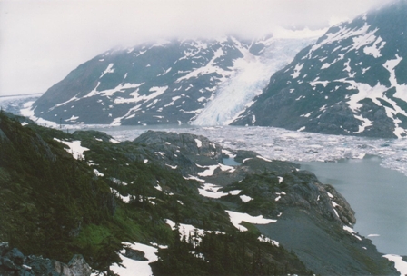
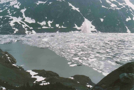
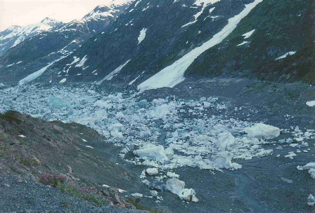
These events have been recorded in many parts of the world where glaciers exist. The most common location is Iceland where many glaciers exist and volcanic events are frequent. On a smaller scale, these events have been recorded in places lake; Salmon Glacier (Summit Lake) on the British Columbia and Alaska border, Grasshopper Glacier in Wyoming, and Mount Rainier's Tahoma Glacier in Washington State.
The geologic record shows that there have been some enormous glacial outburst floods in the past. One of these occurred during the last ice age when water draining out of Lake Missoula, commonly known as the Spokane Floods, which rushed down the Clark Fork River and into the Columbia River in central Washington State. To read about the details of this and other similar events please visit: http://vulcan.wr.usgs.gov/Glossary/Glaciers/IceSheets/
Due to the nature of Jokulhlaups, it is unlikely that most people will be able to witness them unless they live in Iceland. They occur very infrequently, however the Salmon Glacier (Summit Lake) releases its water almost annually and it is possible during good weather to drive to the site. The flow of the Salmon River nearly triples, periodically washing out roads along the waterway including the road you need to travel on to reach the lake!
As of November 20, 2006 to log this Earthcache:
You must e-mail me some unique bit of information regarding the site that you learnt while there. This can be done by answering one of the following questions: if the lake is full measure the temperature of the water or estimate the amount of ice floating in it; if the lake is empty what is your estimate of the depth of the lake when it is full? Posting a photo is not required but appreciated. I will monitor logs and check my e-mails for appropriate information. Unfortunately, any log that does not meet the requirements will be deleted. Thanks for visiting an Earthcache!