 South
Cedar Natural Area___
South
Cedar Natural Area___ ___
___
This is
one of 50 Cache's that Celebrates the Linn County Conservation's
50th Anniversary
In 2008, the Linn County Conservation Board will celebrate 50
years of service to Linn County residents.
A yearlong celebration is planned to highlight all the outdoor
recreation opportunities available right here in Linn County.
In celebration of Linn County Conservation's 50th Anniversary there
will be 50 GeoCaches placed within various parks and recreation
areas in the next year.
Additional information can be obtained from the Linn County Parks Website and
the Iowa
Geocachers Website.
The Cache is an Ammo Box hidden in a typical way.
Other GeoCache's at the South Cedar Natural Area:
Cedar View Stash
Gaurdrail in Space
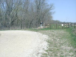
South Cedar Natural
Area
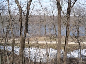
South Cedar Natural Area is located along the Cedar River south
of Mount Vernon, Iowa.
This 162-acre area features two boat ramps, primitive camping areas
and picnic sites.
This area is open to hunting in season.
Due to it's proximity to the Cedar River, this area is prone to
flooding during high water events.
You may wish to check with the Conservation Office as to the status
of our South Cedar area should there be general high water
conditions on the Cedar River.
Parking is available at:
N 41° 52.618
W 91° 26.619
Because of the flooding on
June 14th 2008 the Ammo Can has been (temporarily) replaced with a
Decon
Please obey Park Rules
Open from 4:00am - 10:30pm
Winter / Snow Rating:
Difficulty:  Terrain:
 (1 is easiest, 5 is
hardest)
(1 is easiest, 5 is
hardest)