Obsidian Memorial Plaque Mystery Cache
-
Difficulty:
-

-
Terrain:
-

Size:  (regular)
Please note Use of geocaching.com services is subject to the terms and conditions
in our disclaimer.
This is a LONG HIKE in an area that you will not soon forget.
Depending on your route (we suggest the long one) you will travel
12-17 miles and climb 2000-2500 ft. TAKE A CAMERA.
Limited Entry Area Permit is required to enter this area. Call
Mckenzie River Ranger Station to obtain the pass (no charge)
541-822-3381
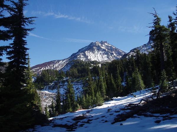
On October 22, we headed out to hike the Obsidian Trail in the
Three Sisters Wilderness area. It was a beautiful late fall day.
Nippy in the morning, t-shirts in the afternoon. Clear skies and
lots of sunshine. What an amazing area.
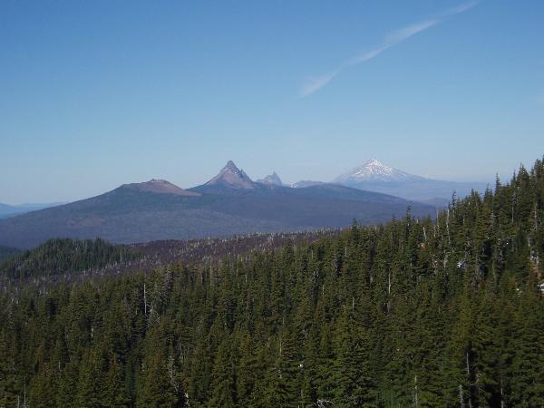
To do the long hike, continue north on the PCT through Sawyer Bar,
Opie Dildock Pass, and Minnie Scott Spring. Catch trail 3531 west
and walk past Four In One Cone back to the highway. More than worth
the extra steps required. The views are unforgettable.
Near the trail(s) there are three memorial plaques.
You will be looking for them to gather some information.
The Prouty Plaque located near 44 10.623 121 49.037
The Montague Plaque located near 44 10.201 121 49.522.
The Bronaugh Plaque located near 44 10.621 121 49.048.
At some point you will pass Obsidian Falls, you will need to
post a picture of your team with the falls in the
background.
On your way out, you will find the cache using the following simple
formulas.
ABC = (Richard's Age + Jerry's Age + Harley's Age)*3 +11
DEF = (Richard's Age + Jerry's Age + Jerry's Age + Harley's
Age)
44 12.ABC
121 52.DEF
checksum 44
Additional Hints
(Decrypt)
QBAG SBETRG GUR CVPGHER NG BOFVQVNA SNYYF. Guvegl srrg bss genvy.
Treasures
You'll collect a digital Treasure from one of these collections when you find and log this geocache:

Loading Treasures