Thorolfur's Treasure Multi-cache
One of the Texas Vikings: The treasure has been bulldozed...
-
Difficulty:
-

-
Terrain:
-

Size:  (regular)
Please note Use of geocaching.com services is subject to the terms and conditions
in our disclaimer.
Trace the wanderings of Icelandic Vikings to find where they hid
their treasure.
The
(New) 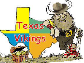 Texas Vikings
(berserkers all
!) Present:
Texas Vikings
(berserkers all
!) Present:
Voyages of the (Old)  Vikings to
Texas
Vikings to
Texas
"Real Viking Rune Stones"
(Runes comprise an ancient
Scandinavian alphabet, with each letter having a name and
meaning.
Although it isn't known exactly when runes first came into use
they predate Christianity.
Germanic and Scandinavian tribes used rune divination to predict
all aspects of the future.
Runes for fertility,love, and good fortune were carved onto stones
and worn as amulets.
The rune casters were honored members of the
tribe.)
|
The
Saga of
Thorolfur's Treasure
|
|
A
bout 1000 years ago,
a famous Icelandic Viking by the name of
Thorolfur, voyaged southwest from Iceland and
sailed along the Eastern Seaboard of the United States.
This intrepid explorer, along with his 30
Vikings, including 5 Berserkers, continued around the
peninsula of Florida and into the Gulf of Mexico.
Continuing into a large bay,
which would become Galveston Bay in about 500 years,
they sailed north into a large flowing river.
Large reptiles, with huge teeth swam in the swampy
areas, as Cypress knees grew out of the water. Here, they
found
a completely different land than they had ever seen before.
Slowly as they sailed North, the river, which
would eventually become known as the San Jacinto, narrowed and
it
became two. Here, they took the West Fork and after a while put
ashore.
On shore, Thorolfur thought about how to hide
the gold and silver, that they had taken from the semi-clothed
savages, and then at a later time be able to come back and
retrieve the treasure.
As there was too much to take all the way back to Iceland, it
would be better to hide the treasure in the woods in the
new land. He left a Rune Stone, where they came ashore.
After he placed the Rune Stone, he took 10 of his
men along with two Beserkers and started out over land,
to hide the treasure. At certain intervals,
Thorolfur left an additional Rune Stone, to
mark their trail back to the treasure.
Unfortunately, the compass was not invented
yet, so the path they took was not in a straight line.
Later the area where he left the first Rune Stone
would be known by latitude/longitude:
N30 02.446 W095 08.044
(This is
the correct location of the first
stone)
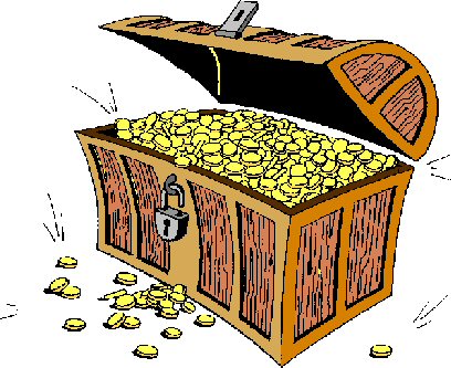
The only way to find the
"Thorolfur's
Treasure" is to follow the
Rune Stones.
| 1: Start at the above
coordinates in red. |
| 2: Find the first rune
stone, |
| 3: Match it's rune to the
chart below. |
| 4: Read the coordinates. Use
this set of coordinates to find the next stone. Not all the runes
on the chart are used on stones. |
| 5: Please replace stone as you
found it, to allow other cachers to participate. |
| 6: Watch for the Rune in
gold. It
indicates the next find is the treasure
! |
Top of Rune
Stones |
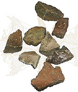
These
are some of the real stones, but
these Runes are done on the computer
to show you what the Rune Stone will look like.
The real stones have the Runes carved
into the bottom.
The sample Runes may or may not have
been used, they are shown here as samples
of what the real ones will look
like....
Each stone is approximately
7 inches by 11 inches and weighs about
2 pounds. Each stone has a Rune (symbol)
on the bottom.These runes correspond to the chart
below. |

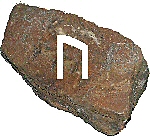 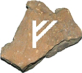
Bottom of Rune Stones,
showing Runes. |
Remember to watch for the GOLD rune,
it's the one that sends you to the Treasure !
Not all the runes on this chart are used,
just some of them.
Cache is a .50 cal Ammo Can,painted and covered with
Camo cloth. Contents include
various items, including a log and pens.
This cache placed by a

Member
Come visit our website.
|
Additional Hints
(Decrypt)
Gurer ner fvk fgbarf jvgu eharf pneirq vagb gurz.