Cache
Information
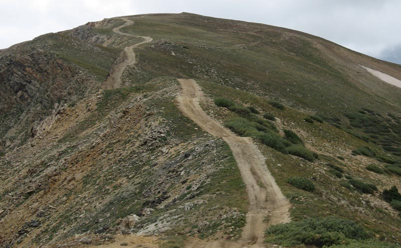
This cache is located
near the beginning of the big hill climb up to the top of Glacier
Mountain. From the cache location, you will have a good view
across the valley to the trail that you came up from Deer
Creek. The climb to Glacier peak looks intimidating, but it's
not as bad as it looks (weather permitting).
RM Off Road Series #3
Complete Cache Listing (North to
South)
1.
First Meadow
2.
Hill Climb Pull Out
3.
Beautiful View
4.
Are we Having Fun Yet?
5.
Hill Climb
6.
Stream Front Property
7.
Cross the Pond
Trail
Information
Rating/Description
The trail starts at Montezuma just above Keystone (Hwy. 6) and
works it's way up Deer Creek eventually climbing above the
tree-line. Once you are up on top, you will follow and awesome
ridgeline with amazing views in all directions (don't forget your
camera). After traveling along the ridgeline, you will climb
up over Glacier Mountain and then traverse some switchbacks into a
beautiful valley where Saints John Creek flows. Saints John
Creek will bring you back to Montezuma where you
started.
This trail is rated moderate and it lives
up to that rating most of the way around the loop. There are
a few sections of this trail that are trending more toward the
difficult range because of the steep hill climbs. Many people
do this trail in their SUV's, but this trail is not suited for low
clearance soccer mom SUV's and you will definitely need (and use)
low range a lot of the time. You should only attempt
this trail if you are an experienced off road driver.
Disclaimer: What ever vehicle you decide to bring on this trip, you
need to decide for yourself if it is safe to make the trip in your
vehicle.
Winter
Months
The trail becomes 4wd impassable in the winter months and is
probably closed. It was actually snowing lightly when I was
up there to place the caches on August 27th.
Time/Distance
The entire loop is approximately 13 miles and you will need to
take short side trips to get two of the caches which adds about 1
mile extra. It should take about 4 hours driving time and you
will also need to include time for finding the caches, exploring,
sight seeing, lunch, etc. I made a few additional side trips
to do some exploring and to get other caches, and I ended up with
about 18 miles on my odometer when I got back to
Montezuma.
Trail
Waypoints
See the waypoint list on the
First Meadow cache for the trail waypoints.