Swedish: Stenshuvud är en av de artrikaste och
mest omväxlande nationalparkerna i vårt land. Den är också den
sydligaste nationalparken i Sverige. Nationalparken bildades 1986
och omfattar 380 hektar. Syftet med parken är att bevara ett
storslaget naturområde som har särskilda geologiska och biologiska
skyddsvärden och som är av stor betydelse för för friluftsliv.
Berget Stenshuvud är sägenomspunnet och från toppen är utsikten
underbar.
För att logga denna earthcache ska du göra följande:
Svara på frågorna: Vad är Stenshuvud för typ av berg, vad består
berget av och hur har det bildats? Hur många meter över havet
ligger den högst belägna strandvallen och hur lågt har vattenytan
legat under dagens nivå?
Svaren går att finna vid informationstavlor runt området, eller
inne på Naturum, vid parkeringen.
Skicka svaren på frågorna i ett email till mig.
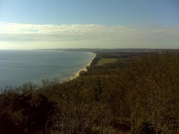
Valfritt (men inte som ett alternativ till ovanstående): Ta en bild
från cache-koordinaterna i sydlig riktning med er och/eller er GPS
på bild och posta den tillsammans med er logg.
Ni behöver inte vänta på att få godkännande på mail innan ni
loggar, jag hör av mig om det skulle vara något problem.
English: Stenshuvud is one of the most
species-richest and changeling national parks in Sweden. It's also
the most Southern national park in Sweden. The national parl was
founded in 1986 and consists of 380 hectares (954 acres). The
purpose with the park is to preserve a grand nature areas that has
specific geological and biological significance protection value
and which is of a great significance for the outdoor recreation.
The mountain Stenshuvud is mythical and from the top you have a
splendid view.
To log this earthcache you will have to do the following
things:
Answer the questions: What type of mountain is Stenshuvud, what
does it consist of and how has it evolved? How many meters above
the sea is the highest beach terrace and how far below has the
waterlevel been from today's level?
You can find the answers at information boards around the area, or
inside Naturum, by the parking lot.
Send the answers to the questions in an email to me.
Optional (but not as an alternative to the above): Take a picture
from the cache-coordinates in a Southern direction with you and/or
your GPS in the picture and post it together with your log.
You don't have to wait for an approval-mail before you log the
cache, I will get in touch if there should be any problems.