What to expect?
1) There is a basic trail to the cache. This is doable in shorts
and a t-shirt but you may want more. The geocache is located about
.8 miles from the parking spot. The trail is a flat old roadway,
however the last 20 years of flooding has resculpted portions.
2) Be prepared for misquitoes and some vegetation in season.
If it is May through Sep - bring mosquito repellent with
you.
3) Be prepared to cross water mid-way down the trail. You may
want to bring towel, preserver, or dry socks. As a rule of thumb,
if you want the water experience come in spring and first-half
summer. If you want less water, come in later summer or fall.
During very high water (early spring), the trail to the cache may
become impassible. In the fall, there may be no water at all.
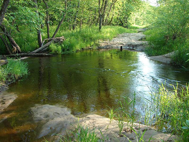 June 1, 2008 water crossing. I crossed using those fallen logs
that happen to be there. In Nov, 2007, this was dry.
June 1, 2008 water crossing. I crossed using those fallen logs
that happen to be there. In Nov, 2007, this was dry.
4) This is a popular hunting spot in late November so during
deer hunting, make sure you wear orange or you might want to choose
a different week to make your visit.
5) In the winter the trail is used as part of the state wide
snowmobile trail system so it is accessable year around.
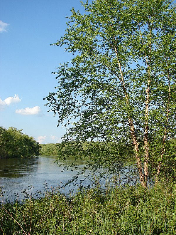
6) It can optionally be accessed by boat or canoe as it is along
the river's shoreline.
7) This would seem to lend itself to a group experience. You may
want to approach it that way.
8) Parking - Park by the North Bend bridge (see attached
waypoint). Some maps show a road coming in from La Crosse County.
that road doesn't exist anymore.
This geocache is registered with the Wisconsin Department of
Natural Resources.
The bigger picture
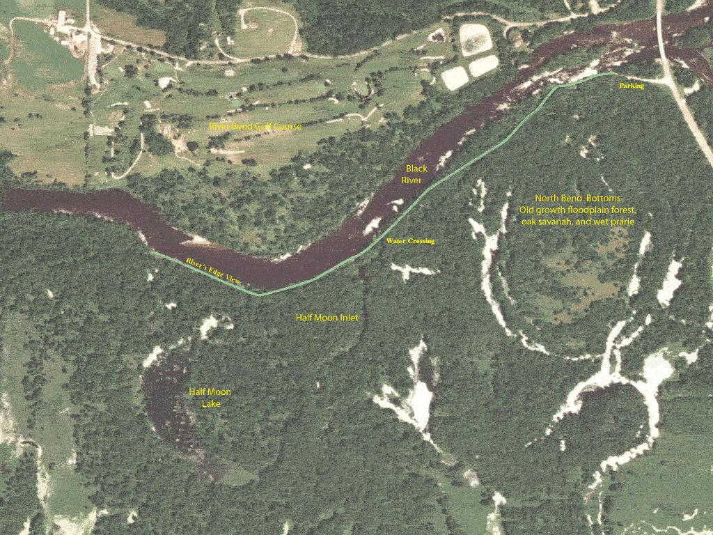 Trail Map to River View
North Bend Bottoms Wildlife Area is a 1,500 acre property
located outside the town of North Bend, in southwest Jackson
County. Access points can be found along Hwy VV. The property
consists of floodplain forest, bottomland hardwoods, marshy oxbows
and some upland fields. The Black River borders the property on the
North.
This property is the jewel of the Black River, providing
outstanding habitat for wetland dependent species. The Black River
provides a critical corridor for a variety of animal, bird and
plant species – making any trip down the Black a trip worth
remembering. Source: WI DNR
Half Moon Lake is an interesting phenomona. You would expect
that the lake flows into the river, but it is the opposite. The
river supplies the lake. The water crossing is the inlet. At that
point you'll see the shallow stream flowing from the river to the
lake.
Listing updated June 1, 2008