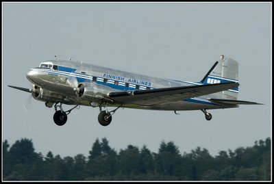

On the 3rd January 1961, a DC-3 owned and operated by Aero Oy
(later known as Finnair) crashed in the woods in the village of
Kvevlax (Koivulahti), some 10.5km from the Vaasa runway.
PROBABLE CAUSE: "The probable cause of the accident was the
wrong execution of a left turn at low altitude at night, as a
result of which the aircraft stalled, lost its maneuverability and
went into a spin.
Contributing factor: As a consequence of having had alcoholic
drinks and insufficient sleep the night before, the pilot was not
considered to be in a satisfactory mental and physical condition to
undertake the flight. For the same reason, the co-pilot should not
have been allowed to start on the flight in question.
Today there is a memorial at the crash site. This site can be muddy
in wet weather.
Not accessible when there is snow.
1. Your flight begins at Kvevlax (Koivulahti) church.
Go to the coordinates shown. Once there you will find a gravestone
for the children of farmer I.E. Lustig.
xxx tells you how many thousandth minutes you’ll have to go south
to get to a parking place for the final hike.
YYY will tell you how many minutes east.
A= Number of children on the gravestone.
B = Those living more than 1 year.
xxx = A – B +781
yyy = A + B + 452.
Car park coordinates N 63° 08.XXX E 021° 50.YYY.
When you are at the car park put in new coordinates for the
memorial.
N 63° 08.XXX E 021° 49.YYY
This time XXX = A X B +351.
YYY = A / B X 321
At the memorial XXX will tell you how many minutes south you
will have to go to find the cache.
YYY willtell you how many minutes east.
C = The number of passengers on this flight.
D = The number of crew.
N 63° 08.XXX E 021° 49.YYY
xxx = C x D + 525
yyy = (A X B X C) - 59

Din flygresa startar vid Kvevlax kyrka.
Gå till platsen som koordinaterna visar. Där hittar du en
gravsten som är rest över bonden I.E Lustigs barn
Xxx berättar hur många 1000-dels minuter söderut du måste åka
för att komma till parkeringsplatsen där den sista delen av resan
börjar.
Yyy berättar hur många 1000-dels minuter du skall gå österut.
A= antalet barn på gravstenen.
B= antalet barn som blev mer än ett år.
XXX = A – B +781
YYY = A + B + 452
Koordinater för parkeringsplatsen
N 63° 08.XXX E 021° 50.YYY
På parkeringsplatsen ställer du in koordinaterna för
minnesstenen.
Denna gång är
XXX = A X B +351
YYY = A / B X 321
N63° 08.XXX
E 021°49.YYY
Vid minnesstenen, xxx berättar hur många 1000-dels minuter
söderut du skall gå för att hitta cachen.
Yyy berättar hur många 1000-dels minuter österut.
C = Antalet passagerare i flygplanet..
D = antalet besättningsmän
xxx = C x D + 525
yyy = (A X B X C) - 59
N 63° 08.XXX
E 021° 49.YYY
You can check your answers for this puzzle on
Geochecker.com.