The Curonian Spit is a unique, original piece of land and the
second largest dune of Europe. The length of it is 97km with 52km
belonging to Lithuania and 47km belonging to Königsberg/ Russia.
The western peninsula's shore is washed by the Baltic Sea and the
eastern one by the Curonian Lagoon. At the end of the year 2000,
the Curonian Spit was included into UNESCO world heritage list as a
cultural object. Since 2001, the Blue Flag was granted to the Nida
beach by the decision of the European Blue Flag Council. In 2004,
this flag was granted to Juokrante beach as well. The beaches meet
the international requirements given for these resort zones.
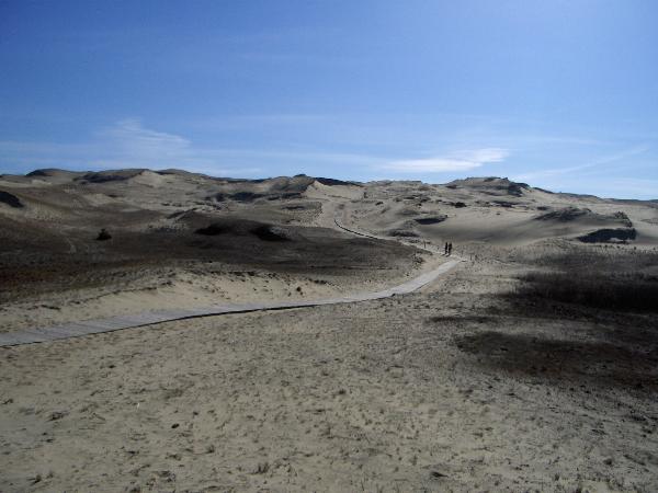
The Curonian Spit is the second largest dune formation in Europe
and separates the Curonian Lagoon from the Baltic Sea. It is an
outstanding example of a landscape of sand dunes that is under
constant threat from natural forces (wind and tide). Therefore it
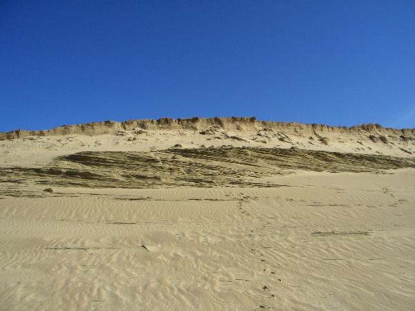
is in constant motion. The coast has been formed by hydrological
processes, i.e. a streaming parallel to the coastline forming an
underwater channel which transports much of the sand to Nida and
building up two to three small sand hills there. Winds from the
southwest transporting sediments during the Atlantic period are
responsible for the present shape of the Curonian Spit. This can be
seen by the form of the dune and the composition of the sediments
found today (glauconite and phosphorite). These sediments are
typical for this period and have been washed out of the
paleogenetic layers of the Sambian-Isle. 300,000 to 1,000,000 cubic
meters of sand are transported per year. The main reason for this
is the coastal erosion. It has its climax during storms near the
Sambian-Isle at 5 to 6 meters under water.
Please stick strickly to the rules given to you when going
there by ferry and keep the nature intact.
To be able to log the cache you have to answer the following
questions and take a picture of yourself in front of the
extraordinary dune landscape.
You can find all the required information on a table of the
UNESCO standing at the coordinates.
1) Why did a small village on the Curonian Spit have to move
several times?
2) Explain how the grey dune is built up and name the
different types of sand.
Mail me the answers via the GC website and wait until I
approve.