Basic information about the area
Coordinates takes you to birthplace of the City of Porvoo. Linnamäki area is about 1 km north east from Porvoo city center. The Linnamäki area is part of the Natura protection program because of its valuable historical biotope and part of the national eskers protection program. In the late 1990s, the City of Porvoo and the National Board of Antiquities signed an agreement concerning the protection zone for the Linnamäki area as well as the drafting of a management and use plan. The goal of this plan is to ensure the sustainable use of the area and its proper management, which also functions to promote the preservation of the historical monuments and the unique vegetation.
One of the most serious problems that threats the Linnamäki area is erosion, which is caused by visitor traffic. When the vegetation is damaged by trampling or bicycle riding, the ground surface becomes sensitive to wear from traffic and rainwater.
Therefore tourists and recreational visitors should stay on the paths topping the embankments and use the bridges to cross from one embankment to the next or to enter and leave the area. Bicycling in the area is prohibited. Area is very popular for picniks and walks so I hope you would enjoy the visit.
Historical information:
Big Linnamäki hill and nearby small Linnamäki hill and Maari bay are the locations where the history of Porvoo town has begun. Town's name actually comes from Borg Å meaning Castle river. Castle can also be the meaning of the coat of arms of Porvoo that have a letter that looks like C. C is Castellum or Castrum in latin meaning castle.
On small Linnanmäki hill archaelogist have found graves from roman era about 0 - 400 ad.
From big Linnamäki hill archaelogits have found parts of buildings atleast from 800 ad and there has been castle from 1100 century till 1300 century.
Castle itself was made of tree and was vanished sometime in late 1300 century. There are still visible evidence of castle, like moats and some holes where used to be of cellars. South of Big linnamäki hill is area called Maari. Maari used to be an harbour of Linnamäki castle.
Areas Geology
There are some intresting geological features that explains why castles have been build in this area.
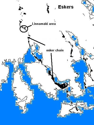
Linnamäki hills are moraine hills formed at the end of the last ice age. These moraine hills are part of the esker chain that begins all the way from Pellinki to northeast to Kerkkoo village. This esker chain is about 40 km long.
Eskers are formed with the melting of the glacier. Streams carry sediments on streams up on the ice or below the ice on tunnels. When ice melted these deposites were remained in long ridges in Northwest - Southeast direction.
Why this hill were picked to build the castle? I think the main reason was the small bay area called Maari between Porvoonjoki river and Big Linnamäki hill. Maari was natural and safe harbour for the people who lived here in that time and a lot earlier also.
How was this bay was formed? In here the river makes a curve where on the outer curve of the river have done a river formation called shoal or shorebar. River sediments and deposits have been carried here and current slows down on outer river curves and together with the post glazial rebound the shoal has then cradually grown over the rivers water level forming this bay area.
In 1990 that bay was only about 0.5 meters deep but the bay was then dredged to be one meter deep in 1999. Today the bay is about meter deep, 200 meters long and about 60 meters wide area filled with rare flora. Post clazial rebound is about 3 mm / year in Southern Finland so in time this bay will be gone.
Logging requirements:
You may log your your find immediately after you have visited the site and emailed the answers to questions below to us small oaks (small(dot)oaks(at)gmail(dot)com:
We contact you if more information is needed.
Questions
A. Walk in a area and estimate by using gps what is the elevation difference between Big Linnamäki and Little Linnamäki from the highest point of the hills?
B. On Maari bay TASK B coordinates. How much higher sea level were here in year 1200 than it is today? Sign has been taken away so do some math with the information given in description.
C. From the parking lot walk to see tree and sign board in TASK C coordinates. In your own words what geological process is seen there by the tree.
NOTE THAT: We will delete any find logs without emailed answers to given questions.
Even if it is not required to add pictures we would appreceate your pictures in found logs. Good spot is for example at maari waypoint.
Waypoints:
Little hill - N 60° 24.005 E 025° 38.842
Task B - 60° 23.904 E 25° 39.034
Maari bridge - N 60° 23.844 E 025° 39.232
Task C. - N 60° 23.948 E 025° 39.188