The Blue Hills was a volcano roughly 440 million years ago, and the magma chamber crystallized as Quincy granite. Granites and other associated volcanic rocks underlie most of the upland Blue Hills area. The Quincy granite is prized for its range of hues from light to extra dark and a golden variety called "gold leaf." The distinctively dark granite of St. Paul's Church in Boston and Minot's Lighthouse in Scituate came from Quincy.
One of the most attractive kinds of Quincy granite is the medium-to-coarse-grained, gray to dark green variety that contains the minerals quartz, microperthite (a feldspar), riebeckite (a bluish amphibole), and aegerine (a greenish pyroxene). This variety owes its unusual color to the riebeckite and the aegerine. Both of these minerals are very rich in sodium and do not commonly occur in granite. A reddish granite of the same composition probably acquired its hue when steeped in its own magmatic juices, or hot fluids, as the pluton crystallized.
Its ability to take on a high polish and its massive character, free of hidden internal flaws and breaks, made it an integral part of the economic development of early New England. Quincy granite has long been used as an architectural stone. Quarry owners financed the first commercial narrow-gauge railway in the United States during construction of the Bunker Hill monument in Charlestown in 1826.
In 1825, after an exhaustive search throughout New England, Solomon Willard selected the Quincy site as the source of stone for the Bunker Hill Monument in Charlestown. After many delays and much obstruction, the railway itself was granted a charter on March 4, 1826, with right of eminent domain to establish its right-of-way. Businessman and state legislator Thomas Handasyd Perkins organized the financing of the new Granite Railway Company, owning a majority of its shares, and he was designated its president. The railroad was designed and built by railway pioneer Gridley Bryant and began operations on October 7, 1826. Mr. Bryant utilized developments that had already been in use on the railroads in England, but he modified his design to allow for heavier, more concentrated loads and a three-foot frost line.
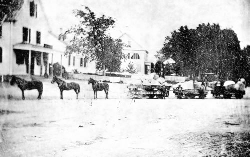
This railway, now a National Civil Engineering Landmark, was established to transport the Quincy granite from the Mannex Quarry, later renamed the Bunker Hill Quarry, to sea for shipping. Specially designed wagons, pulled by horses, carried the blocks along iron rails laid over granite. The old railroad mainly follows the route of I-93 to a stone pier on the Neponset River. From here schooners transported the granite to the docks at the foot of Breeds Hill in Charlestown where it was used in the construction of the Massachusetts State Prison and the Bunker Hill Monument.
What is left over and what you will see at this location is the remains of the inclined plane built by Gridley Bryant, in 1830 for the Granite Railway Company, to move large blocks of stone from the quarry down to the railway. The railway introduced several other important inventions, including railway switches or frogs, the turntable, and double-truck railroad cars. Gridley Bryant never patented his inventions, believing they should be for the benefit of all.
Be sure to grab the other nearby cache Granite Railway by cassabellac while you are here and please wear long pants since there is a good deal of poison ivy at the remains of the incline.
To claim this as a find:
1. Take a photo of you and your GPS between the two polished Quincy granite obelisks at the bottom of the incline. (This requirement is now optional)
2. What was the "endless chain?"
3. Find the elevation at the top of the remaining incline.
4. Find the elevation at the bottom of the incline.
5. In 1958, the upper half of the incline was removed during the construction of the expressway. Find the difference between the two elevations you noted earlier to tell me how much of the original 84 vertical feet remains.
E-mail the answers (numbers 2,5) to me and post the photo (number 1) within a few days of your log.
Failure to comply with these requirements will result in log deletion.
Good luck and good caching.
- Rev Mike
