|
ROCA CORBATERA (1.163 m)
per la canal de Sant Joan del Codolar
|
|
No
hi ha cap altre millor indret per gaudir d’una bona
panoràmica del Priorat i del Parc Natural de la Serra del Montsant
que des de la Roca Corbatera, cim comarcal del Priorat i la
muntanya més alta d’aquesta rocallosa serra que recorda la
morfologia de Montserrat.
|
|
És
un balcó excel·lent de l’embassament de Siurana, de la Mola
de Colldejou, de la Serra de Llaberia i de la mateixa serra de
Montsant.
|
|
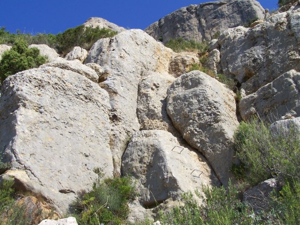
Les
vies d’accés a la Roca Corbatera són diverses, però nosaltres
us proposem una de les més recomanables, i és l’ascensió per
la canal de Sant Joan del Codolar.
|
|
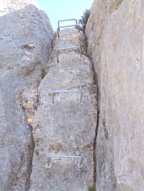
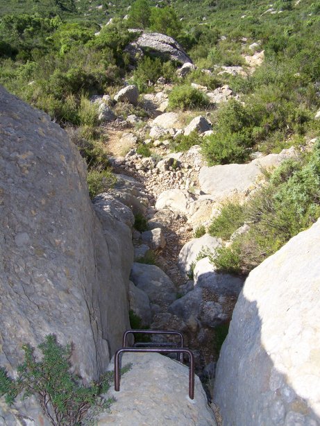
Aquesta canal, anomenada “Grau dels tres Graons”
és enfilada i permet passar per tres trams equipats amb graons que
ho fan més divertit, i que donen a aquesta muntanya el sobrenom de
“la muntanya dels tres graons”.
|
|
Es
pot fer l’aproximació en cotxe fins a l’Ermita de Sant
Joan del Codolar, on s’arriba des de Cornudella del Montsant,
per una pista molt estreta per la que només hi cap un
cotxe, i que comença, més o menys al punt 41º15.975'N
000º54.464'E.
|
|
Després d’una mica més d’1 Km., sobre el punt
41º16.429'N 000º54.323'E, ens desviem,
i continuem per l’esquerra fins arribar a l’Ermita de
Sant Joan del Codolar, on hi ha un petit pàrking a
41º16.839'N 000º53.264'E.
|
|
Des
de l’aparcament, podrem iniciar l’atac al cim del
Montsant.
|
|
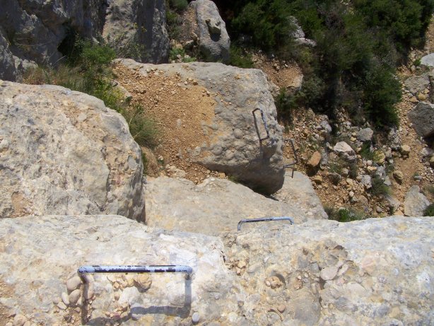
Aquest catxé, només és un multi per pujar a la Roca Corbatera
per aquesta canal, de manera que a cada un dels 3 graons, trobareu
3 microcatxés.
|
|
A
dintre de cada micro, hi ha una targeta amb els valors de A (al 1r
graó), B (al 2n graó) i C (al tercer graó), que us permetran
calcular les coordenades finals del catxé al cim.
|
|
SI US PLAU, NO US ENDUEU LES TARJETES AMB ELS
VALORS DE A, B i C DE CADA MICRO CATXÉ. NOMÉS APUNTEU EL NÚMERO
I DEIXEU LA TARJETA AL
MICROCATXÉ PER ALTRES GEOCATXERS.
GRÀCIES.
|
|
1r Graó – Valor de
A
|
|
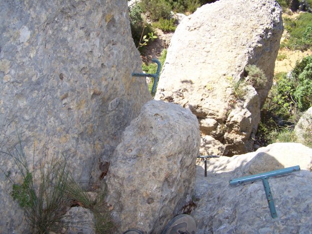
Un
cop superat el primer graó, a mà esquerra, trobareu el primer
microcatxé amb una targeta on obtindreu el valor de A per
calcular les coordenades finals. Mireu les fotos
spoiler.
|
|
|
|
|
El
primer graó
|
|
2n Graó – Valor de
B
|
|
Després de superar el segon graó, a ma dreta a la base
d’un arbre trobareu el segon microcatxé amb una targeta on
obtindreu el valor de B per calcular les coordenades finals.
Mireu les fotos spoiler.
|
|
|
|
|
El
segon graó
|
|
3r Graó – Valor de
C
|
|
I
finalment, un cop superat el tercer i últim graó, a mà esquerra a
la base d’un tronc sota unes pedres, trobareu el tercer
microcatxé amb una targeta on obtindreu el valor de C per
calcular les coordenades finals. Mireu les fotos
spoiler.
|
|
|
|
El
tercer graó
|
|
Un
cop aconseguida la Roca Corbatera (i el catxé) us proposem una
baixada més tranquileta carenejant cap a l’est, passant per
la Punta de la Serra Major (1.159 mts), seguint el camí senyalitzat
(vegeu també el track) i començarem a baixar corbes de nivell per
iniciar el camí de tornada a l’ermita.
|
|
Aquí podeu
descarregar el nostre track (arxiu GPX) per si us pot servir
d’ajuda.
|
|
En
total, nosaltres hem gaudit d’una excursió de més de 6 Kms. i
aproximadament unes 5 hores (incloent l’esmorzar
J i al
nostre ritme, o sigui, mooooooooooolt lent). Totalment
recomanable!
|
|
Esperem que us agradi.
|
|
COORDENADES FINALS:
|
|
N 41º 17, (C+1-B) (5-A) [(A*B)-7]
|
|
E 000º 53, (8+A-B) (C-3) (C-A-B)
|
|
|
|
ROCA CORBATERA (1.163 m)
through canal de Sant Joan del Codolar
|
|
There is no better place to enjoy a good landscape of
Priorat county and Serra del Montsant natural park, that from the
top of Roca Corbatera, the highest peak of the Priorat county and
also the highest of this hill that reminds the morphology of
Montserrat mountain.
|
|
It is an excelent balcony of the Siurana reservoir, Mola de
Colldejou, Llaberia hill, and also of the Montsant
mountains.
|
|
The access to Roca Corbatera can be done from diferent
places, but here we recomend you one of the best: the ascension
through “canal” of Sant Joan del Colodar.
|
|
This way, also namend “Grau dels 3
graons” (three steps grade), is a steep path that will
lead you through three passes equipped with iron steps which make
it more funny. That’s why this peak is also named “the
three steps mountain”.
|
|
The approximation can be done by car until the little
church of Sant Joan del Codolar. You will arrive there through a
very narrow road only one car wide. It starts at
41º15.975'N 000º54.464'E.
|
|
After more that 1 km, nearby the spot 41º16.429'N
000º54.323'E, we take a detour to the left. Soon we will be
in the little parking of Sant Joan del Codolar little
church, at 41º16.839'N 000º53.264'E.
|
|
From the parking, we will be able to attack the Montsant
highest peak.
|
|
This cache is just multi to climb to the Roca Corbatera
through this “canal”. So in each step
you’ll find a microcache.
|
|
Inside each microcache, there’s a card with the
values of A (in the 1st step), B (in the 2nd
step) and C (in the 3rd step). These three values, will
allow you to calculate the coordinates of the final
cache.
|
|
PLEASE,
DON’T TAKE THE CARDS WITH YOU WITH THE VALUES OF
“A”, “B” AND “C” FROM EACH
MICRO CACHE. JUST WRITE THE NUMBERS AND LEAVE IT IN THE
BOX.
|
|
1st STEP – Value of A
|
|
Once climbed the first step, left hand, you’ll find
the first microcache with the card which tells you the value for
A to calculate the final coordinates. See spoiler
photos.
|
|
|
|
|
2nd STEP – Value of B
|
|
Once climbed the second step, right hand, you’ll find
the second microcache with the card which tells you the value for
B to calculate the final coordinates. See spoiler
photos.
|
|
|
|
|
3rd STEP – Value of C
|
|
And finally, once climbed the third step, left hand,
you’ll find the last microcache with the card which tells you
the value for C to calculate the final coordinates. See
spoiler photos.
|
|
|
|
|
|
Once you find the cache, we propose you an easiest way back
down to the parking. You’ll have to walk towards east,
passing away Punta de la Serra Major (1.159 mts), following the
marked path, and start the way down to the church (see
track).
|
|
Here you can
download the track we did (GPX file), just in case it can be useful
for you.
|
|
Finally, we have enjoyed a hike about 6 Kms. long and
approximately 5 hours (including time for breakfast
J and
walking at our own rithym, veeeeeery slow). Absolutely
recommended.
|
|
We hope you like it.
|
|
|
|
FINAL COORDINATES:
|
|
N 41º 17, (C+1-B) (5-A) [(A*B)-7]
|
|
E 000º 53, (8+A-B) (C-3) (C-A-B)
|