V1.00

Deutsche Beschreibung.
English description below.
Zwei Routen bieten sich an:
(1) Für die erste, etwas längere, benötigt man zirka 45 Minuten bis zum Gipfelkreuz, zuvor kann man sich bei unserem Multi „Xunde Runde“ aufwärmen. Vom Parkplatz Hirschenwies (P1) den Wegweisern „Route 2“ zum Nebelstein folgen.
(2) Die andere ist viel kürzer, Gehzeit vom Parkplatz Nebelstein (P2) ca 10 Minuten bis zum Gipfelkreuz, für die Gegend quasi ein "drive in". Dafür verpasst man eben auch den schönen Aufstieg ...
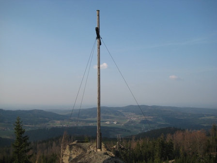
Knapp unterhalb des Gipfelkreuzes lädt die bewirtschaftete Nebelsteinhütte des Österreichischen Alpenvereins zu einer Rast auf ihrer netten Sonnenterrasse ein. Nähere Informationen auch hier.
Der Nebelstein ist Teil und sogar Beginn zahlreicher regionaler, nationaler und internationaler Wanderwege:
Internationale:
• E6 Europäischer Fernwanderweg (Finnland – Slowenien sowie Griechenland – Türkei, 5.200 km)
• E8 Europäischer Fernwanderweg (Irland - Polen sowie Bulgarien, 4.400 km)
Nationale:
• 05 Nord-Süd-Weitwanderweg (Nebelstein – Eibiswald, 200 km)
• 06 Niederösterreichischer Mariazellerweg (Nebelstein – Mariazell, 250 km)
• 07 Ostösterreichischer Grenzlandweg (Nebelstein – Bad Radkersburg, 710 km)
• 08 Eisenwurzenweg (Rottal/Waldviertel – Bad Eisenkappel, 580 km)
Regionale:
• 105 Nordwaldkammweg (Mandelstein – Dreisesselberg, 150 km)
• 620 Kamptalseenweg (Nebelstein – Rosenburg, 100 km)
• 630 Thayatalweg (Nebelstein – Retz, 180 km)
• NÖ-Landesrundwanderweg (950 km)
Bitte soweit es geht die Wanderpfade und Waldwege benutzen.
Achtung: Absturzgefahr!
Der Cache
ist eine 1,75l Plastikbox.
Happy Caching!
Citianer
English description.
There are two routes:
(1) The first one is a bit longer and perfect in conjunction with our multi-cache „Xunde Runde“ . Walking time approx. 45 minutes to the summit. Start at the parking area "Hirschenwies" (P1) and just follow the signs "Route 2 - Nebelstein".
(2) The second one is much shorter, walking time from parking area "Nebelstein" (P2) approx. 10 minutes to the summit, so actually a "drive in" for this Waldviertel area. On the other hand you'll miss the nice ascent this way ...
Near the top just before the cross of the summit there is the "Nebelsteinhütte" , a mountain hut run by the Austrian Alpine Club (ÖAV) with a nice sun terrace.
The Nebelstein is part or even the beginning of quite a lot of regional, national and international hiking routes:
International:
• E6 Europäischer Fernwanderweg / European long distance walk E6 (Finland – Slowenia and Greece – Turkey, 5.200 km)
• E8 Europäischer Fernwanderweg / European long distance walk E8 (Ireland - Poland and Bulgaria, 4.400 km)
National:
• 05 Nord-Süd-Weitwanderweg / North-South long distance walk (Nebelstein – Eibiswald, 200 km)
• 06 Niederösterreichischer Mariazellerweg / Lower Austrian route from/to Mariazell (Nebelstein – Mariazell, 250 km)
• 07 Ostösterreichischer Grenzlandweg (Nebelstein – Bad Radkersburg, 710 km)
• 08 Eisenwurzenweg / route along the Eisenwurzen (Rottal/Waldviertel – Bad Eisenkappel, 580 km)
Regional:
• 105 Nordwaldkammweg / route along the Nordwaldkamm (Mandelstein – Dreisesselberg, 150 km)
• 620 Kamptalseenweg / route along the Kamp river valley and its lakes (Nebelstein – Rosenburg, 100 km)
• 630 Thayatalweg / route along the Thaya valley (Nebelstein – Retz, 180 km)
• NÖ-Landesrundwanderweg / Lower Austrian County circular walk (950 km)
Please use the hiking trails and forest paths as far as possible.
Caution: danger of falling!
The cache
is a 1,75l plastic box.
Happy Caching!
Citianer
Change history
V1.00 Published
GCVote: 