The north entrance is accessed from Ingram Way, off Misty Meadows
Rd, off Route 53. Look for two stone abutments flanking a dirt
driveway between two houses. The trailhead is behind the
houses.
The south entrance is the parking lot and trailhead for Willow
Brook Conservation Area, on the west side of route 14. It is
a slightly longer walk, but much more interesting, with boardwalks
and bridges along the way.
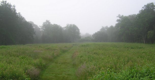
The trails lead through forest and grassy meadows.
Whichever trailhead you choose, you will eventually face a
decision whether or not to bushwhack. Bushwhacking does
present the shortest trek, but both the 1st stage and the final are
only a few feet off trails. If you don't mind a little more
walking, the path will eventually get you there.
There are a maze of trails. If you choose to start at the
north trailhead, study the trail map on the kiosk; some trails that
seem to go your way may end up as dead ends in private property
backyards. The combination of trail confusion and potential
bushwhacking is why the terrain is a 3.
Elsewhere in the Area are trails that lead down to the Herring
Brook, and there are cellarholes and old roadways between stone
walls from the early 1800s.
First stage is a camoed micro. The cache is a 3x5
lock-n-lock in a camo bag. There is some PI around the cache
area, but none at the hide itself.
Also nearby are three older caches;
Willow Brook Boardwalk by geo50chevy,
Willow Brook Wander, by Hunter; the oldest cache on the South
Shore; 12/12/2000.
Herring Brook Valley, by QuestsRUs,
and a recent new hide:
Top of the Tower, by confluenceman