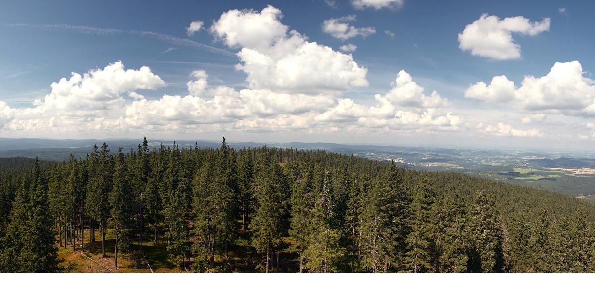
[CZ] Nenapadna hradba lesu a skal mezi udolim Vltavskeho potoka na jedne strane a udolim Teple Vltavy na strane druhe, ukryva ve svem nitru ctyri tisicimetrove vrcholy, Homole ( 1044m), Poledni vrch ( 1053m ), Lovci kamen ( 1100m ) a Polecky vrch ( 1121m ). Tato mista jsou navstevovana velmi, velmi sporadicky a tudiz zde nepotkate zivacka. Budete se pohybovat sami pod klenbou velikanu a pritom relativne blizko cest. Vasim ukolem bude navstivit dva z techto vrcholu a zjistit jednotlive indicie pro vypocet finalky.
ZAHRADKY - dnes verejne taboriste u Borovych Lad se zbytky zakladu pily na brehu Teple Vltavy. Lide se tu zivili hlavne praci v lese a v zemedelstvi.Nebyl zde ani zadny obchod, pouze podomni prodej lahvoveho piva.Znacnou cast obyvatel zamestnaval na sve pile take pan Spannbauer,ktery vlastnil jednu z nejvetsich pil ve spravni obci Novy Svet. Stala v mistech dnesniho turistickeho kempu.Vyrabel vsechny druhy reziva,ale i sindel.Za druhe svetove valky byl Alois Spannbauer starostou Borovych Lad.Dodnes se zachovaly na uzemi Zahradek dva krize,podel kterych vedla puvodni cesta,ktera spojovala kraj Lad s Horni Vltavici a Vimperkem.Dnesni cesta,která vede pres Zahradky nad kempem je o sto let mladsi. Prevzato ze stranek Zanikle obce
A prave o ty dva krizky nam jde. Na kazdem z nich je letopocet ( kriz A + kriz B ) a dosazenim do souradnic se dozvite, kde naleznete treti indicii. Tak, a jak najit krizky :
- Stojite na souradnicich START zady k vjezdu do kempu. Krizek A je na azimutu 10° a 350 m daleko okrajem lesa.
- Krizek B najdete, pokud pujdete po byvale ceste od krizku A smerem na Horni Vltavici, asi 450m daleko
- Souctem obou letopoctu ziskate hodnotu, kterou prictete k nasledujici souradnici, a to jak k severni sirce, tak i k vychodni delce
N 48° 54.152 E 013° 35.845
- Pokud jste spravne dosadili hodnoty a dosli na vypocitane souradnice, tak zde najdete kamenny meznik, a na nem cislice ve tvaru CD.
- Nyni provedte nasledujici pocetni vykon : ( CD*100) + A, dostanete EFGH , ( CD*100 ) + B, dostanete IJKL
- Souradnice finalky jsou :
- Poznamka : Pokud si myslite, ze pismena musi vzdy korespondovat s cislicemi, jste v tomto pripade na omylu !
[GB]The unobtrusive wall of forest and rocks between valley of Vltavsky potok on the first side and valley of Teplá Vltava on the second side, hides four thousand meters high peaks in the inland of it, Homole (1044m), Polední vrch (1053m), Lovcí kamen (1100m) and Polecký vrch (1121m). These places are visited very, very occasionally and so that we can’t to meet anybody. You’ll to move yourself under the dome of the huge one and you’ll be relatively near the ways. Your mission will be to visit two of these peaks and find out all indicia for calculation of the final mission.
ZAHRADKY - today the public camping ground next to Borové Lady with remanis of the base of the saw-mill in the riverside of Teplá Vltava. People lived off of working in the forest and in the farming. There was no shop here only the „house-to-house“ sale of bottled beer. Mr. Spannbauer, who busied a lot of people in his saw-mall, owned one of the biggest saw-mill in the administrative village Nový Svet. This village was in the places of today’s touristic camp. He made all kinds of sawn wood and shingle too. During the Second World War was Alois Spannbauer mayor of Borové Lady. There are in the place of Zahradky two crucifixes too and along them was the original journey which connected the land of Lady with Horní Vltavice and Vimperk. Today’s journey which goes in Zahrádky above camp is by 100 years younger. Taken from sites Ztracene obce.
And the two crucifixes are very important for you now. On each other is the era (crucifix A + crucifix B) and when you do the substitution in an equation, you get to know on which „thousand mountain“ are you going to findings the third indicia. So, and how to find the crucifixes :
- You are on the ordinates START and the entry to the camp is behind you. The crucifix A is on the azimuth 10° and 350meters far along the margin of the forest.
- You find the crucifix B, when you go on the old yourney from the crucifix A to the Horní Vltavice, perhaps 450meters far.
- When you count both eras, you get the value which you have to add to the following ordinate (to the northern latitude and to the eastern longitude).
N 48° 54.152 E 013° 35.845
- When you have a right value and you're on the counted ordinate, you find here the stony terminus and on it the numbers in the form of CD.
- Now you hate to do following numerical rule : ( CD*100) + A, you get EFGH , ( CD*100 ) + B, you get IJKL
- Ordinate of the final part are :
N 48° 51.979 + ( EFGH ) E 013° 32.903 + ( IJKL )
Pro prvnich 10 nalezcu jsou prichystany pametni karty !