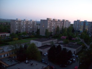
Sídlište Jižní Mesto
[CZ]
Vznik Jižního Mesta
Mestská cást Praha 11 byla ustavena v listopadu roku 1990 pod
jménem Praha - Jižní Mesto. Dnešní oznacení nese od roku 1994. O
dve desetiletí dríve pred vznikem mestské cásti se na jejím dnešním
území rozkládaly dve obce, Chodov a Háje, a jejich dílcí cásti.
Pred rokem 1971 predstavovalo Jižní Mesto pouhý pracovní termín,
známý zprvu jen úzkému okruhu osob, zainteresovaných na výstavbe
rozsáhlého obytného celku na jihu tehdejší Prahy 4.
 Historie Jižního Mesta se pocínala odvíjet...
V šedesátých letech 20. století se v rámci pražské aglomerace
hledala vhodná území pro výstavbu velkých územních celku. Smerný
územní plán z roku 1964 urcoval jako jedno z nejvhodnejších katastr
Chodova a Háju, obcí, které se tehdy ješte nacházely mimo hranice
hlavního mesta. Uvažovaný sídelní prostor mel predpoklady pro
snadné zásobování elektrinou a zemním plynem. Také vodou, nebot už
byla zrejmá nutnost vést v budoucnu tímto regionu vodovod ze
Želivky. Mluvila pro nej i blízkost trasy pripravované dálnice,
zajištující spojení s centrem a snadný výjezd za hranice mesta.
Prostor ležel v okrajové poloze, ale zato v poloze krajinársky
skutecne výrazné. Modelace terénu a prítomnost výrazných prírodních
prvku, jak tehdy situaci charakterizovali opdborníci, umožnovaly
vytvorení zeleného pásu okolo celého budoucího mesta.
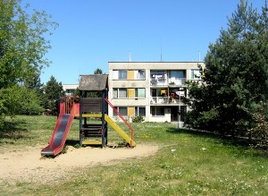
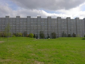
Uvedené kvality skutecne náleží k prednostem dnes již existujícího
osídlení pro asi osmdesát tisíc lidí.
Mezitím ale ubehla rada let, poznamenaných hledáním, usilováním ale
i omezováním možností rešit úkol takového rozsahu, jakým výstavba
mimorádne rozsáhlého sídelního celku byla.
V roce 1966 probehla verejná soutež na pojetí Jižního Mesta,
zamýšleného jako vnitrne propojený celek. Prinesla ruzné prístupy s
radou podnetných námetu. Vítezný návrh od J. Krásného, V. Musila,
K. Ondrouška a V. Skokana, odmenený 2. cenou, uvažoval mestský
celek se znacnou mírou samostatnosti vuci Praze. Ceneno na nem bylo
zejména zaclenení do krajiny a organizace funkcních ploch. Návrh
uvažoval centrum tvorené tremi soubory v nejvyšších polohách
zvlneného terénu a v jejich težišti park, podtrhující charakter
tzv. zahradního mesta. Autori nekolika ocenených návrhu byli
vyzváni k úcasti v užší souteži, v níž byly roku 1967 udeleny dve
druhé a jedna tretí cena. Následovalo vypracování dvou
porovnávacích studií, na jejichž základe se stala výchozí
urbanistickou bází pro konecné rešení studie, vypracovaná
kolektivem Atelieru 9 ve spolupráci s doc. J. Krásným.
Podrobný územní plán Jižního Mesta zpracoval autorský kolektiv Jan
Krásný, Jirí Lasovský a Miroslav Rihošek za autorské spolupráce J.
Zeleného, J. Záruby, V. Rothbauerové, K. Policanského, J. Kaufmana,
E. Hlavácka a Z. Burianové. Plán, schválený koncem roku 1968,
vycházel z puvodního vítezného návrhu a využíval prírodních
podmínek pro vytvorení svébytného mestského útvaru, v nemž by se
pracovište i prostredí k relaxaci nacházela v bezprostrední
blízkosti. Kontakt prírody a zástavby byl dominantním
rysem.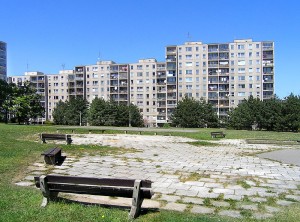 Východne od tehdy již rozestavené dálnice byly koncipovány tri
obytné ctvrte, oznacené jako soubory, jmenovite Háje, Opatov a
Litochleby. Každý byl urcen pro 16,5 - 19,5 tisíc obyvatel.
Další soubor Chodov byl zvažován jako doplnující. Starší a
nová zástavba v nem mely prolínat pri zachování menší výšky
objektu. Uvažované centrum bylo umísteno kolem stanice Opatov,
v dotyku trí souboru, vyjma soubor Háje, v urbanisticky
nejatraktivnejším prostoru. Na soustredení obecne potrebných
objektu v tomto míste mel navázat východním smerem park,
zatímco druhá osa zelene odtud smerovala na sever, kde
navazovala na lesopark nad Hostivarskou prehradní nádrží, a
obráceným smerem mírila z centra na jih, k Milícovskému
lesu.
Východne od tehdy již rozestavené dálnice byly koncipovány tri
obytné ctvrte, oznacené jako soubory, jmenovite Háje, Opatov a
Litochleby. Každý byl urcen pro 16,5 - 19,5 tisíc obyvatel.
Další soubor Chodov byl zvažován jako doplnující. Starší a
nová zástavba v nem mely prolínat pri zachování menší výšky
objektu. Uvažované centrum bylo umísteno kolem stanice Opatov,
v dotyku trí souboru, vyjma soubor Háje, v urbanisticky
nejatraktivnejším prostoru. Na soustredení obecne potrebných
objektu v tomto míste mel navázat východním smerem park,
zatímco druhá osa zelene odtud smerovala na sever, kde
navazovala na lesopark nad Hostivarskou prehradní nádrží, a
obráceným smerem mírila z centra na jih, k Milícovskému
lesu.
Následovalo ale ješte mnoho zmen a úprav. Zejména neustále vzrustal
pocet uvažovaných bytu a tedy i budoucích obyvatel. Rešení obytného
obvodu bylo v príštích letech rozpracováno podrobnou územní
dokumentací. Hlavním architektem mesta se stal Jirí Lasovský,
vedoucími projektanty sídlišt Jižního mesta I - Háje Aleš Borkovec
a Vladimír Ježek, Opatova Jaroslav Vlašánek a Eva Kunová, Litochleb
Bohumil Kríž ve spolupráci s J. Hylišem, Chodova Karel Prager a
uvažovaného centra Jirí Lasovský a Jaroslav Krc. Na rozloze 1200 ha
bylo navrženo kolem 2000 bytových jednotek pro 73400 až 80000
obyvatel.
[EN]
The Origin of Jižní Mesto
The Prague 11 Metropolitan District was established in November
1990 at that time under the name Prague – Jižní Mesto (South City).
Today’s name has been used since 1994. Only two decades before the
establishment of the Metropolitan District there were two
municipalities – Chodov and Háje and their districts – cadastral
areas. Prior to 1971, Jižní Mesto was simply a working name, at
first known only to a small group of people working on a
construction project of a large housing complex in the southern
part of the then Prague 4.
 In the
1960s, the authorities looked for suitable urban development
areas within the Prague agglomeration. The master plan of 1964
identified the cadastral areas of Chodov and Háje as the most
suitable ones. The proposed urban development area was
suitable for easy distribution of electricity and gas, as well
as water supply, as even at that time the necessity to build a
water duct from the Želivka water reservoir through this
region was obvious. The plan was also supported by the
vicinity of the intended motorway providing for connection to
the city centre and an easy way out of town. At that time, the
area was on the outskirts but amidst a distinct landscape.
Terrain remodelling and the presence of distinct natural
elements enabled the creation of a green belt around the
entire future municipality.
In the
1960s, the authorities looked for suitable urban development
areas within the Prague agglomeration. The master plan of 1964
identified the cadastral areas of Chodov and Háje as the most
suitable ones. The proposed urban development area was
suitable for easy distribution of electricity and gas, as well
as water supply, as even at that time the necessity to build a
water duct from the Želivka water reservoir through this
region was obvious. The plan was also supported by the
vicinity of the intended motorway providing for connection to
the city centre and an easy way out of town. At that time, the
area was on the outskirts but amidst a distinct landscape.
Terrain remodelling and the presence of distinct natural
elements enabled the creation of a green belt around the
entire future municipality.
We can say that the above-mentioned qualities really form the
merits of the current urban development, inhabited by some 80
thousand people.
However, many years have passed filled with searching, trying but
also restricting the opportunities to solve the difficult task of
such an extensive urban development.
In 1966 there was a public tender for the conception of the
whole of Jižní Mesto. There were many approaches with many
interesting ideas. The winning concept by J. Krásný, V. Musil, K.
Ondroušek and V. Skokan, awarded the second price, proposed a city
complex with a significant extent of independence on Prague. It was
appreciated mainly for its integration into the landscape and the
organisation of functional areas. The proposal counted on a centre
created by three complexes in the highest areas of the undulated
landscape and a park in its gravity centre to emphasise the
character of a garden suburb. The authors of several award-winning
proposals were invited to participate in a limited tender in which
two second prizes and one third prize were awarded in 1967.
Development of two comparison studies followed, creating the urban
basis for the final solution presented by Atelier 9 in cooperation
with docent J. Krásný.
The detailed urban plan of Jižní Mesto was developed by a
collective of authors: Jan Krásný, Jirí Lasovský and Miroslav
Rihošek, with the authorial cooperation of J. Zelený, J. Záruba, V.
Rothbauerová, K. Policanský, J. Kaufman, E. Hlavácek and Z.
Burianová. Approved by the end of 1968, the plan was based on the
original winning proposal and made use of the natural conditions in
order to create an independent municipality with working and
leisure areas located in close proximity. The dominant feature was
the contact of nature and housing areas. To the east of the
motorway, at that time already under construction, three housing
districts were planned, the complexes Háje, Opatov and Litochleby,
each intended for 16.5 to 19.5 thousands of inhabitants. Another
district – Chodov – was originally intended as a complementary one.
The older and newer construction was supposed to blend while
maintaining lower height of the buildings. The planned centre was
located around the Opatov station, touching on three areas,
especially Háje, from an urban standpoint the most attractive area.
Concentration of generally needed buildings was supposed to link to
a park in the eastern direction, while the second axis of greenery
pointed north where it attached to a wooded park, above the
Hostivar dam basin, and, in the other direction, lead from the
centre south to the Milícov forest.Many changes and modifications
were yet to follow. Especially, the number of proposed flats and,
consequently, future inhabitants, kept growing. The solution of the
housing district was supported by detailed territorial
documentation in the next few years. The main architect of the city
became Jirí Lasovský, while the main designers of the Jižní Mesto I
blocks of flats were Aleš Borkovec and Vladimír Ježek in Háje,
Jaroslav Vlašánek and Eva Kunová in Opatov, Bohumil Kríž, with the
cooperation of J. Hyliš in Litochleby, Karel Prager in Chodov, and
Jirí Lasovský and Jaroslav Krc in the planned center. Around 2,000
units for 73,400 to 80,000 inhabitants were designed on the area of
1,200 hectares.
Zdroj: www.praha11.cz,
www.wikipedia.org
Source: www.praha11.cz,
www.wikipedia.org