Cliffs of Moher
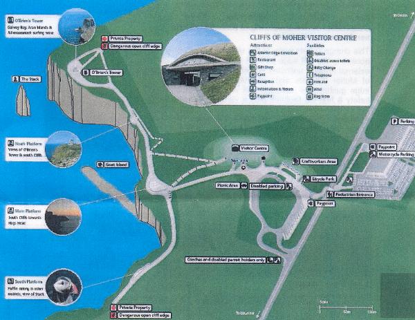
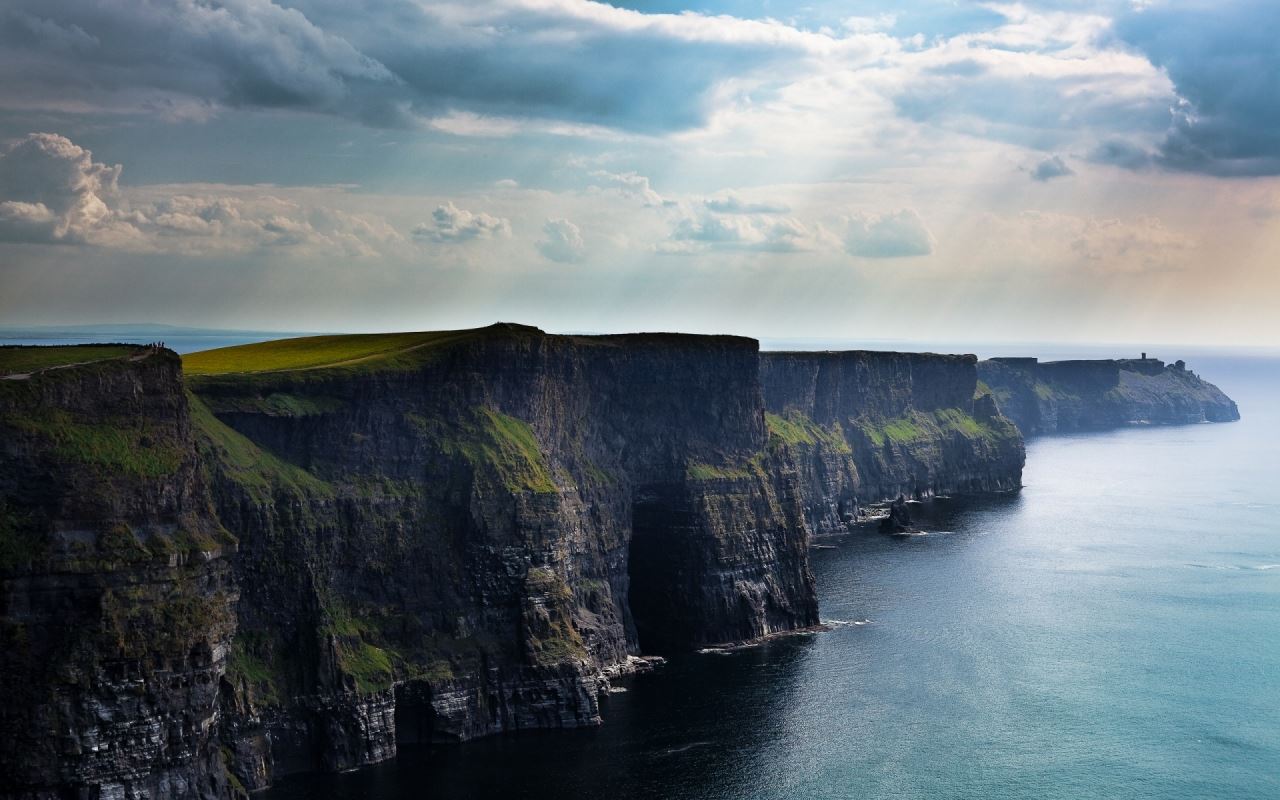
The Cliffs of Moher are one of Ireland's top Visitor attractions. The Cliffs are 214m high at the highest point and range for 8 kilometres over the Atlantic Ocean on the western seaboard of County Clare. O'Brien's Tower stands proudly on a headland of the majestic Cliffs. From the Cliffs one can see the Aran Islands, Galway Bay, as well as The Twelve Pins, the Maum Turk Mountains in Connemara and Loop Head to the South. The Cliffs of Moher are home to one of the major colonies of cliff nesting seabirds in Ireland. The area was designated as a Refuge for Fauna in 1988 and as a Special Protection Area for Birds (SPA) under the EU Birds Directive in 1989. Included within the designated site are the cliffs, the cliff-top maritime grassland and heath, and a 200 metre zone of open water, directly in front of the cliffs to protect part of the birds' feeding area. The designation covers 200 hectares and highlights the area's importance for wildlife.
The cliffs consist mainly of beds of Namurian shale and sandstone, with the oldest rocks being found at the bottom of the cliffs. It is possible to see 300 million year old river channels cutting through the base of the cliffs.Represent a slice through geological time, with the oldest rocks at the bottom of the cliff. The layers are tilted very slightly towards the southwest.
As you walk from the visitor centre towards the viewing point notice the flagstones lining the path. The squiggly marks on them are the impressions left behind some 320 million years ago by soft-bodied animals which burrowed through what was once mud and sand looking for food.
Locality map of studied sections in northern County Clare, western Ireland. The locations of the 11 growth faults seen in the cliff line are depicted.
GEOLOGY OF THE STUDY AREA
The coastal cliff sections of County Clare provide superb exposures of a Carboniferous basin infill that records a history typical of many NW European Carboniferous basins. In the Clare Basin, Dinantian ramp carbonates are overlain by a deep-water black shale (the Clare Shale Formation), which in turn is succeeded by a clastic succession of Upper Carboniferous (Namurian Series) age that records basin infill and shallowing . The higher parts of the succession consist of a series of progradational, deltaic cycles (or cyclothems), up to 250 m thick, separated by condensed, transgressive sediments that include marine bands comprising thin, goniatite-bearing, black shales. Delta-slope facies within these cyclothems display abundant evidence for slope collapse and soft-sediment deformation (slumps, slides and growth faults; see Martinsen, 1989) seen in the extensive series of coastal sections south of Liscannor Bay. These sites have become key localities for the study of such phenomena, but the sections north of Liscannor Bay have received much less study. The lowest deltaic cyclothems are, in ascending order, the Tullig, Kilkee and Doonlicky cycles . Only the lower two cycles have extensive outcrops along the length of the County Clare coastline that allow the regional palaeogeography to be reconstructed with some confidence. As a result, the Tullig and Kilkee cyclothems have become key horizons in a debate concerning basin orientation during the Namurian. The present study focuses on the Kilkee cyclothem sections north of Liscannor Bay.
Taken from materials :Earth and Biosphere Institute, School of Earth Sciences, University of Leeds.
You must fulfill requirements 2, 3 & 4 to log this cache:
1) Insert your photo with GPS picture to log from leads coordinates ( only optional )
2) Altitude at the position send to my email krutizlab.geo@gmail.com
3) What is the maximum height of the cliff.
4) What is the latin name of the bird family Alcidae illustrated in spoiler and living on cliffs?
The logs which will not comply with the requirements will be deleted.