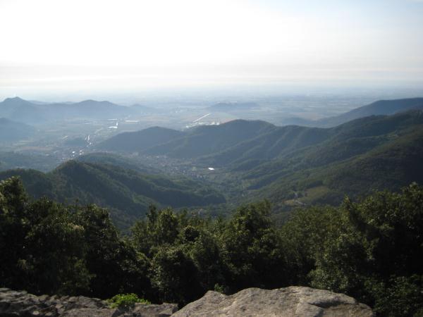
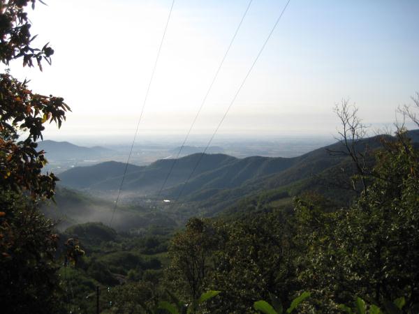
Monte Venda - Colli Euganei EarthCache
Monte Venda - Colli Euganei
-
Difficulty:
-

-
Terrain:
-

Size:  (not chosen)
Please note Use of geocaching.com services is subject to the terms and conditions
in our disclaimer.

Italiano (see below for description in
English)
I Colli Euganei occupano un’area di 18.695 ettari. L'area di
forma un'ellisse con un perimetro di circa 65 chilometri. Il centro
di questa ellisse è la più alta delle colline, il Monte
Venda.
La storia geologica dei Colli Euganei si basa su una complessa
serie di differenti manifestazioni vulcaniche avvenute
nell’area veneta durante l’Era Terziaria.
La prima fase
Le prime attività errutive si ebbero nel corso del l’Eocene
superiore (circa 43 milioni di anni fa). Il vulcanismo fu di tipo
sottomarino e si manifestò con l'emissione di colate di basalto
attraverso fratture apertesi tra gli strati di rocce sedimentarie.
La lave, assai fluide e ricche di gas e vapori, si espansero
rapidamente sul fondale formando estai ma poco elevati campi di
lava. L'acqua che penetrava nei condotti lavici e le tremenda
pressione dei gas magmatici innescarono intense fasi esplosive
durante le quali vennero prodotte grandi quantità di ceneri,
lapilli e brandelli di lava che depositandosi formarono spesse
coltri di tufi frammisti alla fanghiglia del fondale.
La seconda fase
Dopo un relativo periodo di quiete di circa 10 milioni di anni,
all’inizio dell’ Oligocene (circa 35 milioni di anni
fa), si ebbe una forte ripresa del magmatismo con l'apertura di
nuove fratture e l'emissione di materiali lavici di composizione
molto diversa rispetto a quelli della fase precedente. Gli Colli
Euganei furono l'unica zona delle Venezie dove, durante l’Era
terziaria, si generò un vulcanismo dai caratteri particolari che
produsse lava acide estremamente ricche di silice ed assai
viscose.
Questa seconda fase, per l’entità dei fenomenei espressi e la
quantità dei materiale emessi, rapressentò il momento di formazione
degli Colli Euganei. In base ai reciproci rapporti di posizione tra
le rocce si può dire che per prime uscirono le rioliti seguite
dalle trachiti e dalle latite, con filoncelli di basalto a chiudere
il ciclo. La spinta idrostatica dei magmi fortemente viscosi
sollevò e fratturò nei modi più disparati gli antichi strati del
fondo marino: colate lente e poderose attraversarono e ricoprirono,
in parte, i sedimenti vulcanici e le vulcaniti basaltiche,
producendo quella serie di apparati che conferiscono alla
morfologia euganea un aspetto unico e suggestivo.
I ripidi coni che caratterizzano il paesaggio nacquero ognuno nel
corso di un singolo evento eruttivo, dall’accumulo di potenti
colate sopra e nei pressi della frattura di emissione. Ogni colle
perciò è un prodotto unico, diverso da quelli che lo circondano e
conserva nel profilo e nei solchi una sua originaria fisionomia, un
carattere forte e assoluto, solo in parte addolcito
dall’erosione di milioni di anni.
Un buona parte dei magmi, a causa dell’alta viscosità e della
temperatura relativamente bassa, non riuscì ad attraversare il
fondo marino ma si fermò a breve profondità espandendosi
all'interno dei piani di stratificazione delle rocce calcaree che
lentamente vennero sollevate ed innalzate a cupola. Si formarono in
questa modo colli arrotondati, dai profili che si raccordano
morbidamente con la pianura, constituti da un rigonfiamento lavico
al di sotto di una copertura di rocce sedimentarie più antiche
(laccoliti). In alcuni casi, la spinta del magma continuò fino a
sfondare la copertura calcarea, permettendo alla lava di uscire e
di innalzarsi rapidamente sopra la bocca di emissione. Tali
formazioni sono dette laccoliti di erozione, in cui esempio di più
significativo è offerto dal Monte Lozzo. Un nutrito gruppo di
filoni venne iniettato all’interno delle fratture apertesi
durante la messa in posto delle masse laviche.
Alla fine del ciclo le cime più alto emersero andando a formare,
nell’antico mare padano, un arcipelago di ripidi isolotti
pietrosi.
Rocce sedimentarie
Oltra alla famiglia di rocce vulcaniche, il comprensorio euganeo
vanta un notevole spesore di rocce sedimentarie.
La più antica è il Rosso Ammonitico, una calcare risalente al
Giurassico superiore (circa 150 milioni di anni fa), contenente
varie specie di ammoniti, che viene a giorno solo presso
Fontanafredda.
Sopra il Rosso Ammonitico, giacciono gli strati regolari del
biancone, un calcare bianco a grana finissima tipicamente concoide,
presente nella zona di Villa di Teolo, nei dintorni di Bastia e
lungo la valle di Fontanafredda. Alla parte superiore di questa
formazione (Cenomiano superiore; circa 92 milioni di anni fa),
appartiene la lente di argillite nerastra, messa in luce a Cava
Bomba di Cinto Euganeo.
Al biancone segue la Scaglia Rossa, un calcare argilloso rosso
mattone, fittamente stratificato, depositatosi durante tutto il
Cretaceo superiore e parte dell’Eocene inferiore. La roccia
contiene varie specie di ricci di mare e denti di squalo. La
Scaglia è la formazione sedimentaria più diffusa nella zona
collinare, sopratutto nel sud tra Cinto, Valle S. Giorgio e Arquà
Petrarca.
La serie di carbonato-sedimentaria termina con le Marne Euganee,
rocce calcaree fortemente argilloso, molto friabile e fittamente
stratificata, di colore grigio e di età compresa tra l'Eocene
inferiore e l’Oligocene inferiore. La loro estrazione nella
zona di Monselice, Rivadolmo e Cinto è servita in passato alle
produzione di cemento nei tre cementifici della zone. Dopo
l’emersione dal mare, un'erosione selettiva di milioni di
anni ha prodotto un paesaggio tormentato e vario, disgregando ed
asportando in parte le più tenere coperture sedimentarie e mettendo
in risalto i duri corpi vulcanici in forme coniche e snelle.
Come loggare questa earthcache:
Alle coordinate sopra troverete un pannello di informazione. Guarda
il panello e rispondere alle seguenti quattro domande:
1. Monte Venda è il più alto collo dei colli Euganei. Qual è
l'altezza del Monte Venda?
2. Che tipo di roccia è la parte più alta del Monte Venda?
3. La parte più bassa del Monte Venda è caratterizzata da
affioramenti di rocce sedimentarie - qual è il nome di questa
roccia sedimentaria?
4. Due altri tipi di rocce vulcaniche tagliano la parte bassa di
Monte Venda. Quali sono i nomi di queste rocce?
Foto nel log sono i benvenuti.
Si prega di non scrivere le risposte nel log, ma li trasmette a
noi con il nostro profilo sul geocaching.com.
Puoi fare il log quando hai inviato le risposte, non hai bisogno di
aspettare la nostra approvazione. Se le tue risposte sono sbagliato
ti contatteremo.
English
The Euganean Hills (Colli Euganei) cover an area of 18,695
hectares. The area forms an ellipse with a perimeter of about 65
kilometres. The centre of this ellipse is the highest of the hills,
Monte Venda.
The geological history of the Euganean Hills is based on a complex
of series of volcanic events that took place during the Tertiary
period.
The first phase
The first eruptions occurred during the upper Eocene (about 43
million years ago). The volcanism was marine in type, and involved
the emission of flows of basalt through fractures between
sedimentary rock layers. The lava was very fluid and enriched with
gas and steam. It spread rapidly over the seabed, forming extensive
but fairly shallow lava fields. Water penetrating into the lava
conduits and the tremendous pressure of magmatic gases triggered
off intense explosive phases. During these phases huge quantities
of ash, lapilli and cinders were deposited to form thick layers of
tuff mixed with the mud on the seabed.
The second phase
After a period of relative calm lasting about 10 million years,
there was a considerable resurgence of volcanic activity in the
early Oligocene (about 35 million years ago), with the opening of
new fractures and the emission of lava of very different
composition from that of the preceding phase. During the Tertiary
period, the Euganean Hills were the only area in Veneto where the
volcanic activity was of a type which produced very viscous acidic
lava, extremely rich in silica.
This second phase, due to the sheer magnitude of the phenomenon and
the amount of material emitted, gave rise to the Euganean
Hills.
The relative positions of the rocks show that rhyolite emerged
first, followed by trachyte and latite, with small basalt dykes
closing the cycle. The hydrostatic thrust of the highly viscous
magma lifted and fractured the ancient seabed layers in different
ways: Thick, sluggish flows crossed and partly re-covered the
volcanic sediments and basaltic volcanites, producing that complex
series of reliefs that give the Euganean Hills their unique and
evocative appearance.
Each of the steep cones characterising the Euganean landscape was
produced during a single eruption, by the accumulation of thick
flows over and close to the emission fracture. Each hill is
therefore unique, differing from those around it and retaining in
its contours and fissures its original appearance - a strong stark
aspect, only partly softened by millions of years of erosion.
Much of the magna, because of its high viscosity and relatively low
temperature, was unable to cross the seabed and thus remained in
the shallows, expanding within the stratified layers of calcareous
rocks that were slowly lifted and raised into domes. This gave rise
to rounded hills, with contours gradually linking with the plain,
composed of lava swelling beneath a cover of older sedimentary
rocks. In some cases, the trust of magna broke through the
calcareous cover, allowing the lava to escape and rise rapidly
above the emission vent. These formations are known as laccolites,
the best example of which is Monte Lozzo. A sizeable group of dykes
was injected into the fractures which had opened as the masses of
lava settled.
At the end of the cycle, the highest tops emerged, forming an
archipelago of steep rocky islets in the ancient sea.
Sedimentary rocks
As well as volcanic rocks, the Euganean district boasts a
remarkable range of sedimentary rocks.
The oldest is the Rosso ammonitico, a limestone dating from the
upper Jurrasic (about 150 million years ago), containing various
species of ammonites. Rosso ammonitico only appear on the surface
near Fontanafredda.
Above the Rosso ammonitico lie the regular strata of biancone, a
very fine-grained, typically conchoidal, white limestone, found
near Villa di Teolo, around Bastia and along the valley of
Fontanafredda. The lens of blackish argillite belongs to the upper
part of this formation (upper Cenomanian; around 92 million years
ago), outcropping in the Cava Bomba at Cinto Euganeo.
Densely stratified red beds of brick-red clayey limestone,
deposited during the upper Cretaceous and part of the lower Eocene,
follow the biancone. This rock contains various species of sea
urchins and sharks’ teeth. The red beds are the most common
sedimentary formation in the area, especially in the south between
Cinto, Valle S. Giorgio and Arquà Petrarca.
The carbonate-sedimentary series concludes with Euganean marl, a
grey calcareous rock, very clayey, extremely friable and densely
stratified, dating from between the lower Eocene and lower
Oligocene. In the past it was mined in Monselice, Rivadolmo and
Cinto, to supply the three cement works in the area. After its
emergence from the sea, the selective erosion of millions of years
has produced a tormented and varied landscape, demolishing and
partly carrying away the softer sedimentary layers and exposing the
hard volcanic cores with their smooth, stark, conical
outlines.
How to log this earthcache:
At the coordinates above you will find an information board. Look
at the board and answer the following four questions:
1. Monte Venda is the highest of the Euganean hills. What is the
height of Monte Venda?
2. What kind of rock is the highest part of Monte Venda composed
of?
3. The lowest part of Monte Venda is characterised by outcrops of
sedimentary rocks - what is the name of this sedimentary
rock?
4. Two other kinds of volcanic rocks crosses the lower part of
Monte Venda. What are the names of these rocks?
Pictures in the log are welcome
Please don't write the answers in your log, but send them to us
by our geocaching.com profile.
You can log your find as soon as you have sent the answers, you
don't need to wait for our approval. If any of your answers are
wrong we will contact you.


Additional Hints
(No hints available.)