CESKY :
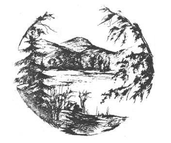
Morske oko
 Vihorlatské pohorí vznikalo sopecnou cinností asi pred 17 mil. roky. Sopecná cinnost se ve Vihorlatu odehrávala hlavne formou poklesu území a až v pozdejším období bylo celé pohorí vyzvednuto vysoko nad své okolí.
Prestože „Vihorlat“ patrí mezi nejmladší pohorí, je jeho povrch znacne narušený. Puvodne vyšší vrchy se vlivem eroze a rozsáhlých sesuvu postupne zmenšovaly. Pocetné svahové toky odnášely pudotvorný materiál a na úpatích svahu vytvárely mohutné náplavové kaluže. Odkryté lávové proudy se rozpadaly na velké kamenné bloky.
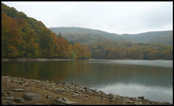
Vznik Morského oka spadá do období doznívání sopecné cinnosti na Vihorlatu. Mohutný sesuv z východního svahu zahradil spodní cást potoka a ze vzniklé bariéry vzniklo prírodní jezero. Morské oko je zvláštní svým puvodem, polohou, fyzikálne – chemickým a biologickým režimem.
V hloubce do 10m žije vetšina živých organismu Morského oka, které jsou spojeny ve vzájemném potravinovém retezci.
PODMINKY K UZNANI LOGU:
Vyfotte se u jezera Morské oko (pokud jsi sám stací foto GPS, tak aby bylo videt jezero).
OTAZKY:
1- V jaké nadmorské výšce se Morské oko nachází ?
2- Jaká je nejvetší hloubka jezera ?
3- Jaká je soucasná rozloha jezera ?
4- Kolík stálých pramenu pritéká do jezera ?
Odpovedi posílejte na email : Email
ENGLISH :
Sea Eye
The Vihorlat mountain range was formed by volcanic activity about 17 mil years ago. The volcanic activity in Vihorlat was showing itself mainly in form of descent of terrain and it wasn’t until later when the whole range was lifted high above the surrounding land.
Although „Vihorlat“ belongs to the youngest mountain ranges, its surface is considerably disturbed. Originally, higher peaks were gradually becoming smaller due to erosion and extensive landslides. Numerous mountain streams were carrying away soil-forming material and formed huge sediment pools on the foothills of the slopes. Exposed lava streams were breaking into big stone blocks.
The formation of Sea Eye dates back to the final period of the volcanic activity in Vihorlat. A powerful descent from the eastern part of the slope blocked the lower part of a stream and from the arisen barrier a natural lake was created. Sea Eye is unique for its origin, location and physically-chemical and biological regime.
In the depth of 10m there live most of living organisms of Sea Eye, which are connected in a food chain.
REQUIREMETS FOR LOG APPROVAL:
Take a picture of yourself by Sea Eye (if you are by yourself, a GPS photo is enough as far as the lake can be seen)
QUESTIONS:
1- Which altitude is Sea Eye situated in?
2- What is the deepest point of the lake?
3- What is the current size of the lake?
4- How many permanent springs flow into the lake?
Send your answers to the following email address Email