Harrington Beach #1 - Stonehaven EarthCache
Harrington Beach #1 - Stonehaven
-
Difficulty:
-

-
Terrain:
-
Size:  (not chosen)
Please note Use of geocaching.com services is subject to the terms and conditions
in our disclaimer.
As a part of geocaching — an adventure game for Global Positioning System (GPS) users to cache and find locations with actual hidden items — an EarthCache adventure is treasure hunting for the caches that the Earth has stored. EarthCache sites do not use stored containers; their treasure is the lessons people learn about our planet when they visit the site.

Millions of years ago, Wisconsin was covered by a vast, shallow inland sea, teeming with marine life. As they died, the shells of animals such as gastropods and corals sank to the bottom and fossilized, creating a sedimentary deposit of rock composed chiefly of calcium carbonate known as limestone. While much of Wisconsin is covered in a layer of limestone dating to the Silurian era (430 – 415 million years ago), Harrington Beach is one of only a few places in the state that dates to the younger Devonian era (400 – 350 million years ago). One of the other places to see similar Devonian era limestone is GCQ9H6: Terra Vista located on the north side of Milwaukee.
About 12,000 years ago, the glaciers that extended south into Wisconsin made striations or scratches in the limestone as it exposed the rock from under the earthen coverings of the intervening years.
In the 1890’s, Milwaukeean David Whittaker noticed the limestone outcroppings near here and bought much of the lakefront property which makes up present day Harrington Beach State Park. Along with his sons and others, he founded the Northwestern Stone Company. They began with what is now known as Little Quarry. The crushed limestone was used primarily in roadbeds. One of the other uses of limestone was in making lime. The largest use of lime was in steel manufacturing where it was used as a flux to remove impurities such as phosphorus and sulfur. Despite Whittaker’s ambitious plans, his company failed to prosper.
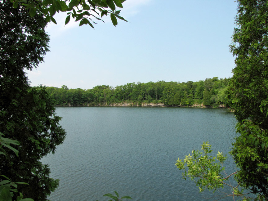
In 1901, the Lake Shore Stone Company bought the property and managed a successful quarrying operation. Needing greater quantities of limestone, they started a larger quarry now known as Quarry Lake. Little Quarry was a mere 6 feet deep and covered 2700 square feet while Quarry Lake was 45 feet deep and covered 23 acres. As many as 150 people worked in and at the quarry. Many families lived on the property in houses built by the company. The Lake Shore Stone Company village was named STONEHAVEN.
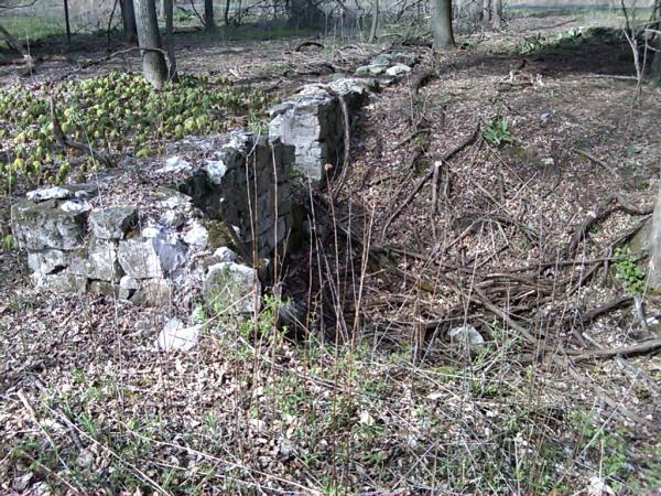
The workers removed the overburden of soil to expose the limestone before quarrying could begin. Then, deep holes were drilled, filled with gunpowder and detonated in order to crack the limestone. Dynamite was then put into the cracks and exploded, blasting tons of stone down into the quarry. Mules pulled rail cars laden with stone from the quarry and cables hauled them to the crusher which could handle 1500 yards of stone each day, producing small stones and limestone powder which were carried out by conveyors.
Workers earned one token, about the size and value of a quarter, for every cart of stone quarried. The best workers might earn nine dollars for a 10 hour work day. On Saturday nights, they’d cash in their weekly accumulation at the company store.
As time passed, washed gravel was found to be cheaper than crushed stone for roadbed construction. In 1925, the company was dissolved, the property sold and the pumps that kept the water out of the quarry were turned off. Because of the shallow water table, the quarry soon filled, becoming the deep, serene lake you see today.
While more could simply be written here, you can learn much more by walking the established trails, reading the informative signs and making direct observations. To get credit for this Earthcache find, you must send the answers for each of the following questions to the cache owner with the exception of the photograph which should be included with your “Found It” log.
(1) The Big Sign: (a) What impurity in the limestone at Stonehaven makes it harder than “pure” limestone? (b) It is therefore known as what kind of limestone?
(2) Pot Kiln: A recipe for lime - Fill a pot kiln with limestone, cook for (a) hours at (b) degrees over a hardwood fire and then let cool for (c) hours.
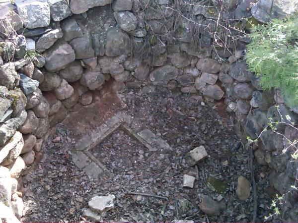
(3) Observations at the Beach: (a) What remnants of a man-made item do you see here and what would it have been used for? (b) What remnants of a natural item do you see here and what does it have to do with the origin of limestone?
(4) Observations at the Quarry: (a) What natural feature is occurring here? (b) Comparing the edge of the limestone being affected by the feature and the limestone on either side of it, does it appear that the limestone is being eroded?
(5) Photograph: Voluntary (no longer a requirement): Take at least one picture of yourself - or your GPS if you are camera shy - with any recognizable background related to Stonehaven or the quarrying operation.
NOTES: From I-43, head east on County Highway D straight to the park. At the office, you will have to pay for parking ($7 daily or $25 annual for Wisconsin residents) if you don’t already have a Wisconsin State Park admission sticker. From the office, head to the Parking / Trail Head coordinates. On the South end of the parking lot, you will see a sign that says “Welcome to White Cedar Swamp”. This is where you will start your walk, paying attention to informational signs along the way. The posted coordinates are for the Big Sign related to Question #1. See Additional Waypoints below for locations of the other signs and observation points.
Additional Hints
(No hints available.)