Isostatic rebound - Vanhalinna, Lieto, Finland EarthCache
Isostatic rebound - Vanhalinna, Lieto, Finland
-
Difficulty:
-

-
Terrain:
-

Size:  (other)
Please note Use of geocaching.com services is subject to the terms and conditions
in our disclaimer.
Isostatic rebound - Vanhalinna,
Lieto, Finland
Isostatic rebound (post-glacial rebound, continental rebound,
isostatic adjustment or post-ice-age recovery) is a term for the
rise of land masses that were depressed by the huge weight of ice
during the last glacial period. This affects northern Europe,
Siberia, Canada and the Great Lakes of Canada and the United
States.
The ice sheet covering northern Europe, Asia, North America,
Greenland and Antarctica was as thick as 3 kilometers, during the
last glacial maximum about 20 000 years ago. This enormous weight
caused the surface of the Earth’s crust to deform and wrap
downward, forcing the fluid mantle material to flow from the loaded
region. Retreat of the glaciers at the end of the ice age, led to
slow uplift of the land and to the return flow of the mantle
material. Due to the extreme viscosity of the mantle, it will take
many thousands of years for the land to reach an equilibrium level.
The total uplift from the end of deglaciation depends on the local
ice load and could be several hundred meters near the center of the
rebound.

Retreating glacier in Iceland,
2010
Before the 18th century, it was thought in Sweden that sea levels
were falling. On the initiative of Andreas Celsius a number of
marks were made on rocks at different locations along the Swedish
coastline. In 1765 it was concluded that it wasn't infact the sea
levels that were lowering, but an uneven rise of land. In 1875
Thomas Jamieson came up with a theory that the rise of land was
connected with the ice age. The theory was accepted in 1890.
Earlier the term used to describe uplift of the land was
post-glacial rebound. Ever since it was recognized that the
response of the Earth to glacial loading and unloading is not
limited to the upward rebound movement, but also involves downward
land movement, horizontal crustal motion, changes in global sea
levels, the Earth's gravity field, induced earthquakes and changes
in the rotational motion. One of the reasons why it is important to
understand isostatic rebound, is for our ability to monitor recent
global change.
Isostatic rebound has also made significant changes to the
coastlines and landscapes over the thousands of years and these
effects continue to be significant. In Finland the effect of
isostatic rebound is best seen at the west coast of the country,
close to city of Vaasa and also the district of Oulu and Kemi. In
the Oulu district it is up to 9 mm.
The archipelago of Kvarken (Merenkurkku), the narrowest part of the
Gulf of Bothnia, was approved to the UNESCO World Natural Heritage
list on July 2006, selected as a "type area" illustrating the
effects of isostatic rebound and the Holocene glacial retreat. It
is predicated that the Gulf of Bothnia will close up at the Kvarken
as a result of isostatic rebound. Also over the past centuries in
several Nordic ports, like Tornio, the harbour has been relocated
several times also due to the uplift of land.
The present-day uplift motion in northern Europe is monitored by a
GPS net work called BIFROST.
Source: Wikipedia
Background picture by: Oakokko, Wikipedia user
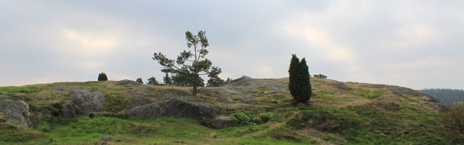
This Earth-cache is located on the root of Vanhalinna hill. Oldest
arkeological finds from this site have been dated to stone age,
around 2000 - 1300 BC. There was settlement at the hill already
during the bronze age. Over the centuries there have been several
fortresses on the hill of Vanhalinna. Due to this the hill is known
also as Linnavuori, Castle hill. When construction of the Castle of
Turku begun in the 1280s, Vanhalinna became the less significant
fortress in the area. Since the late 1400th century Vanhalinna hill
was abandoned. Now a days on the root of the Vanhalinna hill there
is a museum run by Lieto Vanhalinna foundation. All together the
museun and the cultural- and seminar center is 80 hectares wide and
consists of 13 buildings. More information
regarding Vanhalinna - in English
Parking: At coordinates N60º 29.230 E 022º 22.735 you can
find plenty of parking place. If the gate is closed, just drive a
bit further and you should find another parking place on the same
side as the main building is.
Your task:
Task 1: Go to the given coordinates, where you will find
this gate. Use your GPS device (or other means) to figure out
the altitude from the sea level.
Behind the gate you can find a foot path up to the hill of
Vanhalinna. Go to the highest point on top of the hill, measure
again the altitude from the sea level. Now you know the difference
in the altitudes of your starting point and the top.
What you need to do is let me know:
- what was the altitude difference in meters?
- how long it took before the land had risen enough (or sea level
had lowered enough), that one could stand by the gate with out
getting ones feet all wet? To calculate / estimate the time, use
the altitude difference you have measured.
- to what did you base your estimation on?
Task 2: While hiking up to the top, you will find 3 signs
illustrating how the sea level has lovered over the time. To prove
you actually visited the site, write down the years given in these
signs and let me also know what they were.
To log this cache you need to e-mail me your answer via
my profile. An uploaded picture is greatly appreciated
(example
photo).
Logs without send answers will be deleted. Please, do not write the
answers to you log or include spoilers in your photos. Thank
you!
Note! you don't need to wait for my approval before logging
the cache.
Maankohoaminen - Vanhalinna,
Lieto, Finland
Suomen ikivanha kallioperä kuuluu maapallon seismisesti
rauhallisimpiin alueisiin: mannerlaattojen rajat ovat
lähimmilläänkin tuhansien kilometrien päässä maastamme ja maankuori
on paksu ja vakaa. Muinainen mannerjäätikkö painoi kamaramme
kuopalle, joka jään poistuttua oikenee hiljalleen. Ilmiö näkyy
maankohoamisena (maannousu, maankuoren palautuminen isostaattiseen
tasapainotilaan) ja siihen liittyy myös heikkoja
maanjäristyksinä.
Suomen alue alkoi vapautua mannerjäätikön peitosta runsas 10 000
vuotta sitten. Mannerjäätikön paksuudeksi on arvioitu 2500 - 4500
metriä. Kymmenien tuhansien vuosien aikana tämä valtava jäämassa
painoi maankamaraan arviolta yli puolen kilometrin syvyisen kuopan.
Kun jäätikkö suli, alkoi maa kohota entiseen asemaansa. Maa kohoaa
edelleen vaihtelevalla nopeudella eri puolilla maatamme. Nopeinta
maankohoaminen on Pohjanlahden rannikolla, missä sen vaikutus myös
näkyy selvimmin. Maannousu ei rajoitu vain Suomeen ja
Fennoskandiaan vaan myös Pohjois-Kanadassa ja Länsi-Siperiassa on
havaittavissa vastaavat maanousualueet. Fennoskandian maannousualue
on kuitenkin ainoa, joka sijaitsee tiheän asutuksen keskellä ja on
siksi parhaiten tutkittu.
Maannousu kasvattaa Suomen pinta-alaa vuosittain noin seitsemällä
neliökilometrillä. Suomenlahden perukassa maa ei kohoa enää
ollenkaan. Selvimmin puolestaan maannousu on havaittavissa Vaasan
seudulla, Merenkurkun rannoilla. Jos uusi jääkausi ei katkaise
nykyistä maankohoamista, Perämerestä muodostuu sisäjärvi noin 2000
vuoden kuluessa. Heinäkuussa 2006 Merenkurkun saaristo hyväksyttiin
UNESCOn maailmanperintöluetteloon Suomen ensimmäisenä
luontokohteena. Alue lisättiin maailmanperintölistalle aiemmin
listalla olleen Ruotsin Höga kustenin laajennuksena.
Nousunopeuden todellista määrää on vaikea mitata tai arvioida,
koska valtameren pinta on samaan aikaan noussut noin millimetrin
vuosivauhdilla. Nykyään maannousua seurataan seuraavilla
menetelmillä: mareografit, tarkkavaaitus, GPS-mittaus, painovoiman
seuraus Maan pinnalla ja painovoimakentän muuttumisen
seuranta.
Maankohoamisessa on epäsäännöllisyyksiä, joita jäätikköteoria ei
pysty tyydyttävästi selittämään. Nämä oudot piirteet saattavat
selittyä mannerlaatojen liikkeellä eli laajenevan Atlantin
aiheuttamilla voimilla. On arveltu, että 10 - 20 % nykyisen
maankohoamisen määrästä voidaan selittää näiden ns. tektonisten
liikkeiden avulla
Tämä Earth- eli Maa-kätkö on sijoitettu Liedon Vanhalinnan
Linnavuoren juurelle. Alueen vanhimmat arkeologiset löydöt on
ajoitettu kivikaudelle, noin 2000 – 1500 eaa. Asutusta
Linnavuorella oli jo pronssikaudella ja vuosisatojen aikana
alueella onkin ollut useita linnoituksia. Turun linnan rakentamisen
myötä, 1280-luvulla, Liedon Linnavuori alkoi pikku hiljaa menettää
merkitystään. 1300-luvun loppupuolella linnoitus jäi pois
käytöstä.
Tänä päivänä Liedon Vanhalinna on yhden maan merkittävimmän
esihistoriallisen linnavuoren kupeella sijaitseva museo-,
kulttuuri- ja seminaarikeskus. Mauno ja Ester Wanhalinna
lahjoittivat Vanhalinna kartanon yksityiselle Turun yliopistolle
vuonna 1956. Turun yliopisto valtiollistettiin vuonna 1974, jolloin
Vanhalinna jäi muun yliopiston lahjoitusomaisuuden tavoin Turun
Yliopistosäätiön omistukseen. Vuonna 1998 Turun Yliopistosäätiö
perusti erillisen Liedon Vanhalinna -säätiön kehittämään laajenevaa
toimintaa, jonka tuotolla ylläpidetään kulttuurihistoriallista
kohdetta ja varmistetaan Wanhalinnojen perinnön säilyminen
tuleville sukupolville.
Liedon
Vanhalinna
Arkeologia
polku
Lähteet: Taipale et al: Jokamiehen geologia, Taipale et al:
Tulivuorista jääkausiin, Liedon Vanhalinnan
internetsivusto
Parkki: Koordinaateista N60º 29.230 E 022º 22.735 löydät
reilusti parkkitilaa. Jos kartanon portit ovat kiinni, aja vähän
matkaa kartanon ohi, Liedon suuntaan ja sinun pitäisi löytää lisää
parkkitilaa tien päärakennuksen puoleiselta laidalta.
Tehtävä 1: Mene annettuihin koordinaatteihin, josta löydät
tämän portin. Mittaa korkeus merenpinnasta käyttämällä
GPS-laitettasi tai jotain muuta menetelmää.
Portin takaa löydät Linnavuoren laelle vievän polun. Mene mäen
korkeimmalle kohdalle, mittaa jälleen korkeus merenpinnasta. Nyt
tiedät korkeuseron näiden kahden pisteen välillä. Vastaa seuraaviin
kysymyksiin:
- mittaamasi korkeusero metreinä?
- kuinka kauan kesti, että meren pinta laski tämän mittaamasi
metrimäärän? Ilolla otan vastaan myös muut tulkinnat ylempänä
olevaan englanninkieliseen kysymyksen asetteluun.
- kerro mihin perustat arviosi?
Tehtävä 2: Kiivetessäsi polkua ylös Linnavuoren laelle, näet
polun laidalla 3 kylttiä, jotka kertovat merenpinnan korkeuden
muutoksista ajan kuluessa. Todistaaksesi, että todellakin olet
vieraillut Liedon Vanhalinnan Linnavuorella, kirjaa ylös kylteissä
näkyvät vuosiluvut ja lähetä ne minulle.
Logataksesi kätkön löydetyksi, lähetä minulle tehtävien 1 ja 2
vastaukset
profiilini kautta. Loggaukseen liitettyjä valokuvia arvostan
erityisen suuresti (mallikuva).
Ethän kirjoita vastauksia loggaukseesi!
Huom! Sinun ei tarvitse odottaa hyväksyntääni ennen
loggaustasi. Huomaathan, mikäli loggaukseesi liittyviä vastauksia
ei löydy sähköpostistani, niin tulen poistamaan loggauksen.


Additional Hints
(No hints available.)