RI - Narragansett Narrows: Ocean Meets River EarthCache
RI - Narragansett Narrows: Ocean Meets River
-
Difficulty:
-

-
Terrain:
-

Size:  (other)
Please note Use of geocaching.com services is subject to the terms and conditions
in our disclaimer.
The Narrow River runs into and out of the Ocean depending on the tide. This Earthcache provides an educational background in how this area is formed and guides you through the unique area where the river connects with the Ocean. The information below was referenced from the The Narrow River Preservation Association (NRPA) at http://www.ririvers.org
Narrow River
The Narrow River estuary is comprised of three areas. The upper reach consists of two kettle-hole ponds separated from each other and the lower reaches by shallow sills. The Upper and Lower Ponds have maximum widths of approximately 500 meters and depths of 13.5 and 19.5 meters. The ponds contain permanently anoxic bottom layers. Biogenic hydrogen sulfide accumulates to levels among the highest reported in marine waters. The middle reach between Lacey Bridge and Middlebridge Bridge is quite narrow and shallow. The lower reach consists of a narrow inlet extending from the river mouth to Middlebridge Bridge. Depth in this reach is typically between one and two meters while width varies from approximately 10 meters in “the Narrows” near Sprague Bridge, to 100 meters in the upper portion of Pettaquamscutt Cove.
Upstream of the Narrows
Geology and Topograpy
The path of the Narrow River was carved into bedrock millions of years ago by glaciers. During the most recent glacial period (~18 thousand years ago) additional changes occurred. The glacier deepened the river valley by adding material to the east and west sides of the river. In addition to depositing material on the valley walls, the recent glacial action resulted in a layering of outwash material in the valley itself, some of it around massive chunks of ice. This process produced the two ponds known as Upper Pond and Lower Pond. Further south in the watershed, glacial outwash resulted in a thinner layer of sand and gravel being deposited over the relatively flat area of the Lower River and cove.
Finally marine inundation of the valley occurred from Rhode Island Sound (roughly 17,000 years ago). This resulted in the formation of a permanent tidal inlet to the river with associated tidal deltas and salt marshes in the Lower River. This completely changed the river from a closed freshwater system to a tidally influenced, saline system, or estuary. The river bisects its watershed into two sloping, glacial till hillsides with glacial outwash and ice contact deposits at their bases immediately adjacent to and under the river.
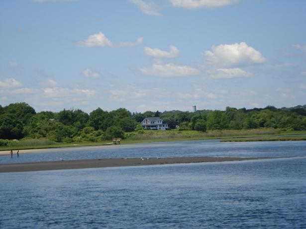
Confluence
At the coordinates posted for the cache is where the Narrows river dumps into the ocean. Here you can see the strong current coming from the river connecting with the waves of the ocean for a unique site of water traveling in both directions.
Confluence Point
Assignment
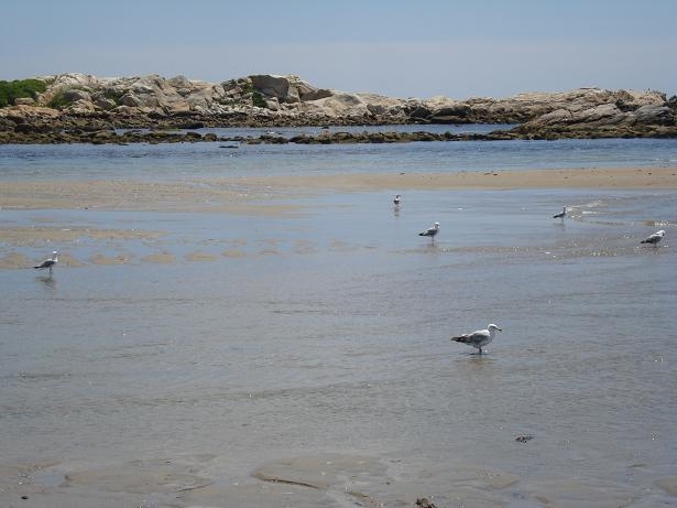
1. Go to the coordinates listed for the Earthcache and note how the waters of the ocean and the river converge. Observe how the forces interact and note any specifics around the water differences and motion differences between the river and the ocean.
2. At Waypoint #1, take something that floats (e.g. a stick) and throw it in the water. Measure a distance between two spots on land and time how far it takes the item to move between the spots. Calculate the speed of the movement (feet per second) in the water on the north side of the sandbar. Note if the item is floating upstream or downstream.
3. Estimate the depth of the water at the deepest point across at Waypoint #1.
4. Send me an e-mail with the answers for 1-3.
5. Optional – Post a picture at the confluence point of the river and the ocean
Additional Hints
(No hints available.)